Property Record
3231 W Lake St, Chicago, IL 60624
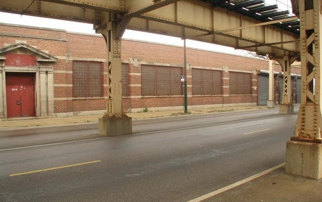
This Property Is For Sale
NEARBY LISTINGS FOR SALE OR LEASE
Property Detail
3231 W Lake St
Chicago-Naperville-Elgin, IL-IN-WI
Castles Sub
16-11-412-025-0000
(SUBDIVISION) OF BLKS 9-10 12-14 & PTS OF BLKS 11 15- 16 CASTLES SUB E 15 ACS EH SE SEC 11-39-13
Commercialnec
Cook
X
Illinois
17031C0415J
7,8
2023
0.12 AC
2024
North Chicago
260800
Chicago
DEMOGRAPHICS near 3231 W Lake St
1 Mile
3 Mile
5 Mile
2024 Total Population
28,123
388,096
1,176,004
2029 Population
26,506
365,050
1,119,628
Pop Growth 2024-2029
(5.75%)
(5.94%)
(4.79%)
Average Age
37
36
37
2024 Total Households
11,017
154,910
509,492
HH Growth 2024-2029
(6.16%)
(5.98%)
(4.38%)
Median Household Inc
$30,167
$65,815
$85,745
Avg Household Size
2.40
2.40
2.20
2024 Avg HH Vehicles
1.00
1.00
1.00
Median Home Value
$240,825
$383,705
$405,780
Median Year Built
1948
1948
1955
Nearby Places
- Restaurants
- Banks
- Shops
- Fitness
- Groceries
PUBLIC TRANSPORTATION
TRANSIT/SUBWAY
Kedzie Station (Green Line) (Green Line - Chicago Transit Authority "L" Trains (The "L"))
DRIVE
WALK
Distance
Kedzie Station (Green Line) (Green Line - Chicago Transit Authority "L" Trains (The "L"))
0 min
3 min
0.1 mi
Conservatory-Central Park Drive Station (Green Line - Chicago Transit Authority "L" Trains (The "L"))
DRIVE
WALK
Distance
Conservatory-Central Park Drive Station (Green Line - Chicago Transit Authority "L" Trains (The "L"))
1 min
10 min
0.5 mi
California Station (Green Line) (Green Line - Chicago Transit Authority "L" Trains (The "L"))
DRIVE
WALK
Distance
California Station (Green Line) (Green Line - Chicago Transit Authority "L" Trains (The "L"))
1 min
12 min
0.6 mi
Kedzie-Homan (Blue Line - Chicago Transit Authority)
DRIVE
WALK
Distance
Kedzie-Homan (Blue Line - Chicago Transit Authority)
3 min
14 min
0.8 mi
Pulaski Station (Green Line) (Green Line - Chicago Transit Authority "L" Trains (The "L"))
DRIVE
WALK
Distance
Pulaski Station (Green Line) (Green Line - Chicago Transit Authority "L" Trains (The "L"))
2 min
18 min
1.0 mi
COMMUTER RAIL
Kedzie Station (Union Pacific West Line - Northeast Illinois Regional Commuter Railroad (Metra))
DRIVE
WALK
Distance
Kedzie Station (Union Pacific West Line - Northeast Illinois Regional Commuter Railroad (Metra))
0 min
6 min
0.3 mi
Western Avenue Station (Md-N/Md-W/Ncs) (Milwaukee District North Line - Northeast Illinois Regional Commuter Railroad (Metra), Milwaukee District West Line - Northeast Illinois Regional Commuter Railroad (Metra), North Central Service - Northeast Illinois Regional Commuter Railroad (Metra))
DRIVE
WALK
Distance
Western Avenue Station (Md-N/Md-W/Ncs) (Milwaukee District North Line - Northeast Illinois Regional Commuter Railroad (Metra), Milwaukee District West Line - Northeast Illinois Regional Commuter Railroad (Metra), North Central Service - Northeast Illinois Regional Commuter Railroad (Metra))
4 min
1.5 mi
AIRPORT
Chicago Midway International
DRIVE
WALK
Distance
Chicago Midway International
15 min
8.4 mi
Chicago O'Hare International
DRIVE
WALK
Distance
Chicago O'Hare International
26 min
16.3 mi
Freight Ports
Port Milwaukee
DRIVE
WALK
Distance
Port Milwaukee
104 min
84.5 mi
Nearby Properties
Address
Land Use
TOTAL SIZE
Lot Size
Zoning
Address
Land Use
TOTAL SIZE
Lot Size
Zoning
559,589 SF
1.72 AC
C3-5
Address
Land Use
TOTAL SIZE
Lot Size
Zoning
1.44 AC
PD 30
Address
Land Use
TOTAL SIZE
Lot Size
Zoning
73,700 SF
0.48 AC
RM-6.5
Address
Land Use
TOTAL SIZE
Lot Size
Zoning
309,985 SF
0.78 AC
PD 1418
Address
Land Use
TOTAL SIZE
Lot Size
Zoning
317,932 SF
0.97 AC
PD 1306
Address
Land Use
TOTAL SIZE
Lot Size
Zoning
230,000 SF
0.60 AC
PD 1456
Address
Land Use
TOTAL SIZE
Lot Size
Zoning
131,800 SF
0.57 AC
PD 1344
Address
Land Use
TOTAL SIZE
Lot Size
Zoning
3.29 AC
PD 522
Address
Land Use
TOTAL SIZE
Lot Size
Zoning
2.67 AC
PD 522
Address
Land Use
TOTAL SIZE
Lot Size
Zoning
131,800 SF
0.43 AC
PD 1344
Address
Land Use
TOTAL SIZE
Lot Size
Zoning
0.82 AC
PD 1470
Address
Land Use
TOTAL SIZE
Lot Size
Zoning
0.37 AC
PD 1344
Address
Land Use
TOTAL SIZE
Lot Size
Zoning
0.66 AC
RS-3
Address
Land Use
TOTAL SIZE
Lot Size
Zoning
1,313,541 SF
44.90 AC
M2-2
Address
Land Use
TOTAL SIZE
Lot Size
Zoning
1,184,800 SF
3.74 AC
PMD 2,PD 1
Address
Land Use
TOTAL SIZE
Lot Size
Zoning
16,600 SF
3.67 AC
PMD 2,PD 1
Address
Land Use
TOTAL SIZE
Lot Size
Zoning
10,600 SF
0.25 AC
PD 1423
Address
Land Use
TOTAL SIZE
Lot Size
Zoning
82,600 SF
3.55 AC
PD 1539
Address
Land Use
TOTAL SIZE
Lot Size
Zoning
250,681 SF
0.23 AC
PD 1360
Address
Land Use
TOTAL SIZE
Lot Size
Zoning
4.85 AC
PD 1505
Address
Land Use
TOTAL SIZE
Lot Size
Zoning
1,220,173 SF
26.53 AC
M2-2
Address
Land Use
TOTAL SIZE
Lot Size
Zoning
1.82 AC
PD 30
Address
Land Use
TOTAL SIZE
Lot Size
Zoning
0.67 AC
PD 1456
Address
Land Use
TOTAL SIZE
Lot Size
Zoning
171,768 SF
0.74 AC
PD 1306
Address
Land Use
TOTAL SIZE
Lot Size
Zoning
101,749 SF
0.34 AC
PD 1383
Address
Land Use
TOTAL SIZE
Lot Size
Zoning
333,340 SF
Address
Land Use
TOTAL SIZE
Lot Size
Zoning
121,250 SF
0.84 AC
PD 30
Address
Land Use
TOTAL SIZE
Lot Size
Zoning
0.41 AC
DR-3
Address
Land Use
TOTAL SIZE
Lot Size
Zoning
800 SF
0.20 AC
PD 1423
Address
Land Use
TOTAL SIZE
Lot Size
Zoning
500 SF
2.69 AC
PD 1539
The World's #1 Commercial Real Estate Marketplace
Connect with us
© 2025 CoStar Group
The information above has been obtained from sources believed reliable. While we do not doubt its accuracy we have not verified it and make no guarantee, warranty or representation about it. It is your responsibility to independently confirm its accuracy and completeness. Any projections, opinions, assumptions, or estimates used are for example only and do not represent the current or future performance of the property. The value of this transaction to you depends on tax and other factors which should be evaluated by your tax, financial, and legal advisors. You and your advisors should conduct a careful, independent investigation of the property to determine to your satisfaction the suitability of the property for your needs.