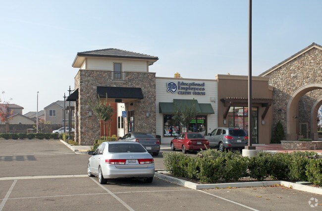
Property Record
3212 N Demaree St, Visalia, CA 93291


NEARBY LISTINGS FOR SALE OR LEASE
Property Detail
3212 N Demaree St
078-210-022-000
MAP4849
Regionalshoppingcenterormallwithanchorstore
Tulare
X
California
06107C0930E
1.01 AC
2024
NW Outlying Tulare County
2025
Visalia/Porterville
001012
Visalia-Porterville, CA
12,388 SF
DEMOGRAPHICS near 3212 N Demaree St
1 Mile
3 Mile
5 Mile
2024 Total Population
13,713
75,896
146,855
2029 Population
14,315
78,859
152,295
Pop Growth 2024-2029
+ 4.39%
+ 3.90%
+ 3.70%
Average Age
33
35
36
2024 Total Households
4,031
23,822
47,984
HH Growth 2024-2029
+ 4.32%
+ 3.90%
+ 3.70%
Median Household Inc
$104,216
$70,156
$68,946
Avg Household Size
3.40
3.10
3.00
2024 Avg HH Vehicles
2.00
2.00
2.00
Median Home Value
$351,089
$325,362
$295,081
Median Year Built
2008
1990
1986
Nearby Places
Map Layers
Map Styles
 Street
 Aerial
- Restaurants
- Banks
- Shops
- Fitness
- Groceries
PUBLIC TRANSPORTATION
AIRPORT
Fresno Yosemite International
DRIVE
WALK
Distance
Fresno Yosemite International
55 min
41.5 mi
Nearby Properties
Address
Land Use
TOTAL SIZE
Lot Size
Zoning
Address
Land Use
TOTAL SIZE
Lot Size
Zoning
300,560 SF
38.07 AC
IL
Address
Land Use
TOTAL SIZE
Lot Size
Zoning
353,600 SF
18.49 AC
Address
Land Use
TOTAL SIZE
Lot Size
Zoning
Address
Land Use
TOTAL SIZE
Lot Size
Zoning
82.35 AC
QP
Address
Land Use
TOTAL SIZE
Lot Size
Zoning
146,890 SF
11.73 AC
CCM
Address
Land Use
TOTAL SIZE
Lot Size
Zoning
139,410 SF
11.35 AC
CC
Address
Land Use
TOTAL SIZE
Lot Size
Zoning
121,380 SF
24.96 AC
QP
Address
Land Use
TOTAL SIZE
Lot Size
Zoning
6.96 AC
Address
Land Use
TOTAL SIZE
Lot Size
Zoning
61,587 SF
0.43 AC
PA
Address
Land Use
TOTAL SIZE
Lot Size
Zoning
178,626 SF
11.39 AC
PA
Address
Land Use
TOTAL SIZE
Lot Size
Zoning
19.34 AC
QP
Address
Land Use
TOTAL SIZE
Lot Size
Zoning
56,384 SF
9.14 AC
Address
Land Use
TOTAL SIZE
Lot Size
Zoning
5.85 AC
RM2
Address
Land Use
TOTAL SIZE
Lot Size
Zoning
82,200 SF
6.29 AC
CSO
Address
Land Use
TOTAL SIZE
Lot Size
Zoning
87,160 SF
0.75 AC
PA
Address
Land Use
TOTAL SIZE
Lot Size
Zoning
Address
Land Use
TOTAL SIZE
Lot Size
Zoning
32,048 SF
2.81 AC
CSO
Address
Land Use
TOTAL SIZE
Lot Size
Zoning
73,500 SF
3.60 AC
IH
Address
Land Use
TOTAL SIZE
Lot Size
Zoning
59,808 SF
34.14 AC
IH
Address
Land Use
TOTAL SIZE
Lot Size
Zoning
105,630 SF
11.50 AC
IH
Address
Land Use
TOTAL SIZE
Lot Size
Zoning
51,362 SF
1.61 AC
CH
Address
Land Use
TOTAL SIZE
Lot Size
Zoning
47,035 SF
3.29 AC
CCM
Address
Land Use
TOTAL SIZE
Lot Size
Zoning
131,624 SF
7.44 AC
RM3
Address
Land Use
TOTAL SIZE
Lot Size
Zoning
32,741 SF
1.87 AC
Address
Land Use
TOTAL SIZE
Lot Size
Zoning
50,318 SF
1.94 AC
Address
Land Use
TOTAL SIZE
Lot Size
Zoning
160,000 SF
9.70 AC
IH
The World's #1 Commercial Real Estate Marketplace
Connect with us
© 2026 CoStar Group
The information above has been obtained from sources believed reliable. While we do not doubt its accuracy we have not verified it and make no guarantee, warranty or representation about it. It is your responsibility to independently confirm its accuracy and completeness. Any projections, opinions, assumptions, or estimates used are for example only and do not represent the current or future performance of the property. The value of this transaction to you depends on tax and other factors which should be evaluated by your tax, financial, and legal advisors. You and your advisors should conduct a careful, independent investigation of the property to determine to your satisfaction the suitability of the property for your needs.