Property Record
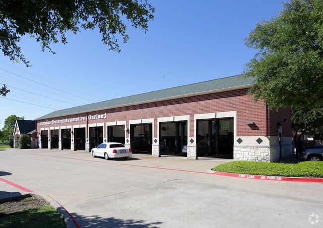
3213 Naaman School Rd, Garland, TX 75040


NEARBY LISTINGS FOR SALE OR LEASE
Property Detail
3213 Naaman School Rd
Dallas-Fort Worth-Arlington, TX
Christian Brothers
26089550010020000
CHRISTIAN BROTHERS BLK 1 LT 2 ACS 0.9095 INT201600146752 DD05312016 CO-DC 0895500100200 2CG08955001
Autorepair
Dallas
X
Texas
48113C0230K
2
2024
0.91 AC
2025
Garland
019025
Dallas/Ft Worth
4,846 SF
DEMOGRAPHICS near 3213 Naaman School Rd
1 Mile
3 Mile
5 Mile
2024 Total Population
11,876
105,302
274,465
2029 Population
11,642
105,502
283,727
Pop Growth 2024-2029
(1.97%)
+ 0.19%
+ 3.37%
Average Age
40
39
38
2024 Total Households
4,162
35,594
91,038
HH Growth 2024-2029
(2.21%)
(0.05%)
+ 3.32%
Median Household Inc
$77,042
$77,141
$80,914
Avg Household Size
2.80
2.90
2.90
2024 Avg HH Vehicles
2.00
2.00
2.00
Median Home Value
$241,266
$251,171
$266,954
Median Year Built
1985
1987
1985
Nearby Places
Map Layers
Map Styles
 Street
 Aerial
- Restaurants
- Banks
- Shops
- Fitness
- Groceries
PUBLIC TRANSPORTATION
AIRPORT
Dallas Love Field
DRIVE
WALK
Distance
Dallas Love Field
36 min
26.5 mi
Dallas-Fort Worth International
DRIVE
WALK
Distance
Dallas-Fort Worth International
41 min
34.6 mi
Nearby Properties
Address
Land Use
TOTAL SIZE
Lot Size
Zoning
Address
Land Use
TOTAL SIZE
Lot Size
Zoning
768,061 SF
42.03 AC
Z02
Address
Land Use
TOTAL SIZE
Lot Size
Zoning
650,164 SF
66.57 AC
Z02
Address
Land Use
TOTAL SIZE
Lot Size
Zoning
548,300 SF
17.29 AC
Z239
Address
Land Use
TOTAL SIZE
Lot Size
Zoning
374,266 SF
19.42 AC
Z239
Address
Land Use
TOTAL SIZE
Lot Size
Zoning
353,347 SF
17 AC
Z02
Address
Land Use
TOTAL SIZE
Lot Size
Zoning
328,843 SF
11.70 AC
Z239
Address
Land Use
TOTAL SIZE
Lot Size
Zoning
433,745 SF
15.18 AC
Z02
Address
Land Use
TOTAL SIZE
Lot Size
Zoning
361,965 SF
11.12 AC
Z06
Address
Land Use
TOTAL SIZE
Lot Size
Zoning
231,434 SF
11.27 AC
Z06
Address
Land Use
TOTAL SIZE
Lot Size
Zoning
310,382 SF
11.78 AC
Z148
Address
Land Use
TOTAL SIZE
Lot Size
Zoning
181,200 SF
15.11 AC
Address
Land Use
TOTAL SIZE
Lot Size
Zoning
320,801 SF
10.14 AC
Z236
Address
Land Use
TOTAL SIZE
Lot Size
Zoning
423,253 SF
30.26 AC
Z239
Address
Land Use
TOTAL SIZE
Lot Size
Zoning
261,164 SF
32.58 AC
Address
Land Use
TOTAL SIZE
Lot Size
Zoning
342,658 SF
4.94 AC
Z239
Address
Land Use
TOTAL SIZE
Lot Size
Zoning
366,600 SF
8.09 AC
Z06
Address
Land Use
TOTAL SIZE
Lot Size
Zoning
244,025 SF
17.80 AC
Z02
Address
Land Use
TOTAL SIZE
Lot Size
Zoning
331,684 SF
9.80 AC
Z148
Address
Land Use
TOTAL SIZE
Lot Size
Zoning
303,169 SF
19.67 AC
Z239
Address
Land Use
TOTAL SIZE
Lot Size
Zoning
403,206 SF
4 AC
Z239
Address
Land Use
TOTAL SIZE
Lot Size
Zoning
276,236 SF
8.96 AC
Z239
Address
Land Use
TOTAL SIZE
Lot Size
Zoning
107,686 SF
30.09 AC
Z386
Address
Land Use
TOTAL SIZE
Lot Size
Zoning
280,598 SF
7.36 AC
Z239
Address
Land Use
TOTAL SIZE
Lot Size
Zoning
232,771 SF
15.69 AC
Z160
Address
Land Use
TOTAL SIZE
Lot Size
Zoning
245,596 SF
14.24 AC
Z160
Address
Land Use
TOTAL SIZE
Lot Size
Zoning
117,500 SF
16.71 AC
Z239
Address
Land Use
TOTAL SIZE
Lot Size
Zoning
65,595 SF
19.22 AC
Z239
Address
Land Use
TOTAL SIZE
Lot Size
Zoning
286,659 SF
9.94 AC
Z236
Address
Land Use
TOTAL SIZE
Lot Size
Zoning
187,440 SF
1.68 AC
Z25
Address
Land Use
TOTAL SIZE
Lot Size
Zoning
77,102 SF
27.47 AC
Z144
The World's #1 Commercial Real Estate Marketplace
Connect with us
© 2026 CoStar Group
The information above has been obtained from sources believed reliable. While we do not doubt its accuracy we have not verified it and make no guarantee, warranty or representation about it. It is your responsibility to independently confirm its accuracy and completeness. Any projections, opinions, assumptions, or estimates used are for example only and do not represent the current or future performance of the property. The value of this transaction to you depends on tax and other factors which should be evaluated by your tax, financial, and legal advisors. You and your advisors should conduct a careful, independent investigation of the property to determine to your satisfaction the suitability of the property for your needs.