Property Record
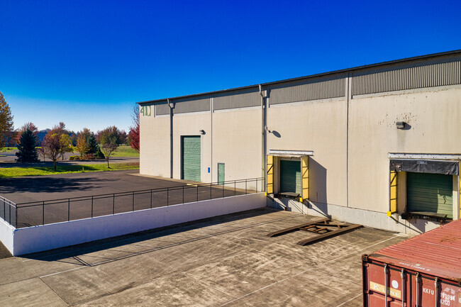
32141 Mallard Ave, Tangent, OR 97389


NEARBY LISTINGS FOR SALE OR LEASE
Property Detail
32141 Mallard Ave
0851757
Willamete Meridian
Municipalproperty
12S03W0600
X
Linn
41043C0536G
Oregon
2025
3.08 AC
2025
Linn County
030700
Portland
51,840 SF
Albany, OR
DEMOGRAPHICS near 32141 Mallard Ave
1 Mile
3 Mile
5 Mile
2024 Total Population
973
3,702
32,188
2029 Population
1,003
3,858
33,533
Pop Growth 2024-2029
+ 3.08%
+ 4.21%
+ 4.18%
Average Age
42
41
40
2024 Total Households
377
1,505
12,688
HH Growth 2024-2029
+ 3.18%
+ 4.39%
+ 4.33%
Median Household Inc
$76,704
$71,136
$69,051
Avg Household Size
2.60
2.40
2.50
2024 Avg HH Vehicles
2.00
2.00
2.00
Median Home Value
$364,999
$352,341
$302,370
Median Year Built
1989
1985
1978
Nearby Places
Map Layers
Map Styles
 Street
 Aerial
- Restaurants
- Banks
- Shops
- Fitness
- Groceries
PUBLIC TRANSPORTATION
COMMUTER RAIL
DRIVE
WALK
Distance
10 min
6.0 mi
AIRPORT
Mahlon Sweet Field
DRIVE
WALK
Distance
Mahlon Sweet Field
54 min
36.1 mi
SALE & LEASE HISTORY
LISTING DATE
SALE/LEASE

Sep 25, 2016
For Lease
Apr 22, 2019
For Lease
Nearby Properties
Address
Land Use
TOTAL SIZE
Lot Size
Zoning
Address
Land Use
TOTAL SIZE
Lot Size
Zoning
8,842 SF
73.88 AC
RS-6.5
Address
Land Use
TOTAL SIZE
Lot Size
Zoning
104.75 AC
LI
Address
Land Use
TOTAL SIZE
Lot Size
Zoning
29.90 AC
HI
Address
Land Use
TOTAL SIZE
Lot Size
Zoning
9.32 AC
LI
Address
Land Use
TOTAL SIZE
Lot Size
Zoning
11.43 AC
HC/I
Address
Land Use
TOTAL SIZE
Lot Size
Zoning
8.70 AC
IND
Address
Land Use
TOTAL SIZE
Lot Size
Zoning
13,600 SF
11.89 AC
LI
Address
Land Use
TOTAL SIZE
Lot Size
Zoning
69,760 SF
2.80 AC
RMA
Address
Land Use
TOTAL SIZE
Lot Size
Zoning
10.56 AC
HC/I
Address
Land Use
TOTAL SIZE
Lot Size
Zoning
64,046 SF
5.22 AC
HC/I
Address
Land Use
TOTAL SIZE
Lot Size
Zoning
36,574 SF
5.10 AC
IP
Address
Land Use
TOTAL SIZE
Lot Size
Zoning
55,725 SF
5.98 AC
HC/I
Address
Land Use
TOTAL SIZE
Lot Size
Zoning
4.64 AC
IND
Address
Land Use
TOTAL SIZE
Lot Size
Zoning
7.33 AC
IND
Address
Land Use
TOTAL SIZE
Lot Size
Zoning
105 SF
33.79 AC
EFU
Address
Land Use
TOTAL SIZE
Lot Size
Zoning
32,800 SF
3.51 AC
CC
Address
Land Use
TOTAL SIZE
Lot Size
Zoning
8.09 AC
CC
Address
Land Use
TOTAL SIZE
Lot Size
Zoning
7.61 AC
IP
Address
Land Use
TOTAL SIZE
Lot Size
Zoning
40,416 SF
2.20 AC
RMA
Address
Land Use
TOTAL SIZE
Lot Size
Zoning
50.07 AC
IP
Address
Land Use
TOTAL SIZE
Lot Size
Zoning
23,000 SF
8.03 AC
EFU
Address
Land Use
TOTAL SIZE
Lot Size
Zoning
22,622 SF
1.97 AC
MUC
Address
Land Use
TOTAL SIZE
Lot Size
Zoning
54,000 SF
3.17 AC
IND
Address
Land Use
TOTAL SIZE
Lot Size
Zoning
50,000 SF
3.13 AC
IND
Address
Land Use
TOTAL SIZE
Lot Size
Zoning
2,520 SF
10.88 AC
IND
Address
Land Use
TOTAL SIZE
Lot Size
Zoning
40,800 SF
8 AC
RR-5
The World's #1 Commercial Real Estate Marketplace
Connect with us
© 2025 CoStar Group
The information above has been obtained from sources believed reliable. While we do not doubt its accuracy we have not verified it and make no guarantee, warranty or representation about it. It is your responsibility to independently confirm its accuracy and completeness. Any projections, opinions, assumptions, or estimates used are for example only and do not represent the current or future performance of the property. The value of this transaction to you depends on tax and other factors which should be evaluated by your tax, financial, and legal advisors. You and your advisors should conduct a careful, independent investigation of the property to determine to your satisfaction the suitability of the property for your needs.