Property Record
3215 Belmeade Dr, Carrollton, TX 75006


NEARBY LISTINGS FOR SALE OR LEASE
Property Detail
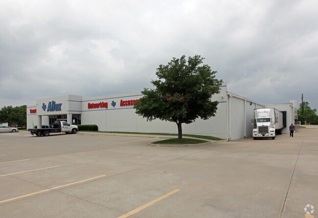
3215 Belmeade Dr
Dallas-Fort Worth-Arlington, TX
Beltwood North Trinity
140032000C0100000
BELTWOOD NORTH TRINITY BLK C LT 10 ACS 2.5166 INT201200378565 DD12212012 CO-DC 0032000C01000 1CC0032000C
Storebuilding
Dallas
X
Texas
48085C0480K
10
2024
2.52 AC
2025
Addison
013722
Dallas/Ft Worth
20,280 SF
DEMOGRAPHICS near 3215 Belmeade Dr
1 Mile
3 Mile
5 Mile
2024 Total Population
17,570
148,350
385,333
2029 Population
19,966
165,717
426,778
Pop Growth 2024-2029
+ 13.64%
+ 11.71%
+ 10.76%
Average Age
38
39
39
2024 Total Households
9,260
71,041
168,959
HH Growth 2024-2029
+ 14.28%
+ 11.79%
+ 11.16%
Median Household Inc
$64,219
$70,218
$77,872
Avg Household Size
1.90
2.00
2.20
2024 Avg HH Vehicles
1.00
2.00
2.00
Median Home Value
$387,446
$346,788
$380,440
Median Year Built
1990
1986
1986
Nearby Places
Map Layers
Map Styles
 Street
 Aerial
- Restaurants
- Banks
- Shops
- Fitness
- Groceries
PUBLIC TRANSPORTATION
COMMUTER RAIL
Trinity Mills Station (Green Line - Dallas Area Rapid Transit (DART))
DRIVE
WALK
Distance
Trinity Mills Station (Green Line - Dallas Area Rapid Transit (DART))
10 min
5.6 mi
Hebron Station (A-train - Denton County Transportation Authority)
DRIVE
WALK
Distance
Hebron Station (A-train - Denton County Transportation Authority)
15 min
9.2 mi
AIRPORT
Dallas Love Field
DRIVE
WALK
Distance
Dallas Love Field
22 min
14.7 mi
Dallas-Fort Worth International
DRIVE
WALK
Distance
Dallas-Fort Worth International
25 min
18.2 mi
Freight Ports
Port of Shreveport
DRIVE
WALK
Distance
Port of Shreveport
225 min
208.1 mi
Nearby Properties
Address
Land Use
TOTAL SIZE
Lot Size
Zoning
Address
Land Use
TOTAL SIZE
Lot Size
Zoning
1,034,981 SF
8.37 AC
Z422
Address
Land Use
TOTAL SIZE
Lot Size
Zoning
615,249 SF
16.17 AC
COMM
Address
Land Use
TOTAL SIZE
Lot Size
Zoning
619,645 SF
5.16 AC
Z422
Address
Land Use
TOTAL SIZE
Lot Size
Zoning
602,424 SF
31.61 AC
Z236
Address
Land Use
TOTAL SIZE
Lot Size
Zoning
417,990 SF
10.42 AC
Address
Land Use
TOTAL SIZE
Lot Size
Zoning
599,705 SF
4.98 AC
Z32
Address
Land Use
TOTAL SIZE
Lot Size
Zoning
429,576 SF
22.03 AC
Z236
Address
Land Use
TOTAL SIZE
Lot Size
Zoning
482,025 SF
11.73 AC
LC
Address
Land Use
TOTAL SIZE
Lot Size
Zoning
1,294,505 SF
7.25 AC
SU
Address
Land Use
TOTAL SIZE
Lot Size
Zoning
113,688 SF
72.86 AC
Z274
Address
Land Use
TOTAL SIZE
Lot Size
Zoning
696,563 SF
19.77 AC
Z239
Address
Land Use
TOTAL SIZE
Lot Size
Zoning
435,696 SF
3 AC
PD
Address
Land Use
TOTAL SIZE
Lot Size
Zoning
284,890 SF
40.44 AC
Z274
Address
Land Use
TOTAL SIZE
Lot Size
Zoning
561,142 SF
4.64 AC
MU-2
Address
Land Use
TOTAL SIZE
Lot Size
Zoning
595,188 SF
6.16 AC
Z239
Address
Land Use
TOTAL SIZE
Lot Size
Zoning
384,424 SF
377.56 AC
Z119
Address
Land Use
TOTAL SIZE
Lot Size
Zoning
739,099 SF
3.34 AC
Z236
Address
Land Use
TOTAL SIZE
Lot Size
Zoning
517,362 SF
23.61 AC
MF-2
Address
Land Use
TOTAL SIZE
Lot Size
Zoning
396,669 SF
18.50 AC
Address
Land Use
TOTAL SIZE
Lot Size
Zoning
1,130,618 SF
6.01 AC
Z32
Address
Land Use
TOTAL SIZE
Lot Size
Zoning
534,929 SF
4.19 AC
Z236
Address
Land Use
TOTAL SIZE
Lot Size
Zoning
511,780 SF
5.88 AC
Z31
Address
Land Use
TOTAL SIZE
Lot Size
Zoning
398,442 SF
5.79 AC
Z163
Address
Land Use
TOTAL SIZE
Lot Size
Zoning
787,326 SF
7.39 AC
Z181
Address
Land Use
TOTAL SIZE
Lot Size
Zoning
353,000 SF
2.27 AC
Z236
Address
Land Use
TOTAL SIZE
Lot Size
Zoning
887,516 SF
3.31 AC
Z123
Address
Land Use
TOTAL SIZE
Lot Size
Zoning
360,647 SF
8.20 AC
Z236
Address
Land Use
TOTAL SIZE
Lot Size
Zoning
498,499 SF
6.42 AC
Z149
Address
Land Use
TOTAL SIZE
Lot Size
Zoning
255,627 SF
14.79 AC
Z123
Address
Land Use
TOTAL SIZE
Lot Size
Zoning
239,913 SF
10.36 AC
RC
The World's #1 Commercial Real Estate Marketplace
Connect with us
© 2025 CoStar Group
The information above has been obtained from sources believed reliable. While we do not doubt its accuracy we have not verified it and make no guarantee, warranty or representation about it. It is your responsibility to independently confirm its accuracy and completeness. Any projections, opinions, assumptions, or estimates used are for example only and do not represent the current or future performance of the property. The value of this transaction to you depends on tax and other factors which should be evaluated by your tax, financial, and legal advisors. You and your advisors should conduct a careful, independent investigation of the property to determine to your satisfaction the suitability of the property for your needs.