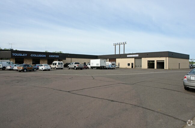
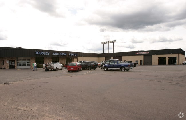
Property Record
3215 Fanum Rd, Saint Paul, MN 55110
NEARBY LISTINGS FOR SALE OR LEASE
Property Detail
3215 Fanum Rd
Minneapolis-St. Paul-Bloomington, MN-WI
Three-R Industrial Park
34-30-22-34-0003
THREE-R INDUSTRIAL PARK S 161.53 FT OF LOT 1 BLK 1
Servicestation
Ramsey
X
Minnesota
27003C0450E
1
2024
2.37 AC
2025
Maplewood
040200
Minneapolis/St Paul
44,648 SF
DEMOGRAPHICS near 3215 Fanum Rd
1 Mile
3 Mile
5 Mile
2024 Total Population
5,268
63,434
197,300
2029 Population
5,103
61,964
193,858
Pop Growth 2024-2029
(3.13%)
(2.32%)
(1.74%)
Average Age
40
41
39
2024 Total Households
2,240
25,315
74,521
HH Growth 2024-2029
(3.44%)
(2.49%)
(1.85%)
Median Household Inc
$76,247
$78,270
$74,999
Avg Household Size
2.30
2.40
2.50
2024 Avg HH Vehicles
2.00
2.00
2.00
Median Home Value
$282,748
$289,370
$284,875
Median Year Built
1994
1978
1974
Nearby Places
Map Layers
Map Styles
 Street
 Aerial
- Restaurants
- Banks
- Shops
- Fitness
- Groceries
PUBLIC TRANSPORTATION
COMMUTER RAIL
DRIVE
WALK
Distance
14 min
9.3 mi
AIRPORT
Minneapolis-St Paul International/Wold-Chamberlain
DRIVE
WALK
Distance
Minneapolis-St Paul International/Wold-Chamberlain
29 min
18.4 mi
Nearby Properties
Address
Land Use
TOTAL SIZE
Lot Size
Zoning
Address
Land Use
TOTAL SIZE
Lot Size
Zoning
187,362 SF
70.96 AC
Address
Land Use
TOTAL SIZE
Lot Size
Zoning
267,576 SF
18.95 AC
Address
Land Use
TOTAL SIZE
Lot Size
Zoning
5.59 AC
Address
Land Use
TOTAL SIZE
Lot Size
Zoning
4,800 SF
20.36 AC
Address
Land Use
TOTAL SIZE
Lot Size
Zoning
77.53 AC
Address
Land Use
TOTAL SIZE
Lot Size
Zoning
143,922 SF
23.12 AC
Address
Land Use
TOTAL SIZE
Lot Size
Zoning
250,050 SF
2.99 AC
Address
Land Use
TOTAL SIZE
Lot Size
Zoning
233,419 SF
5.67 AC
Address
Land Use
TOTAL SIZE
Lot Size
Zoning
74,082 SF
12.10 AC
Address
Land Use
TOTAL SIZE
Lot Size
Zoning
90,293 SF
9.33 AC
Address
Land Use
TOTAL SIZE
Lot Size
Zoning
206,658 SF
8.21 AC
Address
Land Use
TOTAL SIZE
Lot Size
Zoning
138,407 SF
15.67 AC
Address
Land Use
TOTAL SIZE
Lot Size
Zoning
Address
Land Use
TOTAL SIZE
Lot Size
Zoning
1,500 SF
25.38 AC
Address
Land Use
TOTAL SIZE
Lot Size
Zoning
211,420 SF
5.22 AC
Address
Land Use
TOTAL SIZE
Lot Size
Zoning
17.16 AC
Address
Land Use
TOTAL SIZE
Lot Size
Zoning
212,078 SF
2.95 AC
Address
Land Use
TOTAL SIZE
Lot Size
Zoning
118,442 SF
12.83 AC
Address
Land Use
TOTAL SIZE
Lot Size
Zoning
3.91 AC
Address
Land Use
TOTAL SIZE
Lot Size
Zoning
271,355 SF
20.56 AC
Address
Land Use
TOTAL SIZE
Lot Size
Zoning
126,852 SF
11.86 AC
Address
Land Use
TOTAL SIZE
Lot Size
Zoning
67,693 SF
7.30 AC
Address
Land Use
TOTAL SIZE
Lot Size
Zoning
145,458 SF
2.30 AC
Address
Land Use
TOTAL SIZE
Lot Size
Zoning
209,830 SF
10.06 AC
Address
Land Use
TOTAL SIZE
Lot Size
Zoning
3.09 AC
Address
Land Use
TOTAL SIZE
Lot Size
Zoning
155,520 SF
8.28 AC
Address
Land Use
TOTAL SIZE
Lot Size
Zoning
0.73 AC
Address
Land Use
TOTAL SIZE
Lot Size
Zoning
1,344 SF
14.08 AC
Address
Land Use
TOTAL SIZE
Lot Size
Zoning
138,960 SF
Address
Land Use
TOTAL SIZE
Lot Size
Zoning
7,008 SF
140.89 AC
The World's #1 Commercial Real Estate Marketplace
Connect with us
© 2025 CoStar Group
The information above has been obtained from sources believed reliable. While we do not doubt its accuracy we have not verified it and make no guarantee, warranty or representation about it. It is your responsibility to independently confirm its accuracy and completeness. Any projections, opinions, assumptions, or estimates used are for example only and do not represent the current or future performance of the property. The value of this transaction to you depends on tax and other factors which should be evaluated by your tax, financial, and legal advisors. You and your advisors should conduct a careful, independent investigation of the property to determine to your satisfaction the suitability of the property for your needs.