Property Record
3215 Okemos Rd, Mason, MI 48854

Save to a Folder
{{folder.Name}}
{{folder.ListingIds.length}} Properties
{{folder.ListingIds.length}} Property
Create a New Folder
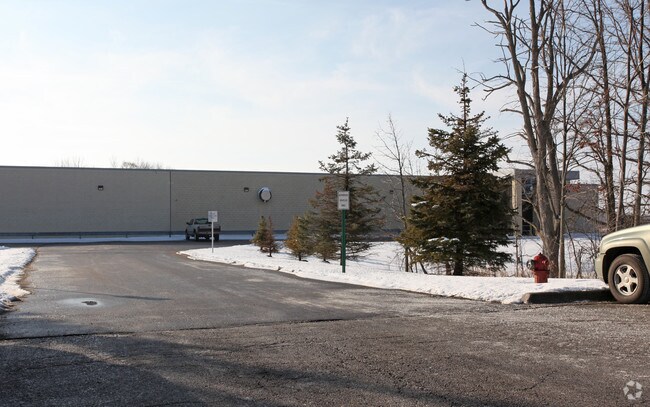
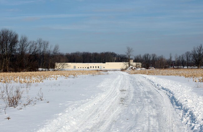
Property Detail
3215 Okemos Rd
01-06-04-376-001
COM 935.21 FT N OF S 1/4 COR SEC 4 T3N R1W, TH W 154 FT, S 272 FT, W 511.81 FT, S 663.21 FT TO S LINE SAID SEC, W ON SAID
Commercialnec
INGHAM
D-1 PRO
Michigan
B and X Area of moderate flood hazard, usually the area between the limits of the 100-year and 500-year floods.
21.42 AC
2025
Mason/SE Ingham County
2026
West Michigan
006301
Lansing-East Lansing, MI
35,214 SF
NEARBY LISTINGS FOR SALE OR LEASE
-
-
View all Mason listings for sale on LoopNet.com
DEMOGRAPHICS near 3215 Okemos Rd
1 mile
3 mile
5 mile
2025 Total Population
1,193
16,296
77,699
2030 Population
1,221
16,478
79,722
Pop Growth 2025-2030
+ 2.35%
+ 1.12%
+ 2.60%
Average Age
39
40
35
2025 Total Households
443
6,357
30,035
HH Growth 2025-2030
+ 2.48%
+ 1.18%
+ 2.68%
Median Household Inc
$124,234
$113,723
$71,366
Avg Household Size
2.70
2.50
2.30
2025 Avg HH Vehicles
2.00
2.00
2.00
Median Home Value
$450,609
$359,188
$275,529
Median Year Built
1996
1983
1981
Nearby Places
Map Layers
Map Styles
 Street
 Aerial
Layers
 Traffic
 Biking
Places
Listings with unknown addresses are not visible on the map
- Restaurants
- Banks
- Shops
- Fitness
- Groceries
PUBLIC TRANSPORTATION
COMMUTER RAIL
East Lansing Amtrak Station (Blue Water - Amtrak)
Drive
Walk
Distance
East Lansing Amtrak Station (Blue Water - Amtrak)
13 min
7.9 mi
AIRPORT
Capital Region International
Drive
Walk
Distance
Capital Region International
24 min
14.4 mi
Freight Ports
Port of Toledo
Drive
Walk
Distance
Port of Toledo
137 min
115.7 mi
Nearby Properties
Address
Land Use
TOTAL SIZE
Lot Size
Zoning
Address
Land Use
TOTAL SIZE
Lot Size
Zoning
8,775 SF
78.38 AC
G-1 BUS
Address
Land Use
TOTAL SIZE
Lot Size
Zoning
251,183 SF
80.28 AC
Address
Land Use
TOTAL SIZE
Lot Size
Zoning
38,332 SF
7.44 AC
C-2
Address
Land Use
TOTAL SIZE
Lot Size
Zoning
26,458 SF
16.65 AC
B-1
Address
Land Use
TOTAL SIZE
Lot Size
Zoning
25,308 SF
45.28 AC
RD
Address
Land Use
TOTAL SIZE
Lot Size
Zoning
15,067 SF
15.64 AC
RC
Address
Land Use
TOTAL SIZE
Lot Size
Zoning
25,430 SF
12.03 AC
RC
Address
Land Use
TOTAL SIZE
Lot Size
Zoning
44,572 SF
4.23 AC
GO
Address
Land Use
TOTAL SIZE
Lot Size
Zoning
40,078 SF
19.38 AC
RC
Address
Land Use
TOTAL SIZE
Lot Size
Zoning
64,646 SF
3.54 AC
PO
Address
Land Use
TOTAL SIZE
Lot Size
Zoning
18,648 SF
5.89 AC
Address
Land Use
TOTAL SIZE
Lot Size
Zoning
34,322 SF
16.53 AC
RC
Address
Land Use
TOTAL SIZE
Lot Size
Zoning
23,454 SF
3.68 AC
Address
Land Use
TOTAL SIZE
Lot Size
Zoning
65,976 SF
2.79 AC
C-2
Address
Land Use
TOTAL SIZE
Lot Size
Zoning
130,032 SF
3.81 AC
GO
Address
Land Use
TOTAL SIZE
Lot Size
Zoning
9,094 SF
7.20 AC
C-3
Address
Land Use
TOTAL SIZE
Lot Size
Zoning
6,931 SF
11.08 AC
RD
Address
Land Use
TOTAL SIZE
Lot Size
Zoning
70,705 SF
2.85 AC
C-2
Address
Land Use
TOTAL SIZE
Lot Size
Zoning
52,762 SF
4.26 AC
B-1
Address
Land Use
TOTAL SIZE
Lot Size
Zoning
38,887 SF
3.85 AC
C-2
Address
Land Use
TOTAL SIZE
Lot Size
Zoning
39,272 SF
9.27 AC
B-1
Address
Land Use
TOTAL SIZE
Lot Size
Zoning
18,648 SF
2 AC
Address
Land Use
TOTAL SIZE
Lot Size
Zoning
24,867 SF
3.01 AC
RA
Address
Land Use
TOTAL SIZE
Lot Size
Zoning
33,088 SF
10.31 AC
Address
Land Use
TOTAL SIZE
Lot Size
Zoning
33,426 SF
8.28 AC
C-2
Address
Land Use
TOTAL SIZE
Lot Size
Zoning
32,090 SF
6.61 AC
B-1
Address
Land Use
TOTAL SIZE
Lot Size
Zoning
3,432 SF
103.58 AC
D-1 PRO
Address
Land Use
TOTAL SIZE
Lot Size
Zoning
4,725 SF
16.71 AC
B-1
Address
Land Use
TOTAL SIZE
Lot Size
Zoning
26,563 SF
3.09 AC
PO
The World's #1 Commercial Real Estate Marketplace
Connect with us
© 2026 CoStar Group
The information above has been obtained from sources believed reliable. While we do not doubt its accuracy we have not verified it and make no guarantee, warranty or representation about it. It is your responsibility to independently confirm its accuracy and completeness. Any projections, opinions, assumptions, or estimates used are for example only and do not represent the current or future performance of the property. The value of this transaction to you depends on tax and other factors which should be evaluated by your tax, financial, and legal advisors. You and your advisors should conduct a careful, independent investigation of the property to determine to your satisfaction the suitability of the property for your needs.