Property Record
3215 State Highway 360, Grapevine, TX 76051

NEARBY LISTINGS FOR SALE OR LEASE
Property Detail
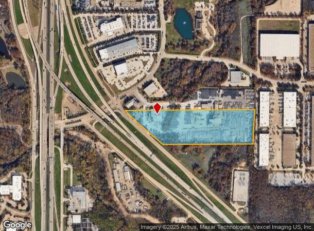
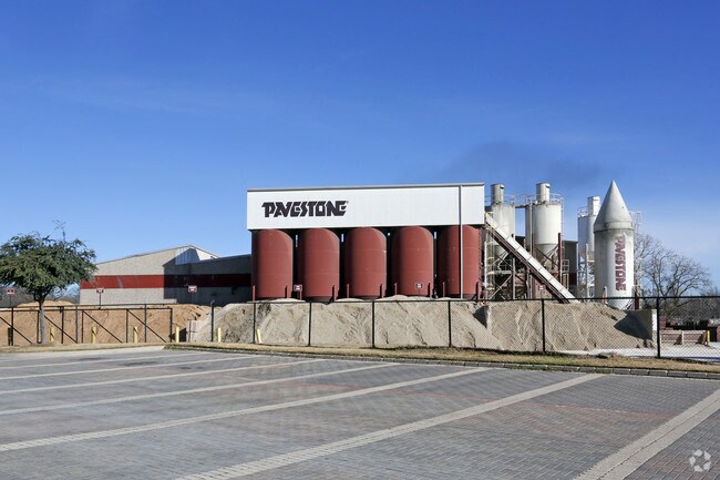
3215 State Highway 360
Dallas-Fort Worth-Arlington, TX
Pavestone Industrial
40331830
PAVESTONE INDUSTRIAL BLOCK 1R LOT 1R1A
Industrialgeneral
Tarrant
AE
Texas
48113C0150K
1
2024
15.28 AC
2025
W DFW Air/Grapevine
113709
Dallas/Ft Worth
39,301 SF
DEMOGRAPHICS near 3215 State Highway 360
1 Mile
3 Mile
5 Mile
2024 Total Population
6,484
59,037
164,132
2029 Population
6,821
61,957
172,425
Pop Growth 2024-2029
+ 5.20%
+ 4.95%
+ 5.05%
Average Age
40
40
40
2024 Total Households
2,529
22,946
64,799
HH Growth 2024-2029
+ 5.30%
+ 5.03%
+ 5.09%
Median Household Inc
$95,425
$108,760
$96,541
Avg Household Size
2.50
2.50
2.50
2024 Avg HH Vehicles
2.00
2.00
2.00
Median Home Value
$455,991
$450,655
$421,584
Median Year Built
1991
1991
1988
Nearby Places
Map Layers
Map Styles
 Street
 Aerial
- Restaurants
- Banks
- Shops
- Fitness
- Groceries
PUBLIC TRANSPORTATION
COMMUTER RAIL
Centre Port/DFW (Trinity Railway Express - Dallas Area Rapid Transit (DART))
DRIVE
WALK
Distance
Centre Port/DFW (Trinity Railway Express - Dallas Area Rapid Transit (DART))
12 min
7.4 mi
Hurst/Bell (Trinity Railway Express - Dallas Area Rapid Transit (DART))
DRIVE
WALK
Distance
Hurst/Bell (Trinity Railway Express - Dallas Area Rapid Transit (DART))
15 min
8.9 mi
AIRPORT
Dallas-Fort Worth International
DRIVE
WALK
Distance
Dallas-Fort Worth International
12 min
7.2 mi
Dallas Love Field
DRIVE
WALK
Distance
Dallas Love Field
30 min
20.9 mi
Nearby Properties
Address
Land Use
TOTAL SIZE
Lot Size
Zoning
Address
Land Use
TOTAL SIZE
Lot Size
Zoning
624,642 SF
15.38 AC
Address
Land Use
TOTAL SIZE
Lot Size
Zoning
631,558 SF
15.49 AC
Address
Land Use
TOTAL SIZE
Lot Size
Zoning
394,769 SF
20.39 AC
Address
Land Use
TOTAL SIZE
Lot Size
Zoning
332,665 SF
9.83 AC
Address
Land Use
TOTAL SIZE
Lot Size
Zoning
630,765 SF
321.80 AC
Address
Land Use
TOTAL SIZE
Lot Size
Zoning
360,898 SF
5.51 AC
Address
Land Use
TOTAL SIZE
Lot Size
Zoning
464,476 SF
5.08 AC
Address
Land Use
TOTAL SIZE
Lot Size
Zoning
401,397 SF
14.94 AC
Address
Land Use
TOTAL SIZE
Lot Size
Zoning
419,655 SF
20.44 AC
Address
Land Use
TOTAL SIZE
Lot Size
Zoning
333,755 SF
19.06 AC
Address
Land Use
TOTAL SIZE
Lot Size
Zoning
321,993 SF
18.20 AC
Address
Land Use
TOTAL SIZE
Lot Size
Zoning
264,000 SF
15.06 AC
Address
Land Use
TOTAL SIZE
Lot Size
Zoning
345,961 SF
14.73 AC
Address
Land Use
TOTAL SIZE
Lot Size
Zoning
234,200 SF
274.75 AC
Address
Land Use
TOTAL SIZE
Lot Size
Zoning
230,666 SF
13.33 AC
Address
Land Use
TOTAL SIZE
Lot Size
Zoning
300,000 SF
27.13 AC
Address
Land Use
TOTAL SIZE
Lot Size
Zoning
236,016 SF
12.81 AC
Address
Land Use
TOTAL SIZE
Lot Size
Zoning
150,510 SF
6.35 AC
Address
Land Use
TOTAL SIZE
Lot Size
Zoning
214,908 SF
13.55 AC
Address
Land Use
TOTAL SIZE
Lot Size
Zoning
921,172 SF
105 AC
Address
Land Use
TOTAL SIZE
Lot Size
Zoning
236,945 SF
14.36 AC
Address
Land Use
TOTAL SIZE
Lot Size
Zoning
261,413 SF
12.50 AC
Address
Land Use
TOTAL SIZE
Lot Size
Zoning
177,093 SF
10.79 AC
Address
Land Use
TOTAL SIZE
Lot Size
Zoning
247,505 SF
32 AC
Address
Land Use
TOTAL SIZE
Lot Size
Zoning
192,666 SF
9.13 AC
Address
Land Use
TOTAL SIZE
Lot Size
Zoning
99,780 SF
0.38 AC
Address
Land Use
TOTAL SIZE
Lot Size
Zoning
206,950 SF
12.13 AC
Address
Land Use
TOTAL SIZE
Lot Size
Zoning
886,100 SF
160 AC
Address
Land Use
TOTAL SIZE
Lot Size
Zoning
136,358 SF
16.51 AC
Address
Land Use
TOTAL SIZE
Lot Size
Zoning
100.88 AC
The World's #1 Commercial Real Estate Marketplace
Connect with us
© 2026 CoStar Group
The information above has been obtained from sources believed reliable. While we do not doubt its accuracy we have not verified it and make no guarantee, warranty or representation about it. It is your responsibility to independently confirm its accuracy and completeness. Any projections, opinions, assumptions, or estimates used are for example only and do not represent the current or future performance of the property. The value of this transaction to you depends on tax and other factors which should be evaluated by your tax, financial, and legal advisors. You and your advisors should conduct a careful, independent investigation of the property to determine to your satisfaction the suitability of the property for your needs.