Property Record
3215 Superior Ave E, Cleveland, OH 44114


Save to a Folder
{{folder.Name}}
{{folder.ListingIds.length}} Properties
{{folder.ListingIds.length}} Property
Create a New Folder
Property Detail
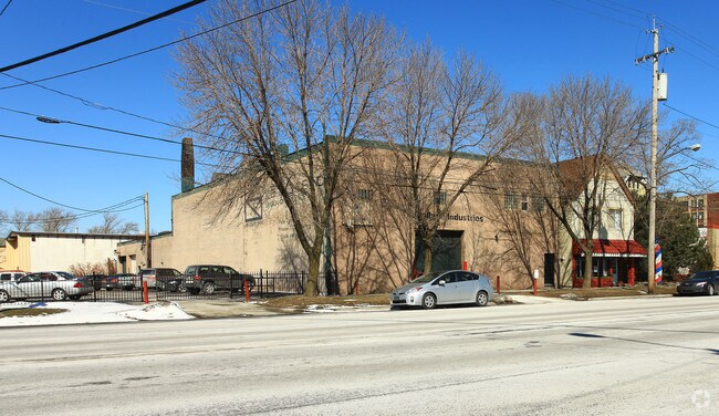
3215 Superior Ave E
102-18-033
115-116 STERLING SL 80WP 10.85FT 00780079ALLALL 10218034 10218076
Publicstorage
Cuyahoga
SI
Ohio
B and X Area of moderate flood hazard, usually the area between the limits of the 100-year and 500-year floods.
78
2025
0.39 AC
2025
Midtown
108201
Cleveland
8,864 SF
Cleveland-Elyria, OH
NEARBY LISTINGS FOR SALE OR LEASE
DEMOGRAPHICS near 3215 Superior Ave E
1 mile
3 mile
5 mile
2025 Total Population
10,627
76,563
224,375
2030 Population
10,759
77,653
225,662
Pop Growth 2025-2030
+ 1.24%
+ 1.42%
+ 0.57%
Average Age
36
37
38
2025 Total Households
5,379
37,192
103,852
HH Growth 2025-2030
+ 2.18%
+ 1.77%
+ 0.73%
Median Household Inc
$30,812
$35,896
$37,650
Avg Household Size
1.70
1.90
2.00
2025 Avg HH Vehicles
1.00
1.00
1.00
Median Home Value
$102,009
$121,197
$99,512
Median Year Built
1953
1949
1947
Nearby Places
Map Layers
Map Styles
 Street
 Aerial
Layers
 Traffic
 Biking
Places
Listings with unknown addresses are not visible on the map
- Restaurants
- Banks
- Shops
- Fitness
- Groceries
PUBLIC TRANSPORTATION
COMMUTER RAIL
Cleveland Lakefront Station (Blue Line - Greater Cleveland Regional Transit Authority Rapid Transit (The Rapid), Green Line - Greater Cleveland Regional Transit Authority Rapid Transit (The Rapid))
Drive
Walk
Distance
Cleveland Lakefront Station (Blue Line - Greater Cleveland Regional Transit Authority Rapid Transit (The Rapid), Green Line - Greater Cleveland Regional Transit Authority Rapid Transit (The Rapid))
9 min
2.7 mi
AIRPORT
Cleveland-Hopkins International
Drive
Walk
Distance
Cleveland-Hopkins International
24 min
14.7 mi
Nearby Properties
Address
Land Use
TOTAL SIZE
Lot Size
Zoning
Address
Land Use
TOTAL SIZE
Lot Size
Zoning
3,172,147 SF
20.33 AC
GR
Address
Land Use
TOTAL SIZE
Lot Size
Zoning
1,104,152 SF
13.96 AC
GR
Address
Land Use
TOTAL SIZE
Lot Size
Zoning
753,970 SF
9.31 AC
GR
Address
Land Use
TOTAL SIZE
Lot Size
Zoning
942,168 SF
8.34 AC
IR
Address
Land Use
TOTAL SIZE
Lot Size
Zoning
1,211,519 SF
13.63 AC
GR
Address
Land Use
TOTAL SIZE
Lot Size
Zoning
484,355 SF
11.60 AC
GR
Address
Land Use
TOTAL SIZE
Lot Size
Zoning
1,570,958 SF
1.33 AC
GR
Address
Land Use
TOTAL SIZE
Lot Size
Zoning
17.45 AC
GI
Address
Land Use
TOTAL SIZE
Lot Size
Zoning
16.78 AC
SI
Address
Land Use
TOTAL SIZE
Lot Size
Zoning
710,780 SF
4.33 AC
GR
Address
Land Use
TOTAL SIZE
Lot Size
Zoning
1,151,581 SF
10.13 AC
L1F
Address
Land Use
TOTAL SIZE
Lot Size
Zoning
136,701 SF
2.97 AC
GR
Address
Land Use
TOTAL SIZE
Lot Size
Zoning
500,042 SF
1.34 AC
1F
Address
Land Use
TOTAL SIZE
Lot Size
Zoning
765,607 SF
12.15 AC
GR
Address
Land Use
TOTAL SIZE
Lot Size
Zoning
788,580 SF
4.85 AC
GR
Address
Land Use
TOTAL SIZE
Lot Size
Zoning
592,922 SF
11.72 AC
GR
Address
Land Use
TOTAL SIZE
Lot Size
Zoning
1,227,793 SF
6.80 AC
GR
Address
Land Use
TOTAL SIZE
Lot Size
Zoning
942,168 SF
9.93 AC
IR
Address
Land Use
TOTAL SIZE
Lot Size
Zoning
434,475 SF
0.53 AC
Address
Land Use
TOTAL SIZE
Lot Size
Zoning
128,967 SF
3.54 AC
Address
Land Use
TOTAL SIZE
Lot Size
Zoning
1,191,268 SF
3.94 AC
SI
Address
Land Use
TOTAL SIZE
Lot Size
Zoning
6.98 AC
SI
Address
Land Use
TOTAL SIZE
Lot Size
Zoning
913,527 SF
5.17 AC
GR
Address
Land Use
TOTAL SIZE
Lot Size
Zoning
148,486 SF
489.21 AC
GI
Address
Land Use
TOTAL SIZE
Lot Size
Zoning
263,723 SF
7.48 AC
GI
Address
Land Use
TOTAL SIZE
Lot Size
Zoning
435,964 SF
55.03 AC
1F
Address
Land Use
TOTAL SIZE
Lot Size
Zoning
1,130,924 SF
4.02 AC
SI
Address
Land Use
TOTAL SIZE
Lot Size
Zoning
724,884 SF
8.67 AC
Address
Land Use
TOTAL SIZE
Lot Size
Zoning
1,181,536 SF
27.82 AC
RO
Address
Land Use
TOTAL SIZE
Lot Size
Zoning
395,625 SF
0.74 AC
The World's #1 Commercial Real Estate Marketplace
Connect with us
© 2026 CoStar Group
The information above has been obtained from sources believed reliable. While we do not doubt its accuracy we have not verified it and make no guarantee, warranty or representation about it. It is your responsibility to independently confirm its accuracy and completeness. Any projections, opinions, assumptions, or estimates used are for example only and do not represent the current or future performance of the property. The value of this transaction to you depends on tax and other factors which should be evaluated by your tax, financial, and legal advisors. You and your advisors should conduct a careful, independent investigation of the property to determine to your satisfaction the suitability of the property for your needs.