Property Record
3217 Harwood Rd, Bedford, TX 76021
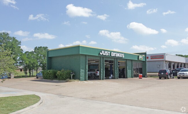


Property Detail
3217 Harwood Rd
Dallas-Fort Worth-Arlington, TX
HARWOOD OAKS PLAZA BLOCK 1 LOT 2
06194451
Tarrant
Commercialnec
Texas
B and X Area of moderate flood hazard, usually the area between the limits of the 100-year and 500-year floods.
2
2024
0.46 AC
2025
Hurst/Euless/Bedford
113624
Dallas/Ft Worth
2,864 SF
NEARBY LISTINGS FOR SALE OR LEASE
DEMOGRAPHICS near 3217 Harwood Rd
1 mile
3 mile
5 mile
2025 Total Population
16,401
131,787
242,485
2030 Population
17,090
137,829
255,319
Pop Growth 2025-2030
+ 4.20%
+ 4.58%
+ 5.29%
Average Age
41
40
39
2025 Total Households
7,341
54,058
98,001
HH Growth 2025-2030
+ 4.41%
+ 4.73%
+ 5.31%
Median Household Inc
$82,695
$88,006
$87,124
Avg Household Size
2.20
2.40
2.40
2025 Avg HH Vehicles
2.00
2.00
2.00
Median Home Value
$371,952
$386,444
$404,768
Median Year Built
1986
1985
1986
Nearby Places
Map Layers
Map Styles
 Street
 Aerial
Transit
 Traffic
 Biking
Places
Listings with unknown addresses are not visible on the map
- Restaurants
- Banks
- Shops
- Fitness
- Groceries
PUBLIC TRANSPORTATION
COMMUTER RAIL
Drive
Walk
Distance
10 min
5.1 mi
Drive
Walk
Distance
12 min
6.1 mi
AIRPORT
Dallas-Fort Worth International
Drive
Walk
Distance
Dallas-Fort Worth International
15 min
11.2 mi
Dallas Love Field
Drive
Walk
Distance
Dallas Love Field
28 min
19.2 mi
Nearby Properties
Address
Land Use
TOTAL SIZE
Lot Size
Zoning
Address
Land Use
TOTAL SIZE
Lot Size
Zoning
624,642 SF
15.38 AC
Address
Land Use
TOTAL SIZE
Lot Size
Zoning
631,558 SF
15.49 AC
Address
Land Use
TOTAL SIZE
Lot Size
Zoning
468,250 SF
37.03 AC
Address
Land Use
TOTAL SIZE
Lot Size
Zoning
415,563 SF
25.40 AC
Address
Land Use
TOTAL SIZE
Lot Size
Zoning
419,655 SF
20.44 AC
Address
Land Use
TOTAL SIZE
Lot Size
Zoning
443,420 SF
10.96 AC
Address
Land Use
TOTAL SIZE
Lot Size
Zoning
333,755 SF
19.06 AC
Address
Land Use
TOTAL SIZE
Lot Size
Zoning
363,849 SF
8.08 AC
Address
Land Use
TOTAL SIZE
Lot Size
Zoning
290,680 SF
26.31 AC
Address
Land Use
TOTAL SIZE
Lot Size
Zoning
348,842 SF
17.09 AC
Address
Land Use
TOTAL SIZE
Lot Size
Zoning
345,961 SF
14.73 AC
Address
Land Use
TOTAL SIZE
Lot Size
Zoning
356,000 SF
39.44 AC
Address
Land Use
TOTAL SIZE
Lot Size
Zoning
344,326 SF
15.25 AC
Address
Land Use
TOTAL SIZE
Lot Size
Zoning
282,665 SF
14.29 AC
Address
Land Use
TOTAL SIZE
Lot Size
Zoning
220,435 SF
14.97 AC
Address
Land Use
TOTAL SIZE
Lot Size
Zoning
172,000 SF
6.34 AC
Address
Land Use
TOTAL SIZE
Lot Size
Zoning
230,666 SF
13.33 AC
Address
Land Use
TOTAL SIZE
Lot Size
Zoning
293,822 SF
18.80 AC
Address
Land Use
TOTAL SIZE
Lot Size
Zoning
223,131 SF
12.50 AC
Address
Land Use
TOTAL SIZE
Lot Size
Zoning
300,000 SF
27.13 AC
Address
Land Use
TOTAL SIZE
Lot Size
Zoning
286,861 SF
13.38 AC
Address
Land Use
TOTAL SIZE
Lot Size
Zoning
236,016 SF
12.81 AC
Address
Land Use
TOTAL SIZE
Lot Size
Zoning
199,373 SF
12.98 AC
Address
Land Use
TOTAL SIZE
Lot Size
Zoning
79,244 SF
54.50 AC
Address
Land Use
TOTAL SIZE
Lot Size
Zoning
269,700 SF
48.40 AC
Address
Land Use
TOTAL SIZE
Lot Size
Zoning
198,800 SF
6.74 AC
Address
Land Use
TOTAL SIZE
Lot Size
Zoning
234,077 SF
12.16 AC
Address
Land Use
TOTAL SIZE
Lot Size
Zoning
236,701 SF
15.96 AC
Address
Land Use
TOTAL SIZE
Lot Size
Zoning
213,928 SF
11.57 AC
Address
Land Use
TOTAL SIZE
Lot Size
Zoning
236,945 SF
14.36 AC
The World's #1 Commercial Real Estate Marketplace
Connect with us
© 2026 CoStar Group
The information above has been obtained from sources believed reliable. While we do not doubt its accuracy we have not verified it and make no guarantee, warranty or representation about it. It is your responsibility to independently confirm its accuracy and completeness. Any projections, opinions, assumptions, or estimates used are for example only and do not represent the current or future performance of the property. The value of this transaction to you depends on tax and other factors which should be evaluated by your tax, financial, and legal advisors. You and your advisors should conduct a careful, independent investigation of the property to determine to your satisfaction the suitability of the property for your needs.