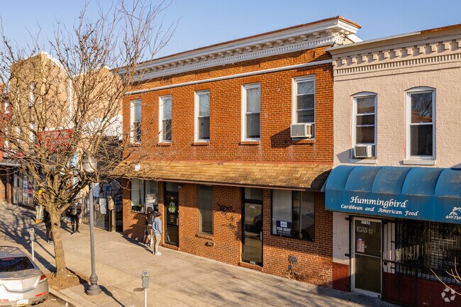
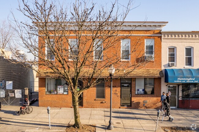
Property Record
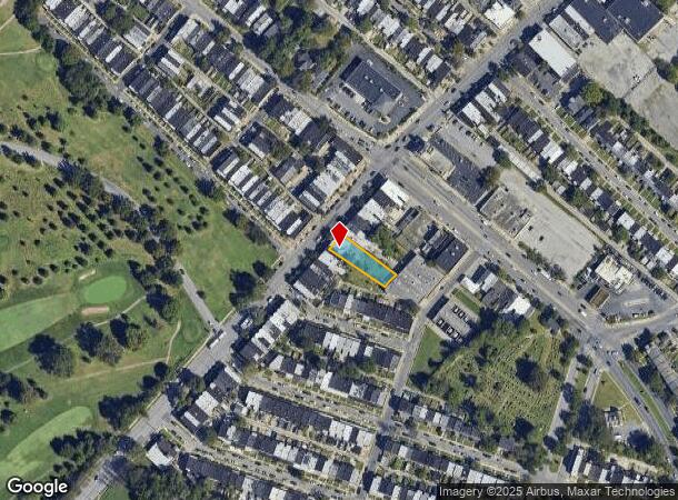
3219 Belair Rd, Baltimore, MD 21213
NEARBY LISTINGS FOR SALE OR LEASE
Property Detail
3219 Belair Rd
4188-010
49-9X185-8
Retailwithmorethanonenonretailuse
Baltimore City
X
Maryland
2400100405G
10
2024
0.20 AC
2025
Baltimore Northeast
080102
Baltimore
4,680 SF
Baltimore-Columbia-Towson, MD
DEMOGRAPHICS near 3219 Belair Rd
1 Mile
3 Mile
5 Mile
2024 Total Population
23,584
248,930
521,685
2029 Population
22,698
239,436
506,528
Pop Growth 2024-2029
(3.76%)
(3.81%)
(2.91%)
Average Age
40
38
39
2024 Total Households
9,127
108,836
223,968
HH Growth 2024-2029
(3.90%)
(4.00%)
(3.18%)
Median Household Inc
$50,005
$59,599
$60,663
Avg Household Size
2.50
2.20
2.20
2024 Avg HH Vehicles
1.00
1.00
1.00
Median Home Value
$132,744
$195,714
$219,800
Median Year Built
1948
1948
1950
Nearby Places
- Restaurants
- Banks
- Shops
- Fitness
- Groceries
PUBLIC TRANSPORTATION
COMMUTER RAIL
Penn Station (PENN - WASHINGTON - Maryland Area Regional Commuter Trains (The MARC), Penn Line - Maryland Area Regional Commuter Trains (The MARC), Penn Station & Camden Yards - Maryland Area Regional Commuter Trains (The MARC))
DRIVE
WALK
Distance
Penn Station (PENN - WASHINGTON - Maryland Area Regional Commuter Trains (The MARC), Penn Line - Maryland Area Regional Commuter Trains (The MARC), Penn Station & Camden Yards - Maryland Area Regional Commuter Trains (The MARC))
8 min
2.8 mi
Camden Station (CAMDEN - WASHINGTON - Maryland Area Regional Commuter Trains (The MARC), Camden Line - Maryland Area Regional Commuter Trains (The MARC))
DRIVE
WALK
Distance
Camden Station (CAMDEN - WASHINGTON - Maryland Area Regional Commuter Trains (The MARC), Camden Line - Maryland Area Regional Commuter Trains (The MARC))
13 min
4.2 mi
AIRPORT
Baltimore/Washington International Thurgood Marshall
DRIVE
WALK
Distance
Baltimore/Washington International Thurgood Marshall
28 min
13.8 mi
Freight Ports
Port of Baltimore
DRIVE
WALK
Distance
Port of Baltimore
18 min
8.6 mi
SALE & LEASE HISTORY
LISTING DATE
SALE/LEASE

Nov 24, 2020
For Sale
Dec 24, 2019
For Sale
Aug 31, 2020
For Sale
Nearby Properties
Address
Land Use
TOTAL SIZE
Lot Size
Zoning
Address
Land Use
TOTAL SIZE
Lot Size
Zoning
1,595,200 SF
20.36 AC
H
Address
Land Use
TOTAL SIZE
Lot Size
Zoning
1,632,000 SF
106.32 AC
EC-2
Address
Land Use
TOTAL SIZE
Lot Size
Zoning
712,573 SF
1.32 AC
C-5DC
Address
Land Use
TOTAL SIZE
Lot Size
Zoning
608,666 SF
8.42 AC
H
Address
Land Use
TOTAL SIZE
Lot Size
Zoning
830,720 SF
1.90 AC
I-MU
Address
Land Use
TOTAL SIZE
Lot Size
Zoning
21,312 SF
54.36 AC
EC-2
Address
Land Use
TOTAL SIZE
Lot Size
Zoning
236,614 SF
1.20 AC
BSC
Address
Land Use
TOTAL SIZE
Lot Size
Zoning
268,543 SF
84.93 AC
H
Address
Land Use
TOTAL SIZE
Lot Size
Zoning
24,993 SF
66.85 AC
EC-2
Address
Land Use
TOTAL SIZE
Lot Size
Zoning
241,576 SF
6.13 AC
H
Address
Land Use
TOTAL SIZE
Lot Size
Zoning
199,435 SF
1.19 AC
BSC
Address
Land Use
TOTAL SIZE
Lot Size
Zoning
334,715 SF
1.77 AC
H
Address
Land Use
TOTAL SIZE
Lot Size
Zoning
579,351 SF
0.96 AC
C-5DC
Address
Land Use
TOTAL SIZE
Lot Size
Zoning
189,700 SF
0.71 AC
TOD-4
Address
Land Use
TOTAL SIZE
Lot Size
Zoning
316,273 SF
25.90 AC
H
Address
Land Use
TOTAL SIZE
Lot Size
Zoning
538,988 SF
8.40 AC
I-MU
Address
Land Use
TOTAL SIZE
Lot Size
Zoning
831,350 SF
5.56 AC
C-2
Address
Land Use
TOTAL SIZE
Lot Size
Zoning
598,638 SF
3.75 AC
C-2
Address
Land Use
TOTAL SIZE
Lot Size
Zoning
728,691 SF
3.95 AC
C-2
Address
Land Use
TOTAL SIZE
Lot Size
Zoning
774,803 SF
7.38 AC
IMU-1
Address
Land Use
TOTAL SIZE
Lot Size
Zoning
534,109 SF
5.57 AC
R-8
Address
Land Use
TOTAL SIZE
Lot Size
Zoning
21.18 AC
H
Address
Land Use
TOTAL SIZE
Lot Size
Zoning
416,790 SF
9.57 AC
C-5DC
Address
Land Use
TOTAL SIZE
Lot Size
Zoning
305,232 SF
7.34 AC
C-2
Address
Land Use
TOTAL SIZE
Lot Size
Zoning
170,000 SF
0.67 AC
BSC
Address
Land Use
TOTAL SIZE
Lot Size
Zoning
600,798 SF
1.07 AC
2-4
Address
Land Use
TOTAL SIZE
Lot Size
Zoning
733,521 SF
7.36 AC
H
Address
Land Use
TOTAL SIZE
Lot Size
Zoning
417,571 SF
4.20 AC
C-2*
Address
Land Use
TOTAL SIZE
Lot Size
Zoning
273,088 SF
0.61 AC
BSC
Address
Land Use
TOTAL SIZE
Lot Size
Zoning
372,287 SF
0.98 AC
R-10
The World's #1 Commercial Real Estate Marketplace
Connect with us
© 2025 CoStar Group
The information above has been obtained from sources believed reliable. While we do not doubt its accuracy we have not verified it and make no guarantee, warranty or representation about it. It is your responsibility to independently confirm its accuracy and completeness. Any projections, opinions, assumptions, or estimates used are for example only and do not represent the current or future performance of the property. The value of this transaction to you depends on tax and other factors which should be evaluated by your tax, financial, and legal advisors. You and your advisors should conduct a careful, independent investigation of the property to determine to your satisfaction the suitability of the property for your needs.