Property Record
3219 Highway 59, Wharton, TX 77488


Save to a Folder
{{folder.Name}}
{{folder.ListingIds.length}} Properties
{{folder.ListingIds.length}} Property
Create a New Folder
Property Detail
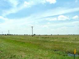
3219 Highway 59
R062527
A20243 ABST.243 TRACT 75A
Timberlandforesttreesagricultural
WHARTON
AE The base floodplain where base flood elevations are provided. AE Zones are now used on new format FIRMs instead of A1-A30 Zones.
Texas
2025
129.41 AC
2025
Texas South Area
740800
Other Market Areas
2,978 SF
El Campo, TX
NEARBY LISTINGS FOR SALE OR LEASE
DEMOGRAPHICS near 3219 Highway 59
1 mile
3 mile
5 mile
2025 Total Population
50
5,021
15,358
2030 Population
51
5,059
15,515
Pop Growth 2025-2030
+ 2.00%
+ 0.76%
+ 1.02%
Average Age
37
37
39
2025 Total Households
17
1,758
5,509
HH Growth 2025-2030
0.00%
+ 0.85%
+ 1.03%
Median Household Inc
$47,500
$47,337
$68,124
Avg Household Size
2.70
2.80
2.70
2025 Avg HH Vehicles
2.00
2.00
2.00
Median Home Value
$174,999
$142,873
$187,317
Median Year Built
1977
1959
1971
Nearby Places
Map Layers
Map Styles
 Street
 Aerial
Layers
 Traffic
 Biking
Places
Listings with unknown addresses are not visible on the map
- Restaurants
- Banks
- Shops
- Fitness
- Groceries
SALE & LEASE HISTORY
LISTING DATE
SALE/LEASE

Sep 05, 2017
For Sale
Nearby Properties
Address
Land Use
TOTAL SIZE
Lot Size
Zoning
Address
Land Use
TOTAL SIZE
Lot Size
Zoning
149,552 SF
29.98 AC
Address
Land Use
TOTAL SIZE
Lot Size
Zoning
26,445 SF
40.01 AC
Address
Land Use
TOTAL SIZE
Lot Size
Zoning
50,397 SF
10 AC
Address
Land Use
TOTAL SIZE
Lot Size
Zoning
95,488 SF
14.30 AC
Address
Land Use
TOTAL SIZE
Lot Size
Zoning
69,644 SF
4.83 AC
Address
Land Use
TOTAL SIZE
Lot Size
Zoning
80,662 SF
8.35 AC
Address
Land Use
TOTAL SIZE
Lot Size
Zoning
21,362 SF
Address
Land Use
TOTAL SIZE
Lot Size
Zoning
28,188 SF
2.07 AC
Address
Land Use
TOTAL SIZE
Lot Size
Zoning
55,280 SF
5.49 AC
Address
Land Use
TOTAL SIZE
Lot Size
Zoning
35,178 SF
4.65 AC
Address
Land Use
TOTAL SIZE
Lot Size
Zoning
46,340 SF
16.06 AC
Address
Land Use
TOTAL SIZE
Lot Size
Zoning
97,400 SF
14.31 AC
Address
Land Use
TOTAL SIZE
Lot Size
Zoning
16,090 SF
3.53 AC
Address
Land Use
TOTAL SIZE
Lot Size
Zoning
22,580 SF
5.41 AC
Address
Land Use
TOTAL SIZE
Lot Size
Zoning
49,725 SF
6.24 AC
Address
Land Use
TOTAL SIZE
Lot Size
Zoning
21,287 SF
0.65 AC
Address
Land Use
TOTAL SIZE
Lot Size
Zoning
15,196 SF
1.45 AC
Address
Land Use
TOTAL SIZE
Lot Size
Zoning
36,660 SF
2.03 AC
Address
Land Use
TOTAL SIZE
Lot Size
Zoning
9,427 SF
2.22 AC
Address
Land Use
TOTAL SIZE
Lot Size
Zoning
71,106 SF
6.15 AC
Address
Land Use
TOTAL SIZE
Lot Size
Zoning
14,958 SF
1.95 AC
Address
Land Use
TOTAL SIZE
Lot Size
Zoning
18,284 SF
28.80 AC
Address
Land Use
TOTAL SIZE
Lot Size
Zoning
6,540 SF
0.07 AC
Address
Land Use
TOTAL SIZE
Lot Size
Zoning
14,138 SF
1.47 AC
Address
Land Use
TOTAL SIZE
Lot Size
Zoning
12,780 SF
3.23 AC
Address
Land Use
TOTAL SIZE
Lot Size
Zoning
0.96 AC
Address
Land Use
TOTAL SIZE
Lot Size
Zoning
19,816 SF
0.68 AC
Address
Land Use
TOTAL SIZE
Lot Size
Zoning
36,002 SF
1.69 AC
Address
Land Use
TOTAL SIZE
Lot Size
Zoning
6,200 SF
7.28 AC
Address
Land Use
TOTAL SIZE
Lot Size
Zoning
13,178 SF
1.10 AC
The World's #1 Commercial Real Estate Marketplace
Connect with us
© 2026 CoStar Group
The information above has been obtained from sources believed reliable. While we do not doubt its accuracy we have not verified it and make no guarantee, warranty or representation about it. It is your responsibility to independently confirm its accuracy and completeness. Any projections, opinions, assumptions, or estimates used are for example only and do not represent the current or future performance of the property. The value of this transaction to you depends on tax and other factors which should be evaluated by your tax, financial, and legal advisors. You and your advisors should conduct a careful, independent investigation of the property to determine to your satisfaction the suitability of the property for your needs.