Property Record
3219 N Monroe St, Tallahassee, FL 32303


NEARBY LISTINGS FOR SALE OR LEASE
Property Detail
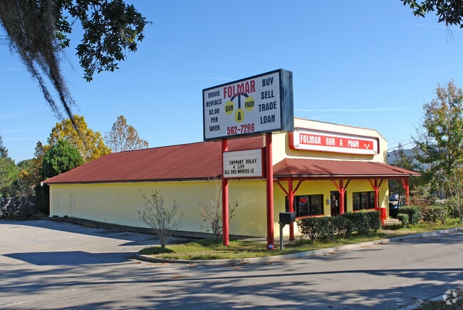
3219 N Monroe St
Tallahassee, FL
Plantation Of Fl Pecan Endowm Co 5Th Div
21-15-51-445-109.5
SECTION 15 T1N R1W PLANTATION OF THE FLORIDA PECAN ENDOWMENT COMPANY PB 1/4 PART OF LOTS 445 446 & 447 LOT 1 LIMITED PARTITION OR 2313/387 OR 5777/2334
Hotel
Leon
X
Florida
12073C0277F
4
2025
2.70 AC
2025
Northwest Leon County
002207
Tallahassee
39,537 SF
DEMOGRAPHICS near 3219 N Monroe St
1 Mile
3 Mile
5 Mile
2024 Total Population
6,809
71,713
136,295
2029 Population
7,237
75,104
142,626
Pop Growth 2024-2029
+ 6.29%
+ 4.73%
+ 4.65%
Average Age
35
33
34
2024 Total Households
2,976
29,758
58,328
HH Growth 2024-2029
+ 6.52%
+ 4.97%
+ 4.82%
Median Household Inc
$53,424
$44,483
$44,262
Avg Household Size
2.20
2.20
2.10
2024 Avg HH Vehicles
2.00
2.00
2.00
Median Home Value
$157,448
$189,538
$214,048
Median Year Built
1980
1985
1983
Nearby Places
Map Layers
Map Styles
 Street
 Aerial
- Restaurants
- Banks
- Shops
- Fitness
- Groceries
PUBLIC TRANSPORTATION
AIRPORT
Tallahassee International
DRIVE
WALK
Distance
Tallahassee International
17 min
9.7 mi
Nearby Properties
Address
Land Use
TOTAL SIZE
Lot Size
Zoning
Address
Land Use
TOTAL SIZE
Lot Size
Zoning
664,514 SF
2.49 AC
UT
Address
Land Use
TOTAL SIZE
Lot Size
Zoning
369,383 SF
4.51 AC
UT
Address
Land Use
TOTAL SIZE
Lot Size
Zoning
556,751 SF
20.60 AC
CP
Address
Land Use
TOTAL SIZE
Lot Size
Zoning
859,666 SF
20.17 AC
MR1
Address
Land Use
TOTAL SIZE
Lot Size
Zoning
538,290 SF
11.05 AC
Address
Land Use
TOTAL SIZE
Lot Size
Zoning
421,095 SF
28.06 AC
MR1
Address
Land Use
TOTAL SIZE
Lot Size
Zoning
459,568 SF
10.10 AC
CU45
Address
Land Use
TOTAL SIZE
Lot Size
Zoning
883,293 SF
35.97 AC
R4
Address
Land Use
TOTAL SIZE
Lot Size
Zoning
607,000 SF
37.55 AC
PUD
Address
Land Use
TOTAL SIZE
Lot Size
Zoning
1,241,812 SF
44.71 AC
MR1
Address
Land Use
TOTAL SIZE
Lot Size
Zoning
423,131 SF
8.36 AC
CU45
Address
Land Use
TOTAL SIZE
Lot Size
Zoning
739,671 SF
20.04 AC
MR1
Address
Land Use
TOTAL SIZE
Lot Size
Zoning
660,721 SF
30.95 AC
Address
Land Use
TOTAL SIZE
Lot Size
Zoning
489,720 SF
2.07 AC
UPUD
Address
Land Use
TOTAL SIZE
Lot Size
Zoning
325,725 SF
2.44 AC
UPUD
Address
Land Use
TOTAL SIZE
Lot Size
Zoning
498,076 SF
22.49 AC
MR1
Address
Land Use
TOTAL SIZE
Lot Size
Zoning
96,444 SF
16.70 AC
UT
Address
Land Use
TOTAL SIZE
Lot Size
Zoning
127,486 SF
8.23 AC
M1
Address
Land Use
TOTAL SIZE
Lot Size
Zoning
196,915 SF
3.33 AC
UT
Address
Land Use
TOTAL SIZE
Lot Size
Zoning
236,679 SF
32.60 AC
MR1
Address
Land Use
TOTAL SIZE
Lot Size
Zoning
588,955 SF
36.20 AC
R3
Address
Land Use
TOTAL SIZE
Lot Size
Zoning
332,760 SF
14.68 AC
MR1
Address
Land Use
TOTAL SIZE
Lot Size
Zoning
509,100 SF
14.93 AC
OR3
Address
Land Use
TOTAL SIZE
Lot Size
Zoning
570,525 SF
18.89 AC
MR1
Address
Land Use
TOTAL SIZE
Lot Size
Zoning
123,020 SF
9.45 AC
M1
Address
Land Use
TOTAL SIZE
Lot Size
Zoning
240,852 SF
8.21 AC
MR1
Address
Land Use
TOTAL SIZE
Lot Size
Zoning
551,527 SF
15.30 AC
MR1
Address
Land Use
TOTAL SIZE
Lot Size
Zoning
364,760 SF
12.05 AC
MR1
Address
Land Use
TOTAL SIZE
Lot Size
Zoning
1,574,384 SF
63.42 AC
AC
Address
Land Use
TOTAL SIZE
Lot Size
Zoning
271,838 SF
6.31 AC
OR2
The World's #1 Commercial Real Estate Marketplace
Connect with us
© 2026 CoStar Group
The information above has been obtained from sources believed reliable. While we do not doubt its accuracy we have not verified it and make no guarantee, warranty or representation about it. It is your responsibility to independently confirm its accuracy and completeness. Any projections, opinions, assumptions, or estimates used are for example only and do not represent the current or future performance of the property. The value of this transaction to you depends on tax and other factors which should be evaluated by your tax, financial, and legal advisors. You and your advisors should conduct a careful, independent investigation of the property to determine to your satisfaction the suitability of the property for your needs.