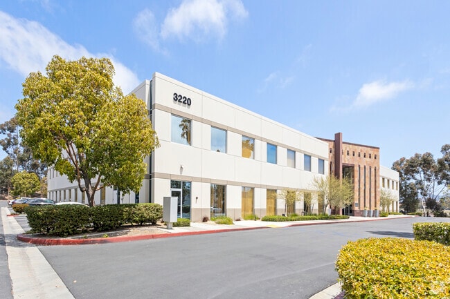
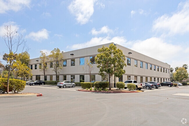
Property Record
3220 Executive Rdg, Vista, CA 92081

Save to a Folder
{{folder.Name}}
{{folder.ListingIds.length}} Properties
{{folder.ListingIds.length}} Property
Create a New Folder
Current Lease Availabilities
Property Detail
3220 Executive Rdg
221-660-31
PAR I POR OF DOC99-669001 IN TR PM18002
Industrialgeneral
San Diego
SPI
California
B and X Area of moderate flood hazard, usually the area between the limits of the 100-year and 500-year floods.
3.64 AC
2025
Vista
2026
San Diego
020019
San Diego-Chula Vista-Carlsbad, CA
10 SF
NEARBY LISTINGS FOR SALE OR LEASE
DEMOGRAPHICS near 3220 Executive Rdg
1 mile
3 mile
5 mile
2025 Total Population
8,712
93,716
232,571
2030 Population
8,754
93,968
233,346
Pop Growth 2025-2030
+ 0.48%
+ 0.27%
+ 0.33%
Average Age
49
41
41
2025 Total Households
3,587
33,355
81,134
HH Growth 2025-2030
+ 0.59%
+ 0.19%
+ 0.23%
Median Household Inc
$86,954
$113,753
$119,957
Avg Household Size
2.40
2.70
2.80
2025 Avg HH Vehicles
2.00
2.00
2.00
Median Home Value
$689,754
$905,960
$968,925
Median Year Built
1985
1991
1990
Nearby Places
Map Layers
Map Styles
 Street
 Aerial
Layers
 Traffic
 Biking
Places
Listings with unknown addresses are not visible on the map
- Restaurants
- Banks
- Shops
- Fitness
- Groceries
PUBLIC TRANSPORTATION
COMMUTER RAIL
Carlsbad Poinsettia (Coaster - San Diego North County Transit District (Coaster/Sprinter/Breeze))
Drive
Walk
Distance
Carlsbad Poinsettia (Coaster - San Diego North County Transit District (Coaster/Sprinter/Breeze))
14 min
7.7 mi
AIRPORT
San Diego International
Drive
Walk
Distance
San Diego International
47 min
34.6 mi
Freight Ports
Port of San Diego
Drive
Walk
Distance
Port of San Diego
52 min
39.0 mi
Nearby Properties
Address
Land Use
TOTAL SIZE
Lot Size
Zoning
Address
Land Use
TOTAL SIZE
Lot Size
Zoning
9,999 SF
13.92 AC
P-M
Address
Land Use
TOTAL SIZE
Lot Size
Zoning
9,999 SF
24.15 AC
RM-B
Address
Land Use
TOTAL SIZE
Lot Size
Zoning
9,999 SF
18.90 AC
R-M
Address
Land Use
TOTAL SIZE
Lot Size
Zoning
9,999 SF
8.76 AC
P-C
Address
Land Use
TOTAL SIZE
Lot Size
Zoning
9,999 SF
14.32 AC
P-M
Address
Land Use
TOTAL SIZE
Lot Size
Zoning
9,999 SF
5.25 AC
SPA
Address
Land Use
TOTAL SIZE
Lot Size
Zoning
9,999 SF
7.31 AC
P-C
Address
Land Use
TOTAL SIZE
Lot Size
Zoning
12.49 AC
P-C
Address
Land Use
TOTAL SIZE
Lot Size
Zoning
9,999 SF
6.38 AC
P-M
Address
Land Use
TOTAL SIZE
Lot Size
Zoning
9,999 SF
5.37 AC
SPA
Address
Land Use
TOTAL SIZE
Lot Size
Zoning
9,999 SF
19.35 AC
P-M
Address
Land Use
TOTAL SIZE
Lot Size
Zoning
9,999 SF
28.45 AC
O-S
Address
Land Use
TOTAL SIZE
Lot Size
Zoning
9,999 SF
11.87 AC
R-M
Address
Land Use
TOTAL SIZE
Lot Size
Zoning
9,999 SF
9.41 AC
SPI
Address
Land Use
TOTAL SIZE
Lot Size
Zoning
9,200 SF
4.52 AC
P-M
Address
Land Use
TOTAL SIZE
Lot Size
Zoning
9,999 SF
16.91 AC
C
Address
Land Use
TOTAL SIZE
Lot Size
Zoning
9,999 SF
11.08 AC
SPI
Address
Land Use
TOTAL SIZE
Lot Size
Zoning
9,999 SF
19.68 AC
SPI
Address
Land Use
TOTAL SIZE
Lot Size
Zoning
9,999 SF
P-M
Address
Land Use
TOTAL SIZE
Lot Size
Zoning
9,999 SF
11.49 AC
P-M
Address
Land Use
TOTAL SIZE
Lot Size
Zoning
9,999 SF
14.91 AC
SPI
Address
Land Use
TOTAL SIZE
Lot Size
Zoning
9,999 SF
7.33 AC
R-M
Address
Land Use
TOTAL SIZE
Lot Size
Zoning
9,999 SF
4.76 AC
C34
Address
Land Use
TOTAL SIZE
Lot Size
Zoning
9,999 SF
10.94 AC
P-M
Address
Land Use
TOTAL SIZE
Lot Size
Zoning
9,999 SF
13.20 AC
P-M
Address
Land Use
TOTAL SIZE
Lot Size
Zoning
9,999 SF
7.91 AC
SPI
Address
Land Use
TOTAL SIZE
Lot Size
Zoning
9,999 SF
9.74 AC
C-M
Address
Land Use
TOTAL SIZE
Lot Size
Zoning
9,999 SF
10.44 AC
P-M
Address
Land Use
TOTAL SIZE
Lot Size
Zoning
27.30 AC
SPI
Address
Land Use
TOTAL SIZE
Lot Size
Zoning
9,999 SF
6.55 AC
C-M
The World's #1 Commercial Real Estate Marketplace
Connect with us
© 2026 CoStar Group
The information above has been obtained from sources believed reliable. While we do not doubt its accuracy we have not verified it and make no guarantee, warranty or representation about it. It is your responsibility to independently confirm its accuracy and completeness. Any projections, opinions, assumptions, or estimates used are for example only and do not represent the current or future performance of the property. The value of this transaction to you depends on tax and other factors which should be evaluated by your tax, financial, and legal advisors. You and your advisors should conduct a careful, independent investigation of the property to determine to your satisfaction the suitability of the property for your needs.