Property Record
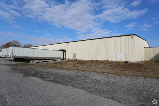
3220 Highway 31 S, Decatur, AL 35603


NEARBY LISTINGS FOR SALE OR LEASE
Property Detail
3220 Highway 31 S
12-03-05-4-000-008.000
BEG AT SE COR OF SEC 5, T6S, R4W, TH W 987.6', TO TPOB. TH W 600'S, TH N 500'S, TH W 130'S, TH N 500', TH W 830'S TO E R/W OF
Publicstorage
Morgan
AE
Alabama
01103C0086F
42 AC
2025
Alabama North Area
2024
Other Market Areas
005109
Decatur, AL
17,400 SF
DEMOGRAPHICS near 3220 Highway 31 S
1 Mile
3 Mile
5 Mile
2024 Total Population
1,909
29,110
61,077
2029 Population
1,893
29,145
61,429
Pop Growth 2024-2029
(0.84%)
+ 0.12%
+ 0.58%
Average Age
35
40
40
2024 Total Households
760
12,019
24,793
HH Growth 2024-2029
(0.92%)
+ 0.11%
+ 0.56%
Median Household Inc
$46,006
$49,433
$50,733
Avg Household Size
2.40
2.30
2.30
2024 Avg HH Vehicles
2.00
2.00
2.00
Median Home Value
$117,187
$163,187
$163,782
Median Year Built
1982
1977
1978
Nearby Places
Map Layers
Map Styles
 Street
 Aerial
- Restaurants
- Banks
- Shops
- Fitness
- Groceries
PUBLIC TRANSPORTATION
AIRPORT
Huntsville International-Carl T Jones Field
DRIVE
WALK
Distance
Huntsville International-Carl T Jones Field
32 min
20.0 mi
Freight Ports
Port of Mobile
DRIVE
WALK
Distance
Port of Mobile
368 min
332.0 mi
SALE & LEASE HISTORY
LISTING DATE
SALE/LEASE

Feb 17, 2022
For Lease
Nearby Properties
Address
Land Use
TOTAL SIZE
Lot Size
Zoning
Address
Land Use
TOTAL SIZE
Lot Size
Zoning
157,720 SF
22 AC
Address
Land Use
TOTAL SIZE
Lot Size
Zoning
128,239 SF
7.10 AC
Address
Land Use
TOTAL SIZE
Lot Size
Zoning
51,958 SF
14 AC
Address
Land Use
TOTAL SIZE
Lot Size
Zoning
81,682 SF
13 AC
Address
Land Use
TOTAL SIZE
Lot Size
Zoning
205,279 SF
25.45 AC
Address
Land Use
TOTAL SIZE
Lot Size
Zoning
135,440 SF
6.76 AC
Address
Land Use
TOTAL SIZE
Lot Size
Zoning
54,352 SF
10.70 AC
Address
Land Use
TOTAL SIZE
Lot Size
Zoning
40,712 SF
12 AC
Address
Land Use
TOTAL SIZE
Lot Size
Zoning
2,546 SF
9.30 AC
Address
Land Use
TOTAL SIZE
Lot Size
Zoning
64,449 SF
12 AC
Address
Land Use
TOTAL SIZE
Lot Size
Zoning
19,239 SF
4.50 AC
Address
Land Use
TOTAL SIZE
Lot Size
Zoning
4,865 SF
22 AC
Address
Land Use
TOTAL SIZE
Lot Size
Zoning
49,384 SF
1.07 AC
Address
Land Use
TOTAL SIZE
Lot Size
Zoning
52,800 SF
14.50 AC
Address
Land Use
TOTAL SIZE
Lot Size
Zoning
42,197 SF
3.75 AC
Address
Land Use
TOTAL SIZE
Lot Size
Zoning
31,720 SF
6 AC
Address
Land Use
TOTAL SIZE
Lot Size
Zoning
53,680 SF
0.50 AC
Address
Land Use
TOTAL SIZE
Lot Size
Zoning
55,283 SF
4.48 AC
Address
Land Use
TOTAL SIZE
Lot Size
Zoning
175,314 SF
Address
Land Use
TOTAL SIZE
Lot Size
Zoning
77,811 SF
9.34 AC
Address
Land Use
TOTAL SIZE
Lot Size
Zoning
6,800 SF
4.18 AC
Address
Land Use
TOTAL SIZE
Lot Size
Zoning
100,525 SF
10.80 AC
Address
Land Use
TOTAL SIZE
Lot Size
Zoning
48,536 SF
7.24 AC
Address
Land Use
TOTAL SIZE
Lot Size
Zoning
35,498 SF
4.70 AC
Address
Land Use
TOTAL SIZE
Lot Size
Zoning
54,705 SF
4.79 AC
Address
Land Use
TOTAL SIZE
Lot Size
Zoning
58,500 SF
3.50 AC
Address
Land Use
TOTAL SIZE
Lot Size
Zoning
2,805 SF
8.20 AC
Address
Land Use
TOTAL SIZE
Lot Size
Zoning
31,920 SF
3.90 AC
Address
Land Use
TOTAL SIZE
Lot Size
Zoning
12,744 SF
3.19 AC
Address
Land Use
TOTAL SIZE
Lot Size
Zoning
11,740 SF
3.67 AC
The World's #1 Commercial Real Estate Marketplace
Connect with us
© 2026 CoStar Group
The information above has been obtained from sources believed reliable. While we do not doubt its accuracy we have not verified it and make no guarantee, warranty or representation about it. It is your responsibility to independently confirm its accuracy and completeness. Any projections, opinions, assumptions, or estimates used are for example only and do not represent the current or future performance of the property. The value of this transaction to you depends on tax and other factors which should be evaluated by your tax, financial, and legal advisors. You and your advisors should conduct a careful, independent investigation of the property to determine to your satisfaction the suitability of the property for your needs.