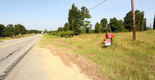
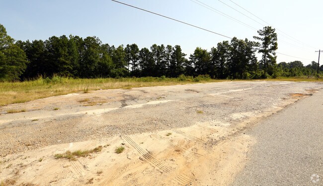
Property Record
3220 Highway 378, Leesville, SC 29070

Save to a Folder
{{folder.Name}}
{{folder.ListingIds.length}} Properties
{{folder.ListingIds.length}} Property
Create a New Folder
Property Detail
3220 Highway 378
003000-02-117
NS HWY 378
Commercialnec
LEXINGTON
RD
South Carolina
B and X Area of moderate flood hazard, usually the area between the limits of the 100-year and 500-year floods.
2.01 AC
2025
Outlying Lexington County
2024
Columbia
021303
Columbia, SC
6,000 SF
NEARBY LISTINGS FOR SALE OR LEASE
DEMOGRAPHICS near 3220 Highway 378
1 mile
3 mile
5 mile
2025 Total Population
923
5,371
13,640
2030 Population
983
5,747
14,536
Pop Growth 2025-2030
+ 6.50%
+ 7.00%
+ 6.57%
Average Age
49
48
46
2025 Total Households
404
2,266
5,533
HH Growth 2025-2030
+ 6.68%
+ 7.24%
+ 6.80%
Median Household Inc
$106,971
$108,858
$109,498
Avg Household Size
2.30
2.40
2.40
2025 Avg HH Vehicles
2.00
2.00
3.00
Median Home Value
$405,814
$444,908
$432,282
Median Year Built
1995
1998
1999
Nearby Places
Map Layers
Map Styles
 Street
 Aerial
Layers
 Traffic
 Biking
Places
Listings with unknown addresses are not visible on the map
- Restaurants
- Banks
- Shops
- Fitness
- Groceries
PUBLIC TRANSPORTATION
AIRPORT
Columbia Metro
Drive
Walk
Distance
Columbia Metro
45 min
24.7 mi
Freight Ports
North Charleston Terminal
Drive
Walk
Distance
North Charleston Terminal
147 min
122.6 mi
SALE & LEASE HISTORY
LISTING DATE
SALE/LEASE

Sep 24, 2016
For Sale
Nearby Properties
Address
Land Use
TOTAL SIZE
Lot Size
Zoning
Address
Land Use
TOTAL SIZE
Lot Size
Zoning
5,145 SF
2 AC
ID
Address
Land Use
TOTAL SIZE
Lot Size
Zoning
9,090 SF
2.15 AC
ID
Address
Land Use
TOTAL SIZE
Lot Size
Zoning
1,712 SF
4.65 AC
ID
Address
Land Use
TOTAL SIZE
Lot Size
Zoning
750 SF
1.59 AC
LR
Address
Land Use
TOTAL SIZE
Lot Size
Zoning
7,960 SF
2.71 AC
ID
Address
Land Use
TOTAL SIZE
Lot Size
Zoning
19,336 SF
1.31 AC
ID
Address
Land Use
TOTAL SIZE
Lot Size
Zoning
11,615 SF
1.11 AC
ID
Address
Land Use
TOTAL SIZE
Lot Size
Zoning
960 SF
3.17 AC
ID
Address
Land Use
TOTAL SIZE
Lot Size
Zoning
3,570 SF
0.39 AC
ID
Address
Land Use
TOTAL SIZE
Lot Size
Zoning
5,050 SF
0.38 AC
RD
Address
Land Use
TOTAL SIZE
Lot Size
Zoning
3,007 SF
0.38 AC
RD
Address
Land Use
TOTAL SIZE
Lot Size
Zoning
2,252 SF
3.33 AC
LR
Address
Land Use
TOTAL SIZE
Lot Size
Zoning
3,057 SF
0.33 AC
RD
Address
Land Use
TOTAL SIZE
Lot Size
Zoning
1.60 AC
ID
Address
Land Use
TOTAL SIZE
Lot Size
Zoning
2.78 AC
RD
Address
Land Use
TOTAL SIZE
Lot Size
Zoning
1,680 SF
15.58 AC
ID
Address
Land Use
TOTAL SIZE
Lot Size
Zoning
6,498 SF
32.50 AC
RD
Address
Land Use
TOTAL SIZE
Lot Size
Zoning
0.56 AC
RD
Address
Land Use
TOTAL SIZE
Lot Size
Zoning
3.27 AC
RD
Address
Land Use
TOTAL SIZE
Lot Size
Zoning
560 SF
RD
Address
Land Use
TOTAL SIZE
Lot Size
Zoning
1,673 SF
1.79 AC
ID
Address
Land Use
TOTAL SIZE
Lot Size
Zoning
3,094 SF
0.49 AC
RD
Address
Land Use
TOTAL SIZE
Lot Size
Zoning
0.87 AC
RD
Address
Land Use
TOTAL SIZE
Lot Size
Zoning
1,848 SF
0.74 AC
RD
Address
Land Use
TOTAL SIZE
Lot Size
Zoning
5.48 AC
LR
Address
Land Use
TOTAL SIZE
Lot Size
Zoning
2,950 SF
1.50 AC
ID
Address
Land Use
TOTAL SIZE
Lot Size
Zoning
2,559 SF
5.78 AC
ID
Address
Land Use
TOTAL SIZE
Lot Size
Zoning
2.89 AC
RD
Address
Land Use
TOTAL SIZE
Lot Size
Zoning
2,000 SF
0.55 AC
RD
Address
Land Use
TOTAL SIZE
Lot Size
Zoning
3,526 SF
0.42 AC
ID
The World's #1 Commercial Real Estate Marketplace
Connect with us
© 2026 CoStar Group
The information above has been obtained from sources believed reliable. While we do not doubt its accuracy we have not verified it and make no guarantee, warranty or representation about it. It is your responsibility to independently confirm its accuracy and completeness. Any projections, opinions, assumptions, or estimates used are for example only and do not represent the current or future performance of the property. The value of this transaction to you depends on tax and other factors which should be evaluated by your tax, financial, and legal advisors. You and your advisors should conduct a careful, independent investigation of the property to determine to your satisfaction the suitability of the property for your needs.