Property Record
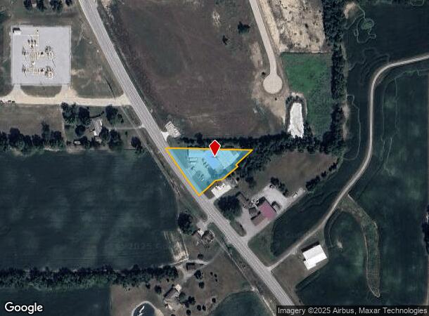
3220 N Us Highway 33, Churubusco, IN 46723

NEARBY LISTINGS FOR SALE OR LEASE
-
-
View all Churubusco listings for sale on LoopNet.com
Property Detail
3220 N Us Highway 33
92-04-24-000-208.000-009
PT S2 SE4 EX .63A EX .003A S24 T32 R10 .601A
Autorepair
Whitley
X
Indiana
18183C0200C
0.60 AC
2024
Outlying Whitley County
2024
Fort Wayne
050100
Fort Wayne, IN
5,848 SF
DEMOGRAPHICS near 3220 N Us Highway 33
1 Mile
3 Mile
5 Mile
2024 Total Population
465
4,142
8,521
2029 Population
483
4,329
8,903
Pop Growth 2024-2029
+ 3.87%
+ 4.51%
+ 4.48%
Average Age
42
41
41
2024 Total Households
186
1,697
3,358
HH Growth 2024-2029
+ 4.30%
+ 4.54%
+ 4.53%
Median Household Inc
$69,782
$64,235
$74,815
Avg Household Size
2.40
2.40
2.50
2024 Avg HH Vehicles
2.00
2.00
2.00
Median Home Value
$152,525
$148,315
$183,562
Median Year Built
1965
1972
1976
Nearby Places
Map Layers
Map Styles
 Street
 Aerial
- Restaurants
- Banks
- Shops
- Fitness
- Groceries
PUBLIC TRANSPORTATION
AIRPORT
Fort Wayne International
DRIVE
WALK
Distance
Fort Wayne International
37 min
21.1 mi
Nearby Properties
Address
Land Use
TOTAL SIZE
Lot Size
Zoning
Address
Land Use
TOTAL SIZE
Lot Size
Zoning
97,135 SF
44.08 AC
Address
Land Use
TOTAL SIZE
Lot Size
Zoning
336,825 SF
38.51 AC
Address
Land Use
TOTAL SIZE
Lot Size
Zoning
9,835 SF
59.73 AC
Address
Land Use
TOTAL SIZE
Lot Size
Zoning
16,639 SF
3 AC
Address
Land Use
TOTAL SIZE
Lot Size
Zoning
94,752 SF
43.69 AC
Address
Land Use
TOTAL SIZE
Lot Size
Zoning
43,089 SF
0.34 AC
Address
Land Use
TOTAL SIZE
Lot Size
Zoning
4,799 SF
15.99 AC
Address
Land Use
TOTAL SIZE
Lot Size
Zoning
4,330 SF
14.11 AC
Address
Land Use
TOTAL SIZE
Lot Size
Zoning
2,641 SF
0.86 AC
Address
Land Use
TOTAL SIZE
Lot Size
Zoning
6,406 SF
4.98 AC
Address
Land Use
TOTAL SIZE
Lot Size
Zoning
6,995 SF
10 AC
Address
Land Use
TOTAL SIZE
Lot Size
Zoning
4,360 SF
6.41 AC
Address
Land Use
TOTAL SIZE
Lot Size
Zoning
4,592 SF
5 AC
Address
Land Use
TOTAL SIZE
Lot Size
Zoning
6,799 SF
11.28 AC
Address
Land Use
TOTAL SIZE
Lot Size
Zoning
32,190 SF
18.95 AC
Address
Land Use
TOTAL SIZE
Lot Size
Zoning
6,176 SF
11.27 AC
Address
Land Use
TOTAL SIZE
Lot Size
Zoning
5,925 SF
8.27 AC
Address
Land Use
TOTAL SIZE
Lot Size
Zoning
5,035 SF
21.75 AC
Address
Land Use
TOTAL SIZE
Lot Size
Zoning
5,123 SF
35.50 AC
Address
Land Use
TOTAL SIZE
Lot Size
Zoning
5,963 SF
11.38 AC
Address
Land Use
TOTAL SIZE
Lot Size
Zoning
7,209 SF
25.96 AC
Address
Land Use
TOTAL SIZE
Lot Size
Zoning
6,934 SF
3.77 AC
Address
Land Use
TOTAL SIZE
Lot Size
Zoning
4,420 SF
10 AC
Address
Land Use
TOTAL SIZE
Lot Size
Zoning
4,776 SF
20.03 AC
Address
Land Use
TOTAL SIZE
Lot Size
Zoning
4,189 SF
5.36 AC
Address
Land Use
TOTAL SIZE
Lot Size
Zoning
4,919 SF
8.94 AC
Address
Land Use
TOTAL SIZE
Lot Size
Zoning
4,818 SF
40 AC
Address
Land Use
TOTAL SIZE
Lot Size
Zoning
8,832 SF
21.78 AC
Address
Land Use
TOTAL SIZE
Lot Size
Zoning
4,952 SF
11.80 AC
Address
Land Use
TOTAL SIZE
Lot Size
Zoning
5,969 SF
7.09 AC
The World's #1 Commercial Real Estate Marketplace
Connect with us
© 2025 CoStar Group
The information above has been obtained from sources believed reliable. While we do not doubt its accuracy we have not verified it and make no guarantee, warranty or representation about it. It is your responsibility to independently confirm its accuracy and completeness. Any projections, opinions, assumptions, or estimates used are for example only and do not represent the current or future performance of the property. The value of this transaction to you depends on tax and other factors which should be evaluated by your tax, financial, and legal advisors. You and your advisors should conduct a careful, independent investigation of the property to determine to your satisfaction the suitability of the property for your needs.