Property Record
32200 Lookout Rd, Paola, KS 66071

NEARBY LISTINGS FOR SALE OR LEASE
-
-
View all Paola listings for sale on LoopNet.com
Property Detail
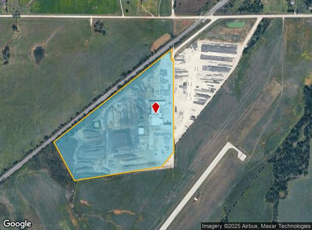
32200 Lookout Rd
147-25-0-00-00-013.00-0
S25, T17, R22, ACRES 29.68, TR BEG 3695' NEC NE4, TH S1192.6' SWLY281.5' WLY1061.9' NWLY485' NELY1809.7' TO POB.
Warehouse
Miami
X
Kansas
20121C0166D
29.68 AC
2025
Outer South Kansas City
2025
Kansas City
100602
Kansas City, MO-KS
29,832 SF
DEMOGRAPHICS near 32200 Lookout Rd
1 Mile
3 Mile
5 Mile
2024 Total Population
207
3,264
13,288
2029 Population
215
3,410
13,945
Pop Growth 2024-2029
+ 3.86%
+ 4.47%
+ 4.94%
Average Age
45
40
40
2024 Total Households
82
1,283
5,236
HH Growth 2024-2029
+ 4.88%
+ 4.60%
+ 4.98%
Median Household Inc
$71,499
$71,834
$65,214
Avg Household Size
2.50
2.40
2.40
2024 Avg HH Vehicles
2.00
2.00
2.00
Median Home Value
$283,333
$185,713
$164,385
Median Year Built
1984
1950
1963
Nearby Places
Map Layers
Map Styles
 Street
 Aerial
- Restaurants
- Banks
- Shops
- Fitness
- Groceries
Nearby Properties
Address
Land Use
TOTAL SIZE
Lot Size
Zoning
Address
Land Use
TOTAL SIZE
Lot Size
Zoning
29,348 SF
0.81 AC
Address
Land Use
TOTAL SIZE
Lot Size
Zoning
27,400 SF
0.77 AC
Address
Land Use
TOTAL SIZE
Lot Size
Zoning
1,761 SF
136.32 AC
BP
Address
Land Use
TOTAL SIZE
Lot Size
Zoning
26,316 SF
6.15 AC
Address
Land Use
TOTAL SIZE
Lot Size
Zoning
7,200 SF
15.23 AC
PGA
Address
Land Use
TOTAL SIZE
Lot Size
Zoning
37,296 SF
1.74 AC
Address
Land Use
TOTAL SIZE
Lot Size
Zoning
2,248 SF
0.27 AC
Address
Land Use
TOTAL SIZE
Lot Size
Zoning
25,784 SF
1.73 AC
Address
Land Use
TOTAL SIZE
Lot Size
Zoning
8,791 SF
0.13 AC
Address
Land Use
TOTAL SIZE
Lot Size
Zoning
16,780 SF
8.17 AC
Address
Land Use
TOTAL SIZE
Lot Size
Zoning
684 SF
18.52 AC
PGA
Address
Land Use
TOTAL SIZE
Lot Size
Zoning
3,532 SF
2.96 AC
Address
Land Use
TOTAL SIZE
Lot Size
Zoning
5,908 SF
8.50 AC
OGA
Address
Land Use
TOTAL SIZE
Lot Size
Zoning
108,696 SF
12.01 AC
Address
Land Use
TOTAL SIZE
Lot Size
Zoning
3,825 SF
0.48 AC
Address
Land Use
TOTAL SIZE
Lot Size
Zoning
93.27 AC
Address
Land Use
TOTAL SIZE
Lot Size
Zoning
10,486 SF
0.15 AC
Address
Land Use
TOTAL SIZE
Lot Size
Zoning
16,673 SF
0.19 AC
Address
Land Use
TOTAL SIZE
Lot Size
Zoning
1.74 AC
Address
Land Use
TOTAL SIZE
Lot Size
Zoning
25.33 AC
PGA
Address
Land Use
TOTAL SIZE
Lot Size
Zoning
3,157 SF
2.62 AC
PGA
Address
Land Use
TOTAL SIZE
Lot Size
Zoning
27.77 AC
Address
Land Use
TOTAL SIZE
Lot Size
Zoning
18,936 SF
4.59 AC
PGA
Address
Land Use
TOTAL SIZE
Lot Size
Zoning
3.86 AC
PGA
Address
Land Use
TOTAL SIZE
Lot Size
Zoning
7,200 SF
0.60 AC
Address
Land Use
TOTAL SIZE
Lot Size
Zoning
33.12 AC
Address
Land Use
TOTAL SIZE
Lot Size
Zoning
4,315 SF
0.32 AC
Address
Land Use
TOTAL SIZE
Lot Size
Zoning
64.96 AC
BP
Address
Land Use
TOTAL SIZE
Lot Size
Zoning
49,998 SF
1.49 AC
The World's #1 Commercial Real Estate Marketplace
Connect with us
© 2026 CoStar Group
The information above has been obtained from sources believed reliable. While we do not doubt its accuracy we have not verified it and make no guarantee, warranty or representation about it. It is your responsibility to independently confirm its accuracy and completeness. Any projections, opinions, assumptions, or estimates used are for example only and do not represent the current or future performance of the property. The value of this transaction to you depends on tax and other factors which should be evaluated by your tax, financial, and legal advisors. You and your advisors should conduct a careful, independent investigation of the property to determine to your satisfaction the suitability of the property for your needs.