Property Record
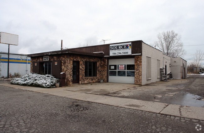
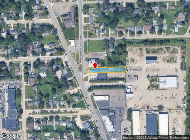
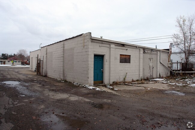
32240 Garfield Rd, Fraser, MI 48026
NEARBY LISTINGS FOR SALE OR LEASE
Property Detail
32240 Garfield Rd
Detroit-Warren-Dearborn, MI
Of The Subdivision
03-14-05-153-006
ASSESSOR'S PLAT NO. 5 OF LOTS 1; 2; 3; AND PARTS OF 4; 5; AND 6 OF THE SUBDIVISION OF NW 1/4 OF SEC 5 AND NE 1/4 AND NE 1/4
Autorepair
Macomb
X
Michigan
26099C0337G
1,91
2024
0.37 AC
2025
Groesbeck Central
254500
Detroit
3,255 SF
DEMOGRAPHICS near 32240 Garfield Rd
1 Mile
3 Mile
5 Mile
2024 Total Population
12,945
112,541
305,454
2029 Population
12,839
111,129
302,046
Pop Growth 2024-2029
(0.82%)
(1.25%)
(1.12%)
Average Age
42
42
42
2024 Total Households
5,563
47,906
128,149
HH Growth 2024-2029
(0.84%)
(1.27%)
(1.12%)
Median Household Inc
$60,139
$61,375
$63,391
Avg Household Size
2.30
2.30
2.30
2024 Avg HH Vehicles
2.00
2.00
2.00
Median Home Value
$164,925
$160,579
$165,508
Median Year Built
1969
1966
1966
Nearby Places
Map Layers
Map Styles
 Street
 Aerial
- Restaurants
- Banks
- Shops
- Fitness
- Groceries
PUBLIC TRANSPORTATION
AIRPORT
Windsor International
DRIVE
WALK
Distance
Windsor International
52 min
31.7 mi
Freight Ports
Port of Toledo
DRIVE
WALK
Distance
Port of Toledo
102 min
79.6 mi
Nearby Properties
Address
Land Use
TOTAL SIZE
Lot Size
Zoning
Address
Land Use
TOTAL SIZE
Lot Size
Zoning
436,218 SF
36.43 AC
B-2
Address
Land Use
TOTAL SIZE
Lot Size
Zoning
283,685 SF
19.90 AC
R-3
Address
Land Use
TOTAL SIZE
Lot Size
Zoning
24.38 AC
RML
Address
Land Use
TOTAL SIZE
Lot Size
Zoning
82,475 SF
16.81 AC
RM-2
Address
Land Use
TOTAL SIZE
Lot Size
Zoning
249,162 SF
27.87 AC
IC
Address
Land Use
TOTAL SIZE
Lot Size
Zoning
31.84 AC
RH
Address
Land Use
TOTAL SIZE
Lot Size
Zoning
236,221 SF
31.30 AC
B-2
Address
Land Use
TOTAL SIZE
Lot Size
Zoning
91,386 SF
B-2
Address
Land Use
TOTAL SIZE
Lot Size
Zoning
209,501 SF
17.74 AC
B-3
Address
Land Use
TOTAL SIZE
Lot Size
Zoning
91,104 SF
11.99 AC
RM-2
Address
Land Use
TOTAL SIZE
Lot Size
Zoning
247,177 SF
26.94 AC
CG
Address
Land Use
TOTAL SIZE
Lot Size
Zoning
217,369 SF
20.15 AC
B-2
Address
Land Use
TOTAL SIZE
Lot Size
Zoning
14.67 AC
RM-2
Address
Land Use
TOTAL SIZE
Lot Size
Zoning
204,620 SF
13.73 AC
R-3
Address
Land Use
TOTAL SIZE
Lot Size
Zoning
218,819 SF
15 AC
R-3
Address
Land Use
TOTAL SIZE
Lot Size
Zoning
102,598 SF
Address
Land Use
TOTAL SIZE
Lot Size
Zoning
376,278 SF
19.85 AC
RM-1
Address
Land Use
TOTAL SIZE
Lot Size
Zoning
179,653 SF
11.56 AC
B-2
Address
Land Use
TOTAL SIZE
Lot Size
Zoning
7.18 AC
RMH
Address
Land Use
TOTAL SIZE
Lot Size
Zoning
370,077 SF
18.24 AC
B-2
Address
Land Use
TOTAL SIZE
Lot Size
Zoning
10.37 AC
RML
Address
Land Use
TOTAL SIZE
Lot Size
Zoning
117,664 SF
6.66 AC
I-1
Address
Land Use
TOTAL SIZE
Lot Size
Zoning
157,610 SF
5.30 AC
RMH
Address
Land Use
TOTAL SIZE
Lot Size
Zoning
108,366 SF
16.66 AC
O-2
Address
Land Use
TOTAL SIZE
Lot Size
Zoning
256 SF
5.57 AC
SP-1
Address
Land Use
TOTAL SIZE
Lot Size
Zoning
10.89 AC
RML
Address
Land Use
TOTAL SIZE
Lot Size
Zoning
41,065 SF
4.30 AC
B-3
Address
Land Use
TOTAL SIZE
Lot Size
Zoning
131,812 SF
12.56 AC
B-3
Address
Land Use
TOTAL SIZE
Lot Size
Zoning
7.20 AC
RM-2
Address
Land Use
TOTAL SIZE
Lot Size
Zoning
187,320 SF
9.55 AC
CG
The World's #1 Commercial Real Estate Marketplace
Connect with us
© 2025 CoStar Group
The information above has been obtained from sources believed reliable. While we do not doubt its accuracy we have not verified it and make no guarantee, warranty or representation about it. It is your responsibility to independently confirm its accuracy and completeness. Any projections, opinions, assumptions, or estimates used are for example only and do not represent the current or future performance of the property. The value of this transaction to you depends on tax and other factors which should be evaluated by your tax, financial, and legal advisors. You and your advisors should conduct a careful, independent investigation of the property to determine to your satisfaction the suitability of the property for your needs.