Property Record
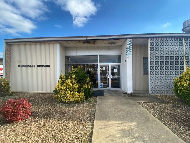
3226 N Valley Pike, Rockingham, VA 22802


NEARBY LISTINGS FOR SALE OR LEASE
Property Detail
3226 N Valley Pike
95-10-L1
Final Plat Of Boundary Line Adjustment O
Heavyindustrial
Rockingham
X
Virginia
51165C0402D
8.13 AC
2025
Staunton & Harrisonburg
2025
Other Market Areas
010500
Harrisonburg, VA
51,428 SF
DEMOGRAPHICS near 3226 N Valley Pike
1 Mile
3 Mile
5 Mile
2024 Total Population
887
19,899
57,892
2029 Population
925
19,636
57,523
Pop Growth 2024-2029
+ 4.28%
(1.32%)
(0.64%)
Average Age
36
36
33
2024 Total Households
336
7,504
19,710
HH Growth 2024-2029
+ 4.46%
(1.57%)
(0.70%)
Median Household Inc
$46,750
$53,363
$54,587
Avg Household Size
2.60
2.50
2.50
2024 Avg HH Vehicles
2.00
2.00
2.00
Median Home Value
$76,893
$221,910
$261,926
Median Year Built
1978
1982
1987
Nearby Places
Map Layers
Map Styles
 Street
 Aerial
- Restaurants
- Banks
- Shops
- Fitness
- Groceries
SALE & LEASE HISTORY
LISTING DATE
SALE/LEASE

Feb 18, 2021
For Lease
Nearby Properties
Address
Land Use
TOTAL SIZE
Lot Size
Zoning
Address
Land Use
TOTAL SIZE
Lot Size
Zoning
219,561 SF
55.38 AC
GENERAL IN
Address
Land Use
TOTAL SIZE
Lot Size
Zoning
40,887 SF
24.09 AC
MULTI DWEL
Address
Land Use
TOTAL SIZE
Lot Size
Zoning
95,500 SF
12.96 AC
GENERAL IN
Address
Land Use
TOTAL SIZE
Lot Size
Zoning
420 SF
88 AC
MULTI DWEL
Address
Land Use
TOTAL SIZE
Lot Size
Zoning
138.58 AC
I1
Address
Land Use
TOTAL SIZE
Lot Size
Zoning
107,978 SF
20.45 AC
MULTI DWEL
Address
Land Use
TOTAL SIZE
Lot Size
Zoning
12,276 SF
120 AC
MULTI DWEL
Address
Land Use
TOTAL SIZE
Lot Size
Zoning
13,939 SF
98 AC
CENTRAL BU
Address
Land Use
TOTAL SIZE
Lot Size
Zoning
19,212 SF
32.58 AC
R3
Address
Land Use
TOTAL SIZE
Lot Size
Zoning
4,112 SF
16.16 AC
MULTI DWEL
Address
Land Use
TOTAL SIZE
Lot Size
Zoning
120 AC
MULTI DWEL
Address
Land Use
TOTAL SIZE
Lot Size
Zoning
7,590 SF
81.38 AC
I1
Address
Land Use
TOTAL SIZE
Lot Size
Zoning
49,489 SF
2.54 AC
CENTRAL BU
Address
Land Use
TOTAL SIZE
Lot Size
Zoning
99,215 SF
7.37 AC
GENERAL BU
Address
Land Use
TOTAL SIZE
Lot Size
Zoning
16,674 SF
108 AC
MULTI DWEL
Address
Land Use
TOTAL SIZE
Lot Size
Zoning
44,614 SF
5.17 AC
B1
Address
Land Use
TOTAL SIZE
Lot Size
Zoning
35,703 SF
9.89 AC
GENERAL BU
Address
Land Use
TOTAL SIZE
Lot Size
Zoning
114,789 SF
150 AC
MULTI DWEL
Address
Land Use
TOTAL SIZE
Lot Size
Zoning
41,673 SF
0.93 AC
CENTRAL BU
Address
Land Use
TOTAL SIZE
Lot Size
Zoning
130,328 SF
16.59 AC
GENERAL IN
Address
Land Use
TOTAL SIZE
Lot Size
Zoning
79,698 SF
36.51 AC
GENERAL IN
Address
Land Use
TOTAL SIZE
Lot Size
Zoning
68,307 SF
16.27 AC
RESIDENTIA
Address
Land Use
TOTAL SIZE
Lot Size
Zoning
6,612 SF
120 AC
MULTI DWEL
Address
Land Use
TOTAL SIZE
Lot Size
Zoning
46,950 SF
5.88 AC
COMMERCIAL
Address
Land Use
TOTAL SIZE
Lot Size
Zoning
15 AC
GENERAL IN
Address
Land Use
TOTAL SIZE
Lot Size
Zoning
24.72 AC
I1
Address
Land Use
TOTAL SIZE
Lot Size
Zoning
4,685 SF
45.22 AC
B1
Address
Land Use
TOTAL SIZE
Lot Size
Zoning
37,263 SF
15.56 AC
MULTI DWEL
Address
Land Use
TOTAL SIZE
Lot Size
Zoning
151.95 AC
GENERAL IN
Address
Land Use
TOTAL SIZE
Lot Size
Zoning
92,405 SF
0.43 AC
CENTRAL BU
The World's #1 Commercial Real Estate Marketplace
Connect with us
© 2025 CoStar Group
The information above has been obtained from sources believed reliable. While we do not doubt its accuracy we have not verified it and make no guarantee, warranty or representation about it. It is your responsibility to independently confirm its accuracy and completeness. Any projections, opinions, assumptions, or estimates used are for example only and do not represent the current or future performance of the property. The value of this transaction to you depends on tax and other factors which should be evaluated by your tax, financial, and legal advisors. You and your advisors should conduct a careful, independent investigation of the property to determine to your satisfaction the suitability of the property for your needs.