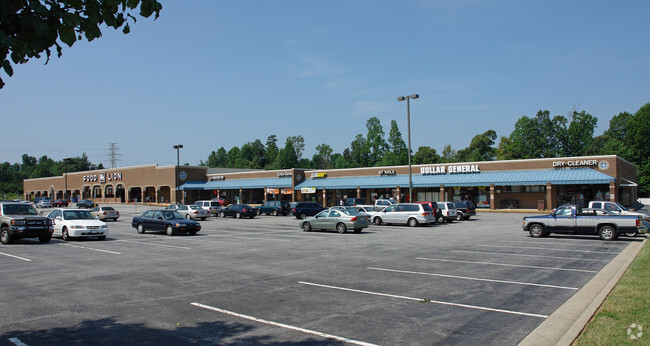
Property Record
3226 Randleman Rd, Greensboro, NC 27406


NEARBY LISTINGS FOR SALE OR LEASE
Property Detail
3226 Randleman Rd
Greensboro-High Point, NC
Royal Oaks Assocs & Royal Oak
0052699
RANDLEMAN MKT LO:1-A PL:130-116
Storebuilding
Guilford
X
North Carolina
3710786200J
14
2024
6.33 AC
2025
South Greensboro
012804
Greensboro/Winston-Salem
1,512 SF
DEMOGRAPHICS near 3226 Randleman Rd
1 Mile
3 Mile
5 Mile
2024 Total Population
10,535
40,751
123,982
2029 Population
10,485
40,485
123,971
Pop Growth 2024-2029
(0.47%)
(0.65%)
(0.01%)
Average Age
37
38
36
2024 Total Households
4,354
16,676
47,360
HH Growth 2024-2029
(0.51%)
(0.65%)
+ 0.13%
Median Household Inc
$48,979
$48,912
$46,484
Avg Household Size
2.30
2.40
2.30
2024 Avg HH Vehicles
2.00
2.00
2.00
Median Home Value
$138,097
$131,726
$151,611
Median Year Built
1990
1983
1978
Nearby Places
Map Layers
Map Styles
 Street
 Aerial
- Restaurants
- Banks
- Shops
- Fitness
- Groceries
PUBLIC TRANSPORTATION
COMMUTER RAIL
Greensboro Station (Piedmont - North Carolina by Train (NC Train))
DRIVE
WALK
Distance
Greensboro Station (Piedmont - North Carolina by Train (NC Train))
9 min
5.0 mi
AIRPORT
Piedmont Triad International
DRIVE
WALK
Distance
Piedmont Triad International
25 min
16.4 mi
SALE & LEASE HISTORY
LISTING DATE
SALE/LEASE

Sep 25, 2016
For Lease
Nov 30, 2020
For Sale
Nearby Properties
Address
Land Use
TOTAL SIZE
Lot Size
Zoning
Address
Land Use
TOTAL SIZE
Lot Size
Zoning
570,402 SF
33.42 AC
RM-18
Address
Land Use
TOTAL SIZE
Lot Size
Zoning
446,318 SF
125.67 AC
LI
Address
Land Use
TOTAL SIZE
Lot Size
Zoning
412,479 SF
19.68 AC
RM-26
Address
Land Use
TOTAL SIZE
Lot Size
Zoning
252,351 SF
9.48 AC
RM-18
Address
Land Use
TOTAL SIZE
Lot Size
Zoning
300,901 SF
20.39 AC
RM-18
Address
Land Use
TOTAL SIZE
Lot Size
Zoning
280,200 SF
19.28 AC
RM-12
Address
Land Use
TOTAL SIZE
Lot Size
Zoning
582,543 SF
47.07 AC
C-M
Address
Land Use
TOTAL SIZE
Lot Size
Zoning
250,084 SF
5.46 AC
PI
Address
Land Use
TOTAL SIZE
Lot Size
Zoning
336,760 SF
55.13 AC
LI
Address
Land Use
TOTAL SIZE
Lot Size
Zoning
201,999 SF
22.18 AC
C-H
Address
Land Use
TOTAL SIZE
Lot Size
Zoning
188,976 SF
41.46 AC
R-5
Address
Land Use
TOTAL SIZE
Lot Size
Zoning
168,572 SF
11.94 AC
LI
Address
Land Use
TOTAL SIZE
Lot Size
Zoning
172,950 SF
11.49 AC
RM-18
Address
Land Use
TOTAL SIZE
Lot Size
Zoning
118,707 SF
15.94 AC
C-H
Address
Land Use
TOTAL SIZE
Lot Size
Zoning
107,867 SF
14.75 AC
RM-8
Address
Land Use
TOTAL SIZE
Lot Size
Zoning
214,062 SF
9.99 AC
LI
Address
Land Use
TOTAL SIZE
Lot Size
Zoning
111,810 SF
5.88 AC
O
Address
Land Use
TOTAL SIZE
Lot Size
Zoning
112,758 SF
10.96 AC
RM-12
Address
Land Use
TOTAL SIZE
Lot Size
Zoning
141,098 SF
8.59 AC
RM-18
Address
Land Use
TOTAL SIZE
Lot Size
Zoning
81,260 SF
6.61 AC
CU-GO-H
Address
Land Use
TOTAL SIZE
Lot Size
Zoning
158,500 SF
17.35 AC
RM-12
Address
Land Use
TOTAL SIZE
Lot Size
Zoning
184,330 SF
10.92 AC
RM-12
Address
Land Use
TOTAL SIZE
Lot Size
Zoning
92,927 SF
6.22 AC
RM-18
Address
Land Use
TOTAL SIZE
Lot Size
Zoning
146,677 SF
11.39 AC
LI
Address
Land Use
TOTAL SIZE
Lot Size
Zoning
114,434 SF
10.89 AC
RM-12
Address
Land Use
TOTAL SIZE
Lot Size
Zoning
87,592 SF
6.97 AC
RM-18
Address
Land Use
TOTAL SIZE
Lot Size
Zoning
95,304 SF
4.58 AC
RM-12
Address
Land Use
TOTAL SIZE
Lot Size
Zoning
117,356 SF
10.11 AC
RM-12
Address
Land Use
TOTAL SIZE
Lot Size
Zoning
303,738 SF
2.41 AC
C-H
Address
Land Use
TOTAL SIZE
Lot Size
Zoning
78,712 SF
12.17 AC
LI
The World's #1 Commercial Real Estate Marketplace
Connect with us
© 2025 CoStar Group
The information above has been obtained from sources believed reliable. While we do not doubt its accuracy we have not verified it and make no guarantee, warranty or representation about it. It is your responsibility to independently confirm its accuracy and completeness. Any projections, opinions, assumptions, or estimates used are for example only and do not represent the current or future performance of the property. The value of this transaction to you depends on tax and other factors which should be evaluated by your tax, financial, and legal advisors. You and your advisors should conduct a careful, independent investigation of the property to determine to your satisfaction the suitability of the property for your needs.