Property Record
3227 Somis Rd, Somis, CA 93066


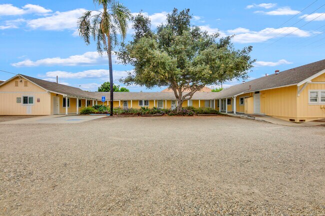

Property Detail
3227 Somis Rd
161-0-101-050
MAP A5 495
Storesoffices
VENTURA
C1
California
B and X Area of moderate flood hazard, usually the area between the limits of the 100-year and 500-year floods.
0.72 AC
2024
Santa Paula/Somis
2025
Los Angeles
005202
Oxnard-Thousand Oaks-Ventura, CA
156 SF
NEARBY LISTINGS FOR SALE OR LEASE
-
-
View all Somis listings for sale on LoopNet.com
DEMOGRAPHICS near 3227 Somis Rd
1 mile
3 mile
5 mile
2025 Total Population
1,376
38,036
78,125
2030 Population
1,355
37,641
77,585
Pop Growth 2025-2030
(1.53%)
(1.04%)
(0.69%)
Average Age
44
45
43
2025 Total Households
430
14,154
28,869
HH Growth 2025-2030
(1.40%)
(1.12%)
(0.83%)
Median Household Inc
$167,262
$120,803
$116,896
Avg Household Size
3.00
2.60
2.60
2025 Avg HH Vehicles
3.00
2.00
2.00
Median Home Value
$1,110,584
$812,508
$829,472
Median Year Built
1982
1978
1979
Nearby Places
Map Layers
Map Styles
 Street
 Aerial
Layers
 Traffic
 Biking
Places
Listings with unknown addresses are not visible on the map
- Restaurants
- Banks
- Shops
- Fitness
- Groceries
PUBLIC TRANSPORTATION
COMMUTER RAIL
Camarillo (Ventura County Line - Southern California Regional Rail Authority (Metrolink))
Drive
Walk
Distance
Camarillo (Ventura County Line - Southern California Regional Rail Authority (Metrolink))
6 min
3.7 mi
Moorpark (Ventura County Line - Southern California Regional Rail Authority (Metrolink))
Drive
Walk
Distance
Moorpark (Ventura County Line - Southern California Regional Rail Authority (Metrolink))
13 min
8.0 mi
Freight Ports
The Port of Hueneme
Drive
Walk
Distance
The Port of Hueneme
26 min
15.5 mi
SALE & LEASE HISTORY
LISTING DATE
SALE/LEASE

Aug 11, 2022
For Sale
Nearby Properties
Address
Land Use
TOTAL SIZE
Lot Size
Zoning
Address
Land Use
TOTAL SIZE
Lot Size
Zoning
9.66 AC
PO
Address
Land Use
TOTAL SIZE
Lot Size
Zoning
98,344 SF
7.40 AC
RPD3
Address
Land Use
TOTAL SIZE
Lot Size
Zoning
13.99 AC
Address
Land Use
TOTAL SIZE
Lot Size
Zoning
9.76 AC
Address
Land Use
TOTAL SIZE
Lot Size
Zoning
3.72 AC
CPD
Address
Land Use
TOTAL SIZE
Lot Size
Zoning
69,560 SF
3.47 AC
Address
Land Use
TOTAL SIZE
Lot Size
Zoning
48,546 SF
4.01 AC
M1
Address
Land Use
TOTAL SIZE
Lot Size
Zoning
77,837 SF
6.46 AC
Address
Land Use
TOTAL SIZE
Lot Size
Zoning
120,688 SF
6.44 AC
Address
Land Use
TOTAL SIZE
Lot Size
Zoning
66,716 SF
1.79 AC
Address
Land Use
TOTAL SIZE
Lot Size
Zoning
117,342 SF
7.20 AC
Address
Land Use
TOTAL SIZE
Lot Size
Zoning
76,037 SF
6 AC
M2
Address
Land Use
TOTAL SIZE
Lot Size
Zoning
117,112 SF
9.03 AC
M-1
Address
Land Use
TOTAL SIZE
Lot Size
Zoning
8.49 AC
Address
Land Use
TOTAL SIZE
Lot Size
Zoning
4.79 AC
Address
Land Use
TOTAL SIZE
Lot Size
Zoning
1,455 SF
4.27 AC
L-M
Address
Land Use
TOTAL SIZE
Lot Size
Zoning
86,502 SF
5.69 AC
RPD3
Address
Land Use
TOTAL SIZE
Lot Size
Zoning
3,397 SF
9.22 AC
Address
Land Use
TOTAL SIZE
Lot Size
Zoning
76,883 SF
3.97 AC
Address
Land Use
TOTAL SIZE
Lot Size
Zoning
6.70 AC
Address
Land Use
TOTAL SIZE
Lot Size
Zoning
45,480 SF
3.15 AC
CPD
Address
Land Use
TOTAL SIZE
Lot Size
Zoning
83,104 SF
4.85 AC
M1
Address
Land Use
TOTAL SIZE
Lot Size
Zoning
76,260 SF
4.46 AC
RPD3
Address
Land Use
TOTAL SIZE
Lot Size
Zoning
85,277 SF
4.39 AC
Address
Land Use
TOTAL SIZE
Lot Size
Zoning
12.04 AC
Address
Land Use
TOTAL SIZE
Lot Size
Zoning
5.68 AC
Address
Land Use
TOTAL SIZE
Lot Size
Zoning
Address
Land Use
TOTAL SIZE
Lot Size
Zoning
145,990 SF
7.02 AC
RE1A
Address
Land Use
TOTAL SIZE
Lot Size
Zoning
45,873 SF
2.33 AC
Address
Land Use
TOTAL SIZE
Lot Size
Zoning
9,478 SF
3.03 AC
CPD
The World's #1 Commercial Real Estate Marketplace
Connect with us
© 2026 CoStar Group
The information above has been obtained from sources believed reliable. While we do not doubt its accuracy we have not verified it and make no guarantee, warranty or representation about it. It is your responsibility to independently confirm its accuracy and completeness. Any projections, opinions, assumptions, or estimates used are for example only and do not represent the current or future performance of the property. The value of this transaction to you depends on tax and other factors which should be evaluated by your tax, financial, and legal advisors. You and your advisors should conduct a careful, independent investigation of the property to determine to your satisfaction the suitability of the property for your needs.