Property Record
323 E Main St, Patchogue, NY 11772
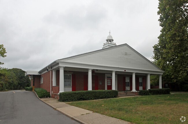

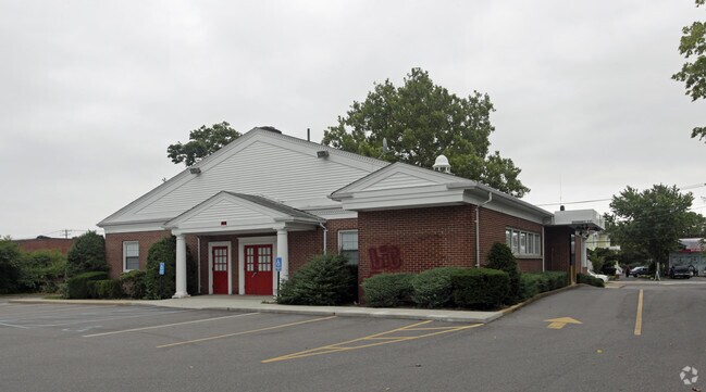
Property Detail
323 E Main St
Nassau County-Suffolk County, NY
N SWEZEY MP 430 E MCCARTHY & ORS S
0200-977-50-02-00-024-000
SUFFOLK
Commercialbuilding
New York
B and X Area of moderate flood hazard, usually the area between the limits of the 100-year and 500-year floods.
24
2024
2.60 AC
2024
Central Suffolk
159109
Long Island (New York)
NEARBY LISTINGS FOR SALE OR LEASE
DEMOGRAPHICS near 323 E Main St
1 mile
3 mile
5 mile
2024 Total Population
12,629
65,910
147,534
2029 Population
12,466
65,639
147,365
Pop Growth 2024-2029
(1.29%)
(0.41%)
(0.11%)
Average Age
42
42
42
2024 Total Households
4,897
24,426
52,488
HH Growth 2024-2029
(1.69%)
(0.74%)
(0.40%)
Median Household Inc
$97,862
$112,378
$118,530
Avg Household Size
2.50
2.60
2.70
2024 Avg HH Vehicles
2.00
2.00
2.00
Median Home Value
$463,733
$496,222
$554,075
Median Year Built
1959
1972
1973
Nearby Places
Map Layers
Map Styles
 Street
 Aerial
Transit
 Traffic
 Biking
Places
Listings with unknown addresses are not visible on the map
- Restaurants
- Banks
- Shops
- Fitness
- Groceries
PUBLIC TRANSPORTATION
TRANSIT/SUBWAY
Patchogue Station (Montauk Branch - Long Island Rail Road)
Drive
Walk
Distance
Patchogue Station (Montauk Branch - Long Island Rail Road)
2 min
17 min
0.9 mi
COMMUTER RAIL
Patchogue Station (Montauk Branch - Long Island Rail Road)
Drive
Walk
Distance
Patchogue Station (Montauk Branch - Long Island Rail Road)
2 min
16 min
0.8 mi
Bellport Station (Montauk Branch - Long Island Rail Road)
Drive
Walk
Distance
Bellport Station (Montauk Branch - Long Island Rail Road)
6 min
3.4 mi
AIRPORT
Long Island MacArthur
Drive
Walk
Distance
Long Island MacArthur
14 min
7.1 mi
Freight Ports
Port of New Haven
Drive
Walk
Distance
Port of New Haven
134 min
51.7 mi
Nearby Properties
Address
Land Use
TOTAL SIZE
Lot Size
Zoning
Address
Land Use
TOTAL SIZE
Lot Size
Zoning
30.25 AC
CA
Address
Land Use
TOTAL SIZE
Lot Size
Zoning
33.47 AC
AA
Address
Land Use
TOTAL SIZE
Lot Size
Zoning
7,290 SF
15.71 AC
CA
Address
Land Use
TOTAL SIZE
Lot Size
Zoning
42.37 AC
Address
Land Use
TOTAL SIZE
Lot Size
Zoning
14.70 AC
BUS3
Address
Land Use
TOTAL SIZE
Lot Size
Zoning
9,148 SF
10.30 AC
CA
Address
Land Use
TOTAL SIZE
Lot Size
Zoning
2,556 SF
0.22 AC
VILLA
Address
Land Use
TOTAL SIZE
Lot Size
Zoning
3,278 SF
0.51 AC
VILLA
Address
Land Use
TOTAL SIZE
Lot Size
Zoning
3,942 SF
0.45 AC
VILLA
Address
Land Use
TOTAL SIZE
Lot Size
Zoning
13.39 AC
C
Address
Land Use
TOTAL SIZE
Lot Size
Zoning
2,432 SF
21.76 AC
IND1
Address
Land Use
TOTAL SIZE
Lot Size
Zoning
4.23 AC
IND1
Address
Land Use
TOTAL SIZE
Lot Size
Zoning
11.14 AC
IND1
Address
Land Use
TOTAL SIZE
Lot Size
Zoning
8.10 AC
GSC
Address
Land Use
TOTAL SIZE
Lot Size
Zoning
3,960 SF
0.72 AC
R40
Address
Land Use
TOTAL SIZE
Lot Size
Zoning
2,828 SF
0.15 AC
VILLA
Address
Land Use
TOTAL SIZE
Lot Size
Zoning
5.31 AC
C
Address
Land Use
TOTAL SIZE
Lot Size
Zoning
5.23 AC
C
Address
Land Use
TOTAL SIZE
Lot Size
Zoning
28.97 AC
Address
Land Use
TOTAL SIZE
Lot Size
Zoning
49.98 AC
BUS1
Address
Land Use
TOTAL SIZE
Lot Size
Zoning
1 AC
R40
Address
Land Use
TOTAL SIZE
Lot Size
Zoning
26.20 AC
Address
Land Use
TOTAL SIZE
Lot Size
Zoning
2,880 SF
0.40 AC
VB
Address
Land Use
TOTAL SIZE
Lot Size
Zoning
Address
Land Use
TOTAL SIZE
Lot Size
Zoning
8.30 AC
Address
Land Use
TOTAL SIZE
Lot Size
Zoning
5.08 AC
IND1
Address
Land Use
TOTAL SIZE
Lot Size
Zoning
4.13 AC
BUS1
Address
Land Use
TOTAL SIZE
Lot Size
Zoning
58.80 AC
AAA
Address
Land Use
TOTAL SIZE
Lot Size
Zoning
28.20 AC
AA278
Address
Land Use
TOTAL SIZE
Lot Size
Zoning
2,444 SF
0.17 AC
VILLA
The World's #1 Commercial Real Estate Marketplace
Connect with us
© 2026 CoStar Group
The information above has been obtained from sources believed reliable. While we do not doubt its accuracy we have not verified it and make no guarantee, warranty or representation about it. It is your responsibility to independently confirm its accuracy and completeness. Any projections, opinions, assumptions, or estimates used are for example only and do not represent the current or future performance of the property. The value of this transaction to you depends on tax and other factors which should be evaluated by your tax, financial, and legal advisors. You and your advisors should conduct a careful, independent investigation of the property to determine to your satisfaction the suitability of the property for your needs.