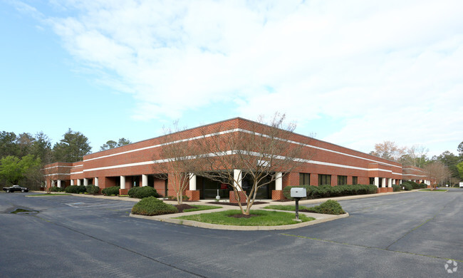
Property Record
323 Hill Carter Pky, Ashland, VA 23005

NEARBY LISTINGS FOR SALE OR LEASE
Property Detail
323 Hill Carter Pky
Richmond, VA
Presidential Bus Ctr
7789-27-2083
PRESIDENTIAL BUS CTR LOT 1
Commercialnec
Hanover
X
Virginia
51085C0302C
1
2025
4.74 AC
2025
I-95 North/Ashland
320602
Richmond VA
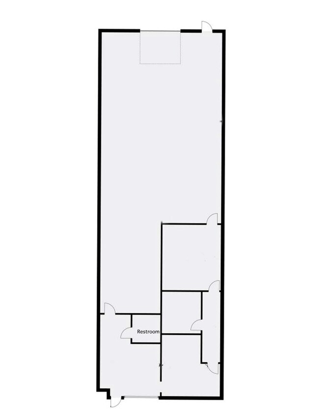
64,000 SF
DEMOGRAPHICS near 323 Hill Carter Pky
1 Mile
3 Mile
5 Mile
2024 Total Population
2,668
13,981
31,568
2029 Population
2,837
15,001
33,613
Pop Growth 2024-2029
+ 6.33%
+ 7.30%
+ 6.48%
Average Age
40
40
41
2024 Total Households
1,103
5,239
11,656
HH Growth 2024-2029
+ 6.44%
+ 7.56%
+ 6.78%
Median Household Inc
$46,059
$69,959
$91,209
Avg Household Size
2.40
2.40
2.60
2024 Avg HH Vehicles
2.00
2.00
2.00
Median Home Value
$211,340
$315,276
$345,797
Median Year Built
1982
1985
1992
Nearby Places
Map Layers
Map Styles
 Street
 Aerial
- Restaurants
- Banks
- Shops
- Fitness
- Groceries
PUBLIC TRANSPORTATION
COMMUTER RAIL
Ashland Amtrak (Northeast Regional - Amtrak)
DRIVE
WALK
Distance
Ashland Amtrak (Northeast Regional - Amtrak)
5 min
2.1 mi
AIRPORT
Richmond International
DRIVE
WALK
Distance
Richmond International
34 min
24.2 mi
Freight Ports
Virginia Port Authority - Richmond
DRIVE
WALK
Distance
Virginia Port Authority - Richmond
35 min
23.9 mi
SALE & LEASE HISTORY
LISTING DATE
SALE/LEASE

Feb 18, 2022
For Lease
Feb 02, 2024
For Lease
Nearby Properties
Address
Land Use
TOTAL SIZE
Lot Size
Zoning
Address
Land Use
TOTAL SIZE
Lot Size
Zoning
36.08 AC
HE
Address
Land Use
TOTAL SIZE
Lot Size
Zoning
26,583 SF
9 AC
HE
Address
Land Use
TOTAL SIZE
Lot Size
Zoning
43.49 AC
M-2
Address
Land Use
TOTAL SIZE
Lot Size
Zoning
50.20 AC
M-2
Address
Land Use
TOTAL SIZE
Lot Size
Zoning
30.94 AC
M-2
Address
Land Use
TOTAL SIZE
Lot Size
Zoning
3.60 AC
HE
Address
Land Use
TOTAL SIZE
Lot Size
Zoning
320,540 SF
18.50 AC
M-2
Address
Land Use
TOTAL SIZE
Lot Size
Zoning
194,598 SF
14.50 AC
R-5
Address
Land Use
TOTAL SIZE
Lot Size
Zoning
311,740 SF
43.40 AC
M-1
Address
Land Use
TOTAL SIZE
Lot Size
Zoning
280,900 SF
22.69 AC
M-1
Address
Land Use
TOTAL SIZE
Lot Size
Zoning
220,499 SF
19.01 AC
PSC
Address
Land Use
TOTAL SIZE
Lot Size
Zoning
293,114 SF
15.56 AC
M-2
Address
Land Use
TOTAL SIZE
Lot Size
Zoning
25.93 AC
M-2
Address
Land Use
TOTAL SIZE
Lot Size
Zoning
24.80 AC
M-2
Address
Land Use
TOTAL SIZE
Lot Size
Zoning
24.17 AC
M-1
Address
Land Use
TOTAL SIZE
Lot Size
Zoning
24.21 AC
RR-1
Address
Land Use
TOTAL SIZE
Lot Size
Zoning
215,072 SF
16.32 AC
M-2
Address
Land Use
TOTAL SIZE
Lot Size
Zoning
43.11 AC
PMH
Address
Land Use
TOTAL SIZE
Lot Size
Zoning
17.80 AC
B-3
Address
Land Use
TOTAL SIZE
Lot Size
Zoning
10.50 AC
R-2
Address
Land Use
TOTAL SIZE
Lot Size
Zoning
151,540 SF
21.15 AC
PSC
Address
Land Use
TOTAL SIZE
Lot Size
Zoning
15.83 AC
M-2
Address
Land Use
TOTAL SIZE
Lot Size
Zoning
14.43 AC
M-2
Address
Land Use
TOTAL SIZE
Lot Size
Zoning
23.97 AC
RR-1
Address
Land Use
TOTAL SIZE
Lot Size
Zoning
8.73 AC
M-2
Address
Land Use
TOTAL SIZE
Lot Size
Zoning
149,582 SF
12.76 AC
M-2
Address
Land Use
TOTAL SIZE
Lot Size
Zoning
7.39 AC
M-2
Address
Land Use
TOTAL SIZE
Lot Size
Zoning
40,415 SF
29.10 AC
M-2
Address
Land Use
TOTAL SIZE
Lot Size
Zoning
66,910 SF
1.94 AC
B-2
Address
Land Use
TOTAL SIZE
Lot Size
Zoning
57,385 SF
2.38 AC
B-3
The World's #1 Commercial Real Estate Marketplace
Connect with us
© 2026 CoStar Group
The information above has been obtained from sources believed reliable. While we do not doubt its accuracy we have not verified it and make no guarantee, warranty or representation about it. It is your responsibility to independently confirm its accuracy and completeness. Any projections, opinions, assumptions, or estimates used are for example only and do not represent the current or future performance of the property. The value of this transaction to you depends on tax and other factors which should be evaluated by your tax, financial, and legal advisors. You and your advisors should conduct a careful, independent investigation of the property to determine to your satisfaction the suitability of the property for your needs.