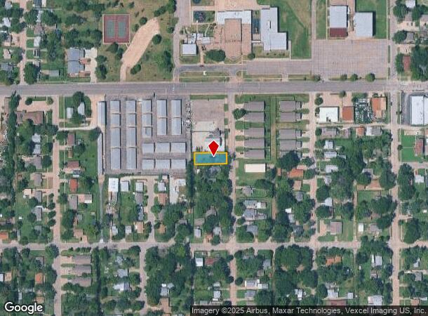
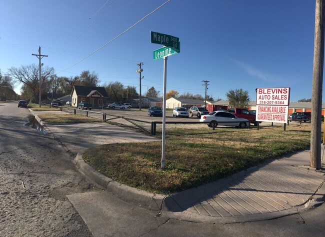
Property Record
323 S Leonine Rd, Wichita, KS 67213

NEARBY LISTINGS FOR SALE OR LEASE
Property Detail
323 S Leonine Rd
Wichita, KS
Dugans Add
137-25-0-21-03-025.00
Sedgwick
Sfr
Kansas
X
0.16 AC
20173C0342G
Southwest
850 SF
Wichita
DEMOGRAPHICS near 323 S Leonine Rd
1 Mile
3 Mile
5 Mile
2024 Total Population
9,679
83,201
203,427
2029 Population
9,839
85,457
208,344
Pop Growth 2024-2029
+ 1.65%
+ 2.71%
+ 2.42%
Average Age
37
38
38
2024 Total Households
4,108
36,210
83,561
HH Growth 2024-2029
+ 1.53%
+ 2.83%
+ 2.46%
Median Household Inc
$42,673
$45,402
$48,871
Avg Household Size
2.20
2.10
2.30
2024 Avg HH Vehicles
2.00
2.00
2.00
Median Home Value
$85,740
$114,122
$127,328
Median Year Built
1955
1962
1964
Nearby Places
Map Layers
Map Styles
 Street
 Aerial
- Restaurants
- Banks
- Shops
- Fitness
- Groceries
PUBLIC TRANSPORTATION
AIRPORT
Wichita Dwight D Eisenhower Ntl
DRIVE
WALK
Distance
Wichita Dwight D Eisenhower Ntl
9 min
4.4 mi
Freight Ports
Tulsa Port Of Catoosa
DRIVE
WALK
Distance
Tulsa Port Of Catoosa
208 min
195.3 mi
SALE & LEASE HISTORY
LISTING DATE
SALE/LEASE

Dec 02, 2016
For Sale
Aug 29, 2017
For Sale
Nearby Properties
Address
Land Use
TOTAL SIZE
Lot Size
Zoning
Address
Land Use
TOTAL SIZE
Lot Size
Zoning
468,755 SF
10.41 AC
CBD,LI
Address
Land Use
TOTAL SIZE
Lot Size
Zoning
1,675,141 SF
1,753.52 AC
LI
Address
Land Use
TOTAL SIZE
Lot Size
Zoning
515,640 SF
14.49 AC
CBD
Address
Land Use
TOTAL SIZE
Lot Size
Zoning
154,716 SF
12.18 AC
LC
Address
Land Use
TOTAL SIZE
Lot Size
Zoning
386,803 SF
13.33 AC
CBD
Address
Land Use
TOTAL SIZE
Lot Size
Zoning
456,792 SF
155.67 AC
LI
Address
Land Use
TOTAL SIZE
Lot Size
Zoning
227,462 SF
17.80 AC
TF-3
Address
Land Use
TOTAL SIZE
Lot Size
Zoning
203,580 SF
15.51 AC
B
Address
Land Use
TOTAL SIZE
Lot Size
Zoning
109,743 SF
6.10 AC
CBD
Address
Land Use
TOTAL SIZE
Lot Size
Zoning
84,959 SF
2 AC
LI
Address
Land Use
TOTAL SIZE
Lot Size
Zoning
225,962 SF
0.24 AC
CBD
Address
Land Use
TOTAL SIZE
Lot Size
Zoning
84,757 SF
1.44 AC
GC
Address
Land Use
TOTAL SIZE
Lot Size
Zoning
328,487 SF
25.95 AC
MF-29
Address
Land Use
TOTAL SIZE
Lot Size
Zoning
180,527 SF
1.93 AC
LI
Address
Land Use
TOTAL SIZE
Lot Size
Zoning
143,110 SF
1.57 AC
LI
Address
Land Use
TOTAL SIZE
Lot Size
Zoning
108,283 SF
14.80 AC
SF-5
Address
Land Use
TOTAL SIZE
Lot Size
Zoning
192,027 SF
117.94 AC
SF-20,GC,L
Address
Land Use
TOTAL SIZE
Lot Size
Zoning
62,535 SF
8.34 AC
B
Address
Land Use
TOTAL SIZE
Lot Size
Zoning
110,839 SF
0.81 AC
CBD
Address
Land Use
TOTAL SIZE
Lot Size
Zoning
169,321 SF
14.61 AC
U
Address
Land Use
TOTAL SIZE
Lot Size
Zoning
79,041 SF
19.51 AC
LC
Address
Land Use
TOTAL SIZE
Lot Size
Zoning
89,057 SF
18.91 AC
B
Address
Land Use
TOTAL SIZE
Lot Size
Zoning
35,097 SF
2.82 AC
U
Address
Land Use
TOTAL SIZE
Lot Size
Zoning
172,486 SF
25.68 AC
SF-5
Address
Land Use
TOTAL SIZE
Lot Size
Zoning
167,923 SF
18.01 AC
SF-5
Address
Land Use
TOTAL SIZE
Lot Size
Zoning
55,930 SF
10.28 AC
LI
Address
Land Use
TOTAL SIZE
Lot Size
Zoning
98,677 SF
5.62 AC
TF-3
Address
Land Use
TOTAL SIZE
Lot Size
Zoning
167,315 SF
2 AC
LC,SF-5
Address
Land Use
TOTAL SIZE
Lot Size
Zoning
211,379 SF
23.34 AC
SF-5
Address
Land Use
TOTAL SIZE
Lot Size
Zoning
68,468 SF
7.17 AC
B,SF-5,GO
The World's #1 Commercial Real Estate Marketplace
Connect with us
© 2025 CoStar Group
The information above has been obtained from sources believed reliable. While we do not doubt its accuracy we have not verified it and make no guarantee, warranty or representation about it. It is your responsibility to independently confirm its accuracy and completeness. Any projections, opinions, assumptions, or estimates used are for example only and do not represent the current or future performance of the property. The value of this transaction to you depends on tax and other factors which should be evaluated by your tax, financial, and legal advisors. You and your advisors should conduct a careful, independent investigation of the property to determine to your satisfaction the suitability of the property for your needs.