Property Record
323 Spreckels Dr, Aptos, CA 95003


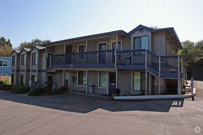
Property Detail
323 Spreckels Dr
Officebuilding
Santa Cruz
PA
California
B and X Area of moderate flood hazard, usually the area between the limits of the 100-year and 500-year floods.
0.31 AC
2024
Mid-County
2025
Santa Cruz/Watsonville
122004
Santa Cruz-Watsonville, CA
3,911 SF
039-233-02-000
NEARBY LISTINGS FOR SALE OR LEASE
DEMOGRAPHICS near 323 Spreckels Dr
1 mile
3 mile
5 mile
2025 Total Population
10,652
35,080
75,035
2030 Population
10,689
34,904
74,167
Pop Growth 2025-2030
+ 0.35%
(0.50%)
(1.16%)
Average Age
47
47
45
2025 Total Households
4,562
14,791
30,864
HH Growth 2025-2030
+ 0.18%
(0.55%)
(1.31%)
Median Household Inc
$127,677
$121,917
$114,140
Avg Household Size
2.30
2.30
2.30
2025 Avg HH Vehicles
2.00
2.00
2.00
Median Home Value
$1,078,890
$1,063,941
$1,040,833
Median Year Built
1973
1974
1975
Nearby Places
Map Layers
Map Styles
 Street
 Aerial
Transit
 Traffic
 Biking
Places
Listings with unknown addresses are not visible on the map
- Restaurants
- Banks
- Shops
- Fitness
- Groceries
PUBLIC TRANSPORTATION
AIRPORT
Monterey Regional
Drive
Walk
Distance
Monterey Regional
45 min
35.7 mi
Norman Y Mineta San Jose International
Drive
Walk
Distance
Norman Y Mineta San Jose International
50 min
37.6 mi
Freight Ports
Port of Redwood City
Drive
Walk
Distance
Port of Redwood City
70 min
53.4 mi
Nearby Properties
Address
Land Use
TOTAL SIZE
Lot Size
Zoning
Address
Land Use
TOTAL SIZE
Lot Size
Zoning
70,818 SF
6.38 AC
C-2
Address
Land Use
TOTAL SIZE
Lot Size
Zoning
60,052 SF
3 AC
PA
Address
Land Use
TOTAL SIZE
Lot Size
Zoning
50,511 SF
2.54 AC
RM-3-H
Address
Land Use
TOTAL SIZE
Lot Size
Zoning
77,029 SF
5.87 AC
RA
Address
Land Use
TOTAL SIZE
Lot Size
Zoning
52,804 SF
4.17 AC
C-2
Address
Land Use
TOTAL SIZE
Lot Size
Zoning
55,012 SF
6.77 AC
Address
Land Use
TOTAL SIZE
Lot Size
Zoning
3.62 AC
VA
Address
Land Use
TOTAL SIZE
Lot Size
Zoning
3.84 AC
RM-4
Address
Land Use
TOTAL SIZE
Lot Size
Zoning
50,600 SF
4.19 AC
SU
Address
Land Use
TOTAL SIZE
Lot Size
Zoning
76,516 SF
4.18 AC
Address
Land Use
TOTAL SIZE
Lot Size
Zoning
20,787 SF
0.64 AC
Address
Land Use
TOTAL SIZE
Lot Size
Zoning
73,991 SF
9.15 AC
C-1
Address
Land Use
TOTAL SIZE
Lot Size
Zoning
6,292 SF
15.93 AC
PF
Address
Land Use
TOTAL SIZE
Lot Size
Zoning
44,571 SF
2.92 AC
Address
Land Use
TOTAL SIZE
Lot Size
Zoning
34,070 SF
1.36 AC
Address
Land Use
TOTAL SIZE
Lot Size
Zoning
0.35 AC
VA
Address
Land Use
TOTAL SIZE
Lot Size
Zoning
1.86 AC
VA
Address
Land Use
TOTAL SIZE
Lot Size
Zoning
17,952 SF
1.47 AC
RM-3
Address
Land Use
TOTAL SIZE
Lot Size
Zoning
44,868 SF
4.08 AC
C-1
Address
Land Use
TOTAL SIZE
Lot Size
Zoning
3.79 AC
PF
Address
Land Use
TOTAL SIZE
Lot Size
Zoning
27,052 SF
0.44 AC
Address
Land Use
TOTAL SIZE
Lot Size
Zoning
17,980 SF
3.29 AC
Address
Land Use
TOTAL SIZE
Lot Size
Zoning
62,592 SF
5.55 AC
RM-2-R-L
Address
Land Use
TOTAL SIZE
Lot Size
Zoning
24,617 SF
3.09 AC
Address
Land Use
TOTAL SIZE
Lot Size
Zoning
11,781 SF
76.71 AC
SU
Address
Land Use
TOTAL SIZE
Lot Size
Zoning
8,397 SF
21.48 AC
RA
Address
Land Use
TOTAL SIZE
Lot Size
Zoning
7,135 SF
4.06 AC
R-1-5
Address
Land Use
TOTAL SIZE
Lot Size
Zoning
86,623 SF
7.96 AC
Address
Land Use
TOTAL SIZE
Lot Size
Zoning
6,937 SF
13.53 AC
SU
Address
Land Use
TOTAL SIZE
Lot Size
Zoning
10,091 SF
0.65 AC
PA
The World's #1 Commercial Real Estate Marketplace
Connect with us
© 2026 CoStar Group
The information above has been obtained from sources believed reliable. While we do not doubt its accuracy we have not verified it and make no guarantee, warranty or representation about it. It is your responsibility to independently confirm its accuracy and completeness. Any projections, opinions, assumptions, or estimates used are for example only and do not represent the current or future performance of the property. The value of this transaction to you depends on tax and other factors which should be evaluated by your tax, financial, and legal advisors. You and your advisors should conduct a careful, independent investigation of the property to determine to your satisfaction the suitability of the property for your needs.