Property Record
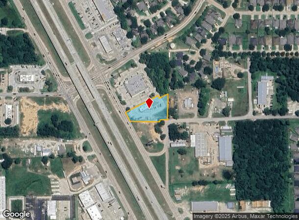
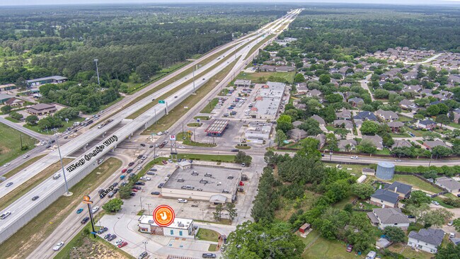
32310 State Highway 249, Pinehurst, TX 77362

Property Detail
32310 State Highway 249
3201-00-00300
S320100 - CW STATE HWY 249, RES C, ACRES 0.8578
Commercialnec
Montgomery
B and X Area of moderate flood hazard, usually the area between the limits of the 100-year and 500-year floods.
Texas
2024
0.86 AC
2025
Montgomery County
690405
Houston
2,306 SF
Houston-Pasadena-The Woodlands, TX
NEARBY LISTINGS FOR SALE OR LEASE
DEMOGRAPHICS near 32310 State Highway 249
1 mile
3 mile
5 mile
2025 Total Population
4,101
22,685
60,786
2030 Population
4,799
26,106
69,752
Pop Growth 2025-2030
+ 17.02%
+ 15.08%
+ 14.75%
Average Age
37
40
39
2025 Total Households
1,380
7,930
21,359
HH Growth 2025-2030
+ 17.61%
+ 15.26%
+ 14.84%
Median Household Inc
$77,573
$105,554
$96,315
Avg Household Size
2.90
2.80
2.80
2025 Avg HH Vehicles
2.00
2.00
2.00
Median Home Value
$290,562
$395,987
$397,130
Median Year Built
2007
2003
2005
Nearby Places
Map Layers
Map Styles
 Street
 Aerial
Layers
 Traffic
 Biking
Places
Listings with unknown addresses are not visible on the map
- Restaurants
- Banks
- Shops
- Fitness
- Groceries
PUBLIC TRANSPORTATION
AIRPORT
George Bush Intcntl/Houston
Drive
Walk
Distance
George Bush Intcntl/Houston
38 min
30.7 mi
Freight Ports
Port of Houston
Drive
Walk
Distance
Port of Houston
58 min
41.3 mi
SALE & LEASE HISTORY
LISTING DATE
SALE/LEASE

May 20, 2022
For Sale
Nearby Properties
Address
Land Use
TOTAL SIZE
Lot Size
Zoning
Address
Land Use
TOTAL SIZE
Lot Size
Zoning
146,990 SF
7.02 AC
Address
Land Use
TOTAL SIZE
Lot Size
Zoning
112,854 SF
5.80 AC
Address
Land Use
TOTAL SIZE
Lot Size
Zoning
104,859 SF
5.29 AC
Address
Land Use
TOTAL SIZE
Lot Size
Zoning
81,277 SF
4.43 AC
Address
Land Use
TOTAL SIZE
Lot Size
Zoning
14,865 SF
1.98 AC
2
Address
Land Use
TOTAL SIZE
Lot Size
Zoning
90,311 SF
10 AC
Address
Land Use
TOTAL SIZE
Lot Size
Zoning
7,800 SF
18.47 AC
Address
Land Use
TOTAL SIZE
Lot Size
Zoning
100,389 SF
5.47 AC
2
Address
Land Use
TOTAL SIZE
Lot Size
Zoning
1,184 SF
27.54 AC
Address
Land Use
TOTAL SIZE
Lot Size
Zoning
48,896 SF
2 AC
Address
Land Use
TOTAL SIZE
Lot Size
Zoning
68,950 SF
18.57 AC
2
Address
Land Use
TOTAL SIZE
Lot Size
Zoning
1,722 SF
31.19 AC
2
Address
Land Use
TOTAL SIZE
Lot Size
Zoning
25,050 SF
2.16 AC
Address
Land Use
TOTAL SIZE
Lot Size
Zoning
12,276 SF
4.81 AC
Address
Land Use
TOTAL SIZE
Lot Size
Zoning
40.23 AC
Address
Land Use
TOTAL SIZE
Lot Size
Zoning
43,400 SF
6.05 AC
2
Address
Land Use
TOTAL SIZE
Lot Size
Zoning
22,650 SF
2.03 AC
Address
Land Use
TOTAL SIZE
Lot Size
Zoning
28,400 SF
3.85 AC
Address
Land Use
TOTAL SIZE
Lot Size
Zoning
4,365 SF
0.99 AC
Address
Land Use
TOTAL SIZE
Lot Size
Zoning
29,682 SF
2.41 AC
Address
Land Use
TOTAL SIZE
Lot Size
Zoning
13,545 SF
4.56 AC
2
Address
Land Use
TOTAL SIZE
Lot Size
Zoning
2,566 SF
31.34 AC
Address
Land Use
TOTAL SIZE
Lot Size
Zoning
10,500 SF
1.64 AC
Address
Land Use
TOTAL SIZE
Lot Size
Zoning
8,958 SF
40.19 AC
2
Address
Land Use
TOTAL SIZE
Lot Size
Zoning
19,314 SF
3 AC
Address
Land Use
TOTAL SIZE
Lot Size
Zoning
11,723 SF
2.50 AC
2
Address
Land Use
TOTAL SIZE
Lot Size
Zoning
37,512 SF
9.91 AC
2
Address
Land Use
TOTAL SIZE
Lot Size
Zoning
13,871 SF
1.68 AC
2
Address
Land Use
TOTAL SIZE
Lot Size
Zoning
27,450 SF
2.08 AC
Address
Land Use
TOTAL SIZE
Lot Size
Zoning
31,627 SF
11.46 AC
The World's #1 Commercial Real Estate Marketplace
Connect with us
© 2026 CoStar Group
The information above has been obtained from sources believed reliable. While we do not doubt its accuracy we have not verified it and make no guarantee, warranty or representation about it. It is your responsibility to independently confirm its accuracy and completeness. Any projections, opinions, assumptions, or estimates used are for example only and do not represent the current or future performance of the property. The value of this transaction to you depends on tax and other factors which should be evaluated by your tax, financial, and legal advisors. You and your advisors should conduct a careful, independent investigation of the property to determine to your satisfaction the suitability of the property for your needs.