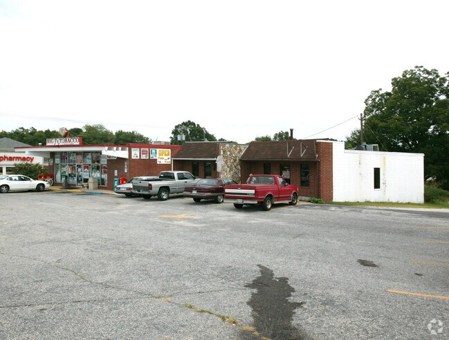
Property Record
3234 Wade Hampton Blvd, Taylors, SC 29687


NEARBY LISTINGS FOR SALE OR LEASE
Property Detail
3234 Wade Hampton Blvd
Greenville-Anderson-Mauldin, SC
Combination Survey For Lisa Brisson
T002.00-06-001.02
1,2,3 SEC1
Drycleanerlaundryservice
Greenville
X
South Carolina
45045C0337E
001.02
2025
0.66 AC
2024
Wade Hampton
001803
Greenville/Spartanburg
DEMOGRAPHICS near 3234 Wade Hampton Blvd
1 Mile
3 Mile
5 Mile
2024 Total Population
6,631
53,057
133,847
2029 Population
7,244
58,087
146,752
Pop Growth 2024-2029
+ 9.24%
+ 9.48%
+ 9.64%
Average Age
40
40
40
2024 Total Households
2,700
21,126
54,405
HH Growth 2024-2029
+ 9.33%
+ 9.56%
+ 9.75%
Median Household Inc
$62,691
$68,559
$71,139
Avg Household Size
2.40
2.50
2.40
2024 Avg HH Vehicles
2.00
2.00
2.00
Median Home Value
$184,152
$239,199
$265,698
Median Year Built
1977
1981
1985
Nearby Places
Map Layers
Map Styles
 Street
 Aerial
- Restaurants
- Banks
- Shops
- Fitness
- Groceries
PUBLIC TRANSPORTATION
COMMUTER RAIL
Greenville Amtrak Station (Crescent - Amtrak)
DRIVE
WALK
Distance
Greenville Amtrak Station (Crescent - Amtrak)
14 min
7.3 mi
AIRPORT
Greenville Spartanburg International
DRIVE
WALK
Distance
Greenville Spartanburg International
22 min
10.5 mi
Freight Ports
North Charleston Terminal
DRIVE
WALK
Distance
North Charleston Terminal
234 min
205.3 mi
SALE & LEASE HISTORY
LISTING DATE
SALE/LEASE

Apr 28, 2020
For Sale
Nearby Properties
Address
Land Use
TOTAL SIZE
Lot Size
Zoning
Address
Land Use
TOTAL SIZE
Lot Size
Zoning
11.80 AC
R10
Address
Land Use
TOTAL SIZE
Lot Size
Zoning
11.30 AC
R10
Address
Land Use
TOTAL SIZE
Lot Size
Zoning
4.95 AC
C1
Address
Land Use
TOTAL SIZE
Lot Size
Zoning
25.70 AC
R20
Address
Land Use
TOTAL SIZE
Lot Size
Zoning
8.98 AC
C1
Address
Land Use
TOTAL SIZE
Lot Size
Zoning
8.95 AC
OD
Address
Land Use
TOTAL SIZE
Lot Size
Zoning
41.90 AC
RMA
Address
Land Use
TOTAL SIZE
Lot Size
Zoning
3.40 AC
C2
Address
Land Use
TOTAL SIZE
Lot Size
Zoning
58.81 AC
R15
Address
Land Use
TOTAL SIZE
Lot Size
Zoning
15.83 AC
RM
Address
Land Use
TOTAL SIZE
Lot Size
Zoning
3.50 AC
C2
Address
Land Use
TOTAL SIZE
Lot Size
Zoning
1.20 AC
I1
Address
Land Use
TOTAL SIZE
Lot Size
Zoning
3.70 AC
C2
Address
Land Use
TOTAL SIZE
Lot Size
Zoning
16.40 AC
PDC
Address
Land Use
TOTAL SIZE
Lot Size
Zoning
8.10 AC
I1
Address
Land Use
TOTAL SIZE
Lot Size
Zoning
21.65 AC
RM7
Address
Land Use
TOTAL SIZE
Lot Size
Zoning
6.10 AC
C2
Address
Land Use
TOTAL SIZE
Lot Size
Zoning
1.03 AC
RM
Address
Land Use
TOTAL SIZE
Lot Size
Zoning
14.78 AC
I1
Address
Land Use
TOTAL SIZE
Lot Size
Zoning
5.21 AC
C2
Address
Land Use
TOTAL SIZE
Lot Size
Zoning
9.14 AC
R75
Address
Land Use
TOTAL SIZE
Lot Size
Zoning
3.11 AC
I1
Address
Land Use
TOTAL SIZE
Lot Size
Zoning
12 AC
RM
Address
Land Use
TOTAL SIZE
Lot Size
Zoning
12.30 AC
I1
Address
Land Use
TOTAL SIZE
Lot Size
Zoning
2,323 SF
23.11 AC
R20
Address
Land Use
TOTAL SIZE
Lot Size
Zoning
11.90 AC
R12
Address
Land Use
TOTAL SIZE
Lot Size
Zoning
1.70 AC
R75
Address
Land Use
TOTAL SIZE
Lot Size
Zoning
9.17 AC
RM
Address
Land Use
TOTAL SIZE
Lot Size
Zoning
17.32 AC
C3
Address
Land Use
TOTAL SIZE
Lot Size
Zoning
2,194 SF
56.43 AC
S1
The World's #1 Commercial Real Estate Marketplace
Connect with us
© 2025 CoStar Group
The information above has been obtained from sources believed reliable. While we do not doubt its accuracy we have not verified it and make no guarantee, warranty or representation about it. It is your responsibility to independently confirm its accuracy and completeness. Any projections, opinions, assumptions, or estimates used are for example only and do not represent the current or future performance of the property. The value of this transaction to you depends on tax and other factors which should be evaluated by your tax, financial, and legal advisors. You and your advisors should conduct a careful, independent investigation of the property to determine to your satisfaction the suitability of the property for your needs.