Property Record
3236 N Highway 17, Mount Pleasant, SC 29466
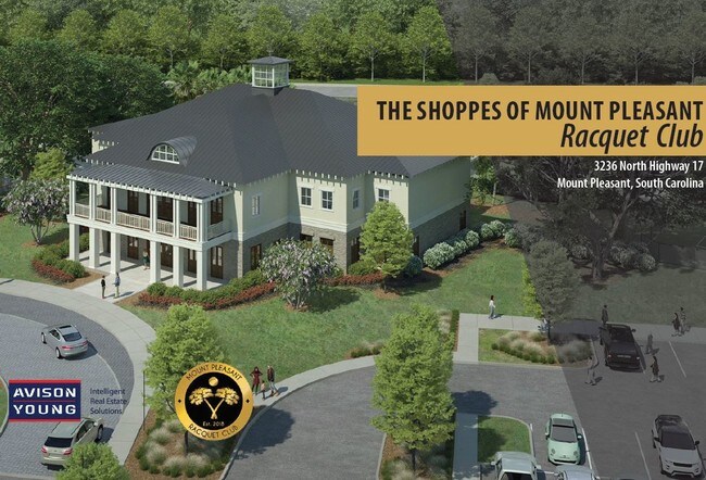

Property Detail
3236 N Highway 17
Charleston-North Charleston, SC
LEGAL DESCRIPTION SUBDIVISION NAME -CHRIST CHURCH PARISH SITE NAME -N SIDE APPROX 5950FT E HWY 4 1 PLATSUFFIX P-116 POLTWP 00
598-00-00-008
Charleston
Commercialacreage
South Carolina
C and X Area of minimal flood hazard, usually depicted on FIRMs as above the 500-year flood level.
9.70 AC
2025
East Islands/Mt Pleasant
2024
Charleston/N Charleston
004618
NEARBY LISTINGS FOR SALE OR LEASE
DEMOGRAPHICS near 3236 N Highway 17
1 mile
3 mile
5 mile
2025 Total Population
4,187
33,870
63,203
2030 Population
4,247
35,109
65,661
Pop Growth 2025-2030
+ 1.43%
+ 3.66%
+ 3.89%
Average Age
42
42
42
2025 Total Households
1,726
12,627
24,533
HH Growth 2025-2030
+ 1.45%
+ 3.66%
+ 3.84%
Median Household Inc
$88,933
$122,797
$123,591
Avg Household Size
2.40
2.60
2.50
2025 Avg HH Vehicles
2.00
2.00
2.00
Median Home Value
$545,299
$712,720
$730,297
Median Year Built
2004
2004
2001
Nearby Places
Map Layers
Map Styles
 Street
 Aerial
Layers
 Traffic
 Biking
Places
Listings with unknown addresses are not visible on the map
- Restaurants
- Banks
- Shops
- Fitness
- Groceries
PUBLIC TRANSPORTATION
AIRPORT
Charleston AFB/International
Drive
Walk
Distance
Charleston AFB/International
34 min
22.0 mi
Nearby Properties
Address
Land Use
TOTAL SIZE
Lot Size
Zoning
Address
Land Use
TOTAL SIZE
Lot Size
Zoning
19.70 AC
Address
Land Use
TOTAL SIZE
Lot Size
Zoning
20.24 AC
Address
Land Use
TOTAL SIZE
Lot Size
Zoning
Address
Land Use
TOTAL SIZE
Lot Size
Zoning
10,948 SF
1.94 AC
Address
Land Use
TOTAL SIZE
Lot Size
Zoning
24,836 SF
10.63 AC
Address
Land Use
TOTAL SIZE
Lot Size
Zoning
9.11 AC
Address
Land Use
TOTAL SIZE
Lot Size
Zoning
Address
Land Use
TOTAL SIZE
Lot Size
Zoning
6,622 SF
20.06 AC
Address
Land Use
TOTAL SIZE
Lot Size
Zoning
3.76 AC
Address
Land Use
TOTAL SIZE
Lot Size
Zoning
2,646 SF
16.35 AC
Address
Land Use
TOTAL SIZE
Lot Size
Zoning
Address
Land Use
TOTAL SIZE
Lot Size
Zoning
Address
Land Use
TOTAL SIZE
Lot Size
Zoning
Address
Land Use
TOTAL SIZE
Lot Size
Zoning
Address
Land Use
TOTAL SIZE
Lot Size
Zoning
5,209 SF
5.88 AC
Address
Land Use
TOTAL SIZE
Lot Size
Zoning
1,104 SF
13.70 AC
Address
Land Use
TOTAL SIZE
Lot Size
Zoning
864 SF
22.36 AC
Address
Land Use
TOTAL SIZE
Lot Size
Zoning
Address
Land Use
TOTAL SIZE
Lot Size
Zoning
12.60 AC
Address
Land Use
TOTAL SIZE
Lot Size
Zoning
30,495 SF
8.73 AC
Address
Land Use
TOTAL SIZE
Lot Size
Zoning
45,969 SF
10.76 AC
Address
Land Use
TOTAL SIZE
Lot Size
Zoning
Address
Land Use
TOTAL SIZE
Lot Size
Zoning
Address
Land Use
TOTAL SIZE
Lot Size
Zoning
Address
Land Use
TOTAL SIZE
Lot Size
Zoning
9.81 AC
Address
Land Use
TOTAL SIZE
Lot Size
Zoning
38,788 SF
10.28 AC
Address
Land Use
TOTAL SIZE
Lot Size
Zoning
Address
Land Use
TOTAL SIZE
Lot Size
Zoning
1,910 SF
7.59 AC
Address
Land Use
TOTAL SIZE
Lot Size
Zoning
8,080 SF
8.82 AC
Address
Land Use
TOTAL SIZE
Lot Size
Zoning
The World's #1 Commercial Real Estate Marketplace
Connect with us
© 2026 CoStar Group
The information above has been obtained from sources believed reliable. While we do not doubt its accuracy we have not verified it and make no guarantee, warranty or representation about it. It is your responsibility to independently confirm its accuracy and completeness. Any projections, opinions, assumptions, or estimates used are for example only and do not represent the current or future performance of the property. The value of this transaction to you depends on tax and other factors which should be evaluated by your tax, financial, and legal advisors. You and your advisors should conduct a careful, independent investigation of the property to determine to your satisfaction the suitability of the property for your needs.