Property Record
324 Route 9 St, Waretown, NJ 08758


Property Detail
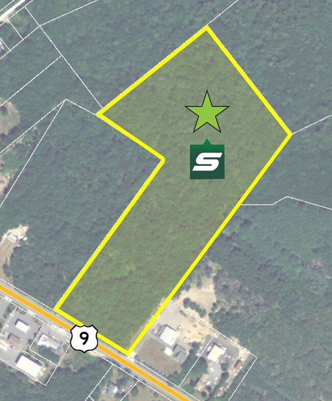
324 Route 9 St
Lakewood-New Brunswick, NJ
196.50AC. GAME PRESERVE
09-00004-0000-00161
OCEAN
Governmentalpublicusegeneral
New Jersey
C-2
161
AE The base floodplain where base flood elevations are provided. AE Zones are now used on new format FIRMs instead of A1-A30 Zones.
196.50 AC
0
Ocean County
2025
Northern New Jersey
733001
NEARBY LISTINGS FOR SALE OR LEASE
DEMOGRAPHICS near 324 Route 9 St
1 mile
3 mile
5 mile
2025 Total Population
1,194
7,130
31,935
2030 Population
1,248
7,429
33,999
Pop Growth 2025-2030
+ 4.52%
+ 4.19%
+ 6.46%
Average Age
43
45
45
2025 Total Households
460
2,929
13,319
HH Growth 2025-2030
+ 3.91%
+ 3.69%
+ 6.28%
Median Household Inc
$90,441
$93,873
$99,414
Avg Household Size
2.60
2.40
2.40
2025 Avg HH Vehicles
2.00
2.00
2.00
Median Home Value
$405,085
$397,172
$438,772
Median Year Built
1978
1993
1989
Nearby Places
Map Layers
Map Styles
 Street
 Aerial
Transit
 Traffic
 Biking
Places
Listings with unknown addresses are not visible on the map
- Restaurants
- Banks
- Shops
- Fitness
- Groceries
PUBLIC TRANSPORTATION
AIRPORT
Atlantic City International
Drive
Walk
Distance
Atlantic City International
58 min
27.9 mi
Freight Ports
Broadway Terminal - Pier 5
Drive
Walk
Distance
Broadway Terminal - Pier 5
77 min
59.8 mi
SALE & LEASE HISTORY
LISTING DATE
SALE/LEASE

May 08, 2017
For Sale
Nearby Properties
Address
Land Use
TOTAL SIZE
Lot Size
Zoning
Address
Land Use
TOTAL SIZE
Lot Size
Zoning
13,320 SF
6.97 AC
B2
Address
Land Use
TOTAL SIZE
Lot Size
Zoning
30.78 AC
R1A
Address
Land Use
TOTAL SIZE
Lot Size
Zoning
1,980 SF
155.56 AC
PRD
Address
Land Use
TOTAL SIZE
Lot Size
Zoning
11.94 AC
GBSG
Address
Land Use
TOTAL SIZE
Lot Size
Zoning
41,194 SF
3.67 AC
R400
Address
Land Use
TOTAL SIZE
Lot Size
Zoning
53,927 SF
1.87 AC
B2
Address
Land Use
TOTAL SIZE
Lot Size
Zoning
12,669 SF
1.73 AC
B2
Address
Land Use
TOTAL SIZE
Lot Size
Zoning
415.17 AC
RROS
Address
Land Use
TOTAL SIZE
Lot Size
Zoning
20,232 SF
2.25 AC
VOB
Address
Land Use
TOTAL SIZE
Lot Size
Zoning
499.24 AC
RC
Address
Land Use
TOTAL SIZE
Lot Size
Zoning
Address
Land Use
TOTAL SIZE
Lot Size
Zoning
0.72 AC
RA-5
Address
Land Use
TOTAL SIZE
Lot Size
Zoning
39.59 AC
B2
Address
Land Use
TOTAL SIZE
Lot Size
Zoning
7.69 AC
C-2V
Address
Land Use
TOTAL SIZE
Lot Size
Zoning
2,805 SF
11.08 AC
RA4
Address
Land Use
TOTAL SIZE
Lot Size
Zoning
36,300 SF
22.07 AC
LIC
Address
Land Use
TOTAL SIZE
Lot Size
Zoning
3.94 AC
R100
Address
Land Use
TOTAL SIZE
Lot Size
Zoning
8,267 SF
1.13 AC
B2
Address
Land Use
TOTAL SIZE
Lot Size
Zoning
0.98 AC
PRD
Address
Land Use
TOTAL SIZE
Lot Size
Zoning
13,804 SF
2.37 AC
RA4
Address
Land Use
TOTAL SIZE
Lot Size
Zoning
6,184 SF
16.25 AC
B2
Address
Land Use
TOTAL SIZE
Lot Size
Zoning
4,640 SF
8.07 AC
GBSG
Address
Land Use
TOTAL SIZE
Lot Size
Zoning
36.13 AC
LB
Address
Land Use
TOTAL SIZE
Lot Size
Zoning
12 AC
C-2V
Address
Land Use
TOTAL SIZE
Lot Size
Zoning
52.54 AC
R-3A
Address
Land Use
TOTAL SIZE
Lot Size
Zoning
2.17 AC
C-2
Address
Land Use
TOTAL SIZE
Lot Size
Zoning
1,013.30 AC
RC
Address
Land Use
TOTAL SIZE
Lot Size
Zoning
39.39 AC
GBSG
Address
Land Use
TOTAL SIZE
Lot Size
Zoning
2,090 SF
1.64 AC
R-3
Address
Land Use
TOTAL SIZE
Lot Size
Zoning
20.12 AC
GBSG
The World's #1 Commercial Real Estate Marketplace
Connect with us
© 2026 CoStar Group
The information above has been obtained from sources believed reliable. While we do not doubt its accuracy we have not verified it and make no guarantee, warranty or representation about it. It is your responsibility to independently confirm its accuracy and completeness. Any projections, opinions, assumptions, or estimates used are for example only and do not represent the current or future performance of the property. The value of this transaction to you depends on tax and other factors which should be evaluated by your tax, financial, and legal advisors. You and your advisors should conduct a careful, independent investigation of the property to determine to your satisfaction the suitability of the property for your needs.