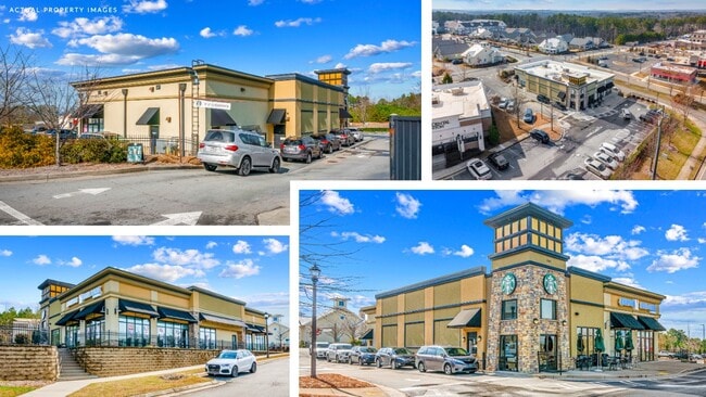
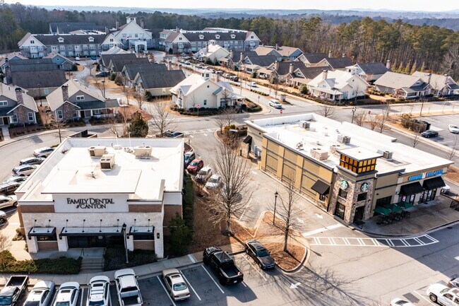
Property Record
3241 Sixes Rd, Canton, GA 30114

NEARBY LISTINGS FOR SALE OR LEASE
Property Detail
3241 Sixes Rd
015N08-00000-017-00D-0000
LL 354 15TH D
Restaurantdrivein
Cherokee
X
Georgia
13057C0241E
354
2025
0.92 AC
2025
Cherokee/Woodstock
090705
Atlanta
5,752 SF
Atlanta-Sandy Springs-Roswell, GA
DEMOGRAPHICS near 3241 Sixes Rd
1 Mile
3 Mile
5 Mile
2024 Total Population
3,994
42,620
104,983
2029 Population
4,559
48,645
120,143
Pop Growth 2024-2029
+ 14.15%
+ 14.14%
+ 14.44%
Average Age
42
39
39
2024 Total Households
1,405
15,135
37,378
HH Growth 2024-2029
+ 14.38%
+ 14.32%
+ 14.64%
Median Household Inc
$144,770
$113,549
$99,849
Avg Household Size
2.80
2.80
2.70
2024 Avg HH Vehicles
3.00
2.00
2.00
Median Home Value
$382,566
$364,446
$345,894
Median Year Built
1997
2001
1999
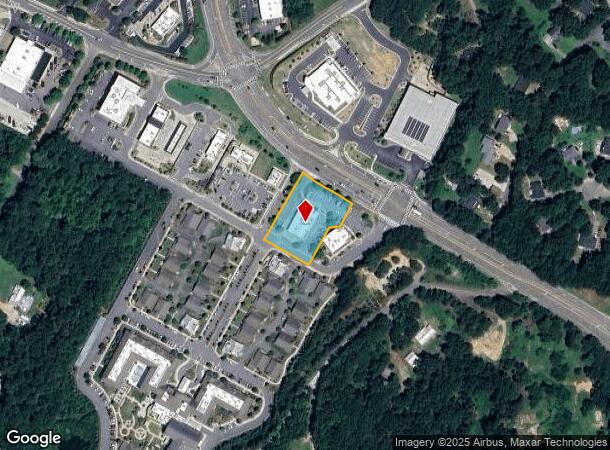
Nearby Places
Map Layers
Map Styles
 Street
 Aerial
- Restaurants
- Banks
- Shops
- Fitness
- Groceries
SALE & LEASE HISTORY
LISTING DATE
SALE/LEASE

Sep 25, 2016
For Lease
Mar 04, 2020
For Sale
Feb 02, 2024
For Lease
Nearby Properties
Address
Land Use
TOTAL SIZE
Lot Size
Zoning
Address
Land Use
TOTAL SIZE
Lot Size
Zoning
235,863 SF
18.96 AC
HDMFR
Address
Land Use
TOTAL SIZE
Lot Size
Zoning
275,118 SF
21.61 AC
R-40
Address
Land Use
TOTAL SIZE
Lot Size
Zoning
353,395 SF
29.15 AC
GC
Address
Land Use
TOTAL SIZE
Lot Size
Zoning
120,084 SF
25.15 AC
LI
Address
Land Use
TOTAL SIZE
Lot Size
Zoning
79,162 SF
8.54 AC
RM16
Address
Land Use
TOTAL SIZE
Lot Size
Zoning
103,620 SF
19.78 AC
R-5
Address
Land Use
TOTAL SIZE
Lot Size
Zoning
145,195 SF
14.47 AC
R-40
Address
Land Use
TOTAL SIZE
Lot Size
Zoning
302,757 SF
62.80 AC
PUD
Address
Land Use
TOTAL SIZE
Lot Size
Zoning
177,744 SF
23.73 AC
PUD
Address
Land Use
TOTAL SIZE
Lot Size
Zoning
155,341 SF
14.54 AC
R-5
Address
Land Use
TOTAL SIZE
Lot Size
Zoning
299,408 SF
15 AC
TND
Address
Land Use
TOTAL SIZE
Lot Size
Zoning
43,897 SF
8.45 AC
PUD
Address
Land Use
TOTAL SIZE
Lot Size
Zoning
182,067 SF
23.83 AC
GC
Address
Land Use
TOTAL SIZE
Lot Size
Zoning
52,703 SF
37.65 AC
LI
Address
Land Use
TOTAL SIZE
Lot Size
Zoning
32,224 SF
2.89 AC
GC
Address
Land Use
TOTAL SIZE
Lot Size
Zoning
107,977 SF
17.26 AC
GC
Address
Land Use
TOTAL SIZE
Lot Size
Zoning
85,343 SF
2.46 AC
GC
Address
Land Use
TOTAL SIZE
Lot Size
Zoning
94,150 SF
24.74 AC
AG
Address
Land Use
TOTAL SIZE
Lot Size
Zoning
70,397 SF
13.24 AC
R-20
Address
Land Use
TOTAL SIZE
Lot Size
Zoning
78,987 SF
6.54 AC
GC
Address
Land Use
TOTAL SIZE
Lot Size
Zoning
44,397 SF
15.84 AC
GC
Address
Land Use
TOTAL SIZE
Lot Size
Zoning
33,071 SF
1.70 AC
TND
Address
Land Use
TOTAL SIZE
Lot Size
Zoning
24,984 SF
2.16 AC
GC
Address
Land Use
TOTAL SIZE
Lot Size
Zoning
57,363 SF
19.68 AC
PUD
Address
Land Use
TOTAL SIZE
Lot Size
Zoning
78,503 SF
9.51 AC
PUD
Address
Land Use
TOTAL SIZE
Lot Size
Zoning
31,232 SF
8.61 AC
LI
Address
Land Use
TOTAL SIZE
Lot Size
Zoning
54,922 SF
6.03 AC
GC
Address
Land Use
TOTAL SIZE
Lot Size
Zoning
49,876 SF
3.84 AC
GC
Address
Land Use
TOTAL SIZE
Lot Size
Zoning
67,422 SF
8.14 AC
PUD
Address
Land Use
TOTAL SIZE
Lot Size
Zoning
40,590 SF
2.80 AC
GC
The World's #1 Commercial Real Estate Marketplace
Connect with us
© 2025 CoStar Group
The information above has been obtained from sources believed reliable. While we do not doubt its accuracy we have not verified it and make no guarantee, warranty or representation about it. It is your responsibility to independently confirm its accuracy and completeness. Any projections, opinions, assumptions, or estimates used are for example only and do not represent the current or future performance of the property. The value of this transaction to you depends on tax and other factors which should be evaluated by your tax, financial, and legal advisors. You and your advisors should conduct a careful, independent investigation of the property to determine to your satisfaction the suitability of the property for your needs.