Property Record
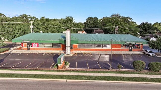
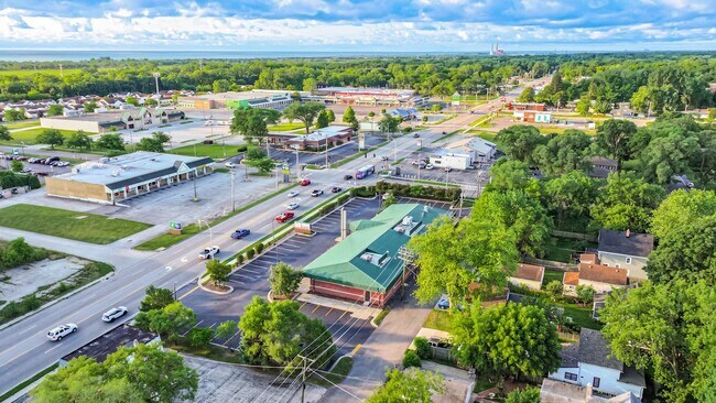
0 Sheridan Rd, Zion, IL 60099

Current Lease Availabilities
NEARBY LISTINGS FOR SALE OR LEASE
Property Detail
0 Sheridan Rd
Chicago-Naperville-Elgin, IL-IN-WI
Receiver S Resub.
04-28-225-019
RECEIVER S RESUB. SEC.28 LOT 23 BLOCK 48
Commercialacreage
Lake
X
Illinois
17097C0087L
23
2023
0.07 AC
2024
Far North
860301
Chicago
DEMOGRAPHICS near 0 Sheridan Rd
1 Mile
3 Mile
5 Mile
2024 Total Population
9,482
42,101
96,840
2029 Population
9,384
41,698
95,379
Pop Growth 2024-2029
(1.03%)
(0.96%)
(1.51%)
Average Age
39
38
38
2024 Total Households
3,430
14,662
33,971
HH Growth 2024-2029
(1.17%)
(1.13%)
(1.64%)
Median Household Inc
$44,586
$67,961
$67,536
Avg Household Size
2.60
2.80
2.80
2024 Avg HH Vehicles
2.00
2.00
2.00
Median Home Value
$142,857
$162,992
$174,841
Median Year Built
1960
1969
1970
Nearby Places
- Restaurants
- Banks
- Shops
- Fitness
- Groceries
PUBLIC TRANSPORTATION
COMMUTER RAIL
Zion Station (Union Pacific North Line - Northeast Illinois Regional Commuter Railroad (Metra))
DRIVE
WALK
Distance
Zion Station (Union Pacific North Line - Northeast Illinois Regional Commuter Railroad (Metra))
4 min
1.4 mi
Winthrop Harbor Station (Union Pacific North Line - Northeast Illinois Regional Commuter Railroad (Metra))
DRIVE
WALK
Distance
Winthrop Harbor Station (Union Pacific North Line - Northeast Illinois Regional Commuter Railroad (Metra))
8 min
3.6 mi
Freight Ports
Port of Baltimore
DRIVE
WALK
Distance
Port of Baltimore
1 min
625.9 mi
Nearby Properties
Address
Land Use
TOTAL SIZE
Lot Size
Zoning
Address
Land Use
TOTAL SIZE
Lot Size
Zoning
32,000 SF
0.92 AC
Address
Land Use
TOTAL SIZE
Lot Size
Zoning
5,690 SF
93.61 AC
Address
Land Use
TOTAL SIZE
Lot Size
Zoning
18.23 AC
Address
Land Use
TOTAL SIZE
Lot Size
Zoning
244,800 SF
23.32 AC
Address
Land Use
TOTAL SIZE
Lot Size
Zoning
215,773 SF
20.50 AC
Address
Land Use
TOTAL SIZE
Lot Size
Zoning
96,384 SF
8.73 AC
Address
Land Use
TOTAL SIZE
Lot Size
Zoning
320,050 SF
0.96 AC
Address
Land Use
TOTAL SIZE
Lot Size
Zoning
224,750 SF
15.11 AC
Address
Land Use
TOTAL SIZE
Lot Size
Zoning
70,268 SF
8.66 AC
Address
Land Use
TOTAL SIZE
Lot Size
Zoning
66,140 SF
0.88 AC
Address
Land Use
TOTAL SIZE
Lot Size
Zoning
0.24 AC
Address
Land Use
TOTAL SIZE
Lot Size
Zoning
0.36 AC
Address
Land Use
TOTAL SIZE
Lot Size
Zoning
1,003 SF
25 AC
Address
Land Use
TOTAL SIZE
Lot Size
Zoning
95,368 SF
7.07 AC
Address
Land Use
TOTAL SIZE
Lot Size
Zoning
34,476 SF
0.24 AC
Address
Land Use
TOTAL SIZE
Lot Size
Zoning
Address
Land Use
TOTAL SIZE
Lot Size
Zoning
0.40 AC
Address
Land Use
TOTAL SIZE
Lot Size
Zoning
55,087 SF
0.57 AC
Address
Land Use
TOTAL SIZE
Lot Size
Zoning
85,238 SF
1.14 AC
Address
Land Use
TOTAL SIZE
Lot Size
Zoning
Address
Land Use
TOTAL SIZE
Lot Size
Zoning
86,978 SF
2.81 AC
Address
Land Use
TOTAL SIZE
Lot Size
Zoning
0.24 AC
Address
Land Use
TOTAL SIZE
Lot Size
Zoning
17.39 AC
Address
Land Use
TOTAL SIZE
Lot Size
Zoning
65,440 SF
0.16 AC
Address
Land Use
TOTAL SIZE
Lot Size
Zoning
44,900 SF
3.83 AC
Address
Land Use
TOTAL SIZE
Lot Size
Zoning
882 SF
17.88 AC
Address
Land Use
TOTAL SIZE
Lot Size
Zoning
15.20 AC
Address
Land Use
TOTAL SIZE
Lot Size
Zoning
0.24 AC
Address
Land Use
TOTAL SIZE
Lot Size
Zoning
76,280 SF
3.88 AC
Address
Land Use
TOTAL SIZE
Lot Size
Zoning
70,625 SF
5.44 AC
The World's #1 Commercial Real Estate Marketplace
Connect with us
© 2025 CoStar Group
The information above has been obtained from sources believed reliable. While we do not doubt its accuracy we have not verified it and make no guarantee, warranty or representation about it. It is your responsibility to independently confirm its accuracy and completeness. Any projections, opinions, assumptions, or estimates used are for example only and do not represent the current or future performance of the property. The value of this transaction to you depends on tax and other factors which should be evaluated by your tax, financial, and legal advisors. You and your advisors should conduct a careful, independent investigation of the property to determine to your satisfaction the suitability of the property for your needs.