Property Record
3244 N Monroe St, Tallahassee, FL 32303


NEARBY LISTINGS FOR SALE OR LEASE
Property Detail
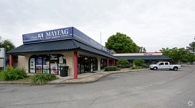
3244 N Monroe St
Tallahassee, FL
Plantation Of Fl Pecan Endowm Co 5Th Div
21-15-51-502-157.0
15 1N 1W PART OF LOTS 502 & 506 S OF MONROE ST OR 1264/517 1285/863 2744/1307
Warehouse
Leon
X
Florida
12073C0277F
157
2025
6.76 AC
2025
Northwest Leon County
002207
Tallahassee
228,834 SF
DEMOGRAPHICS near 3244 N Monroe St
1 Mile
3 Mile
5 Mile
2024 Total Population
6,880
72,156
135,982
2029 Population
7,309
75,570
142,304
Pop Growth 2024-2029
+ 6.24%
+ 4.73%
+ 4.65%
Average Age
35
33
34
2024 Total Households
2,986
29,949
58,192
HH Growth 2024-2029
+ 6.43%
+ 4.97%
+ 4.83%
Median Household Inc
$53,928
$44,278
$44,168
Avg Household Size
2.20
2.20
2.10
2024 Avg HH Vehicles
2.00
2.00
2.00
Median Home Value
$156,920
$187,794
$212,885
Median Year Built
1979
1985
1983
Nearby Places
Map Layers
Map Styles
 Street
 Aerial
- Restaurants
- Banks
- Shops
- Fitness
- Groceries
PUBLIC TRANSPORTATION
AIRPORT
Tallahassee International
DRIVE
WALK
Distance
Tallahassee International
17 min
9.8 mi
Freight Ports
Port of Panama City
DRIVE
WALK
Distance
Port of Panama City
137 min
103.0 mi
Nearby Properties
Address
Land Use
TOTAL SIZE
Lot Size
Zoning
Address
Land Use
TOTAL SIZE
Lot Size
Zoning
664,514 SF
2.49 AC
UT
Address
Land Use
TOTAL SIZE
Lot Size
Zoning
369,383 SF
4.51 AC
UT
Address
Land Use
TOTAL SIZE
Lot Size
Zoning
758,762 SF
20.82 AC
UT
Address
Land Use
TOTAL SIZE
Lot Size
Zoning
556,751 SF
20.60 AC
CP
Address
Land Use
TOTAL SIZE
Lot Size
Zoning
859,666 SF
20.17 AC
MR1
Address
Land Use
TOTAL SIZE
Lot Size
Zoning
538,290 SF
11.05 AC
Address
Land Use
TOTAL SIZE
Lot Size
Zoning
421,095 SF
28.06 AC
MR1
Address
Land Use
TOTAL SIZE
Lot Size
Zoning
459,568 SF
10.10 AC
CU45
Address
Land Use
TOTAL SIZE
Lot Size
Zoning
883,293 SF
35.97 AC
R4
Address
Land Use
TOTAL SIZE
Lot Size
Zoning
607,000 SF
37.55 AC
PUD
Address
Land Use
TOTAL SIZE
Lot Size
Zoning
1,241,812 SF
44.71 AC
MR1
Address
Land Use
TOTAL SIZE
Lot Size
Zoning
423,131 SF
8.36 AC
CU45
Address
Land Use
TOTAL SIZE
Lot Size
Zoning
739,671 SF
20.04 AC
MR1
Address
Land Use
TOTAL SIZE
Lot Size
Zoning
1,048,414 SF
5.88 AC
UT
Address
Land Use
TOTAL SIZE
Lot Size
Zoning
660,721 SF
30.95 AC
Address
Land Use
TOTAL SIZE
Lot Size
Zoning
489,720 SF
2.07 AC
UPUD
Address
Land Use
TOTAL SIZE
Lot Size
Zoning
325,725 SF
2.44 AC
UPUD
Address
Land Use
TOTAL SIZE
Lot Size
Zoning
498,076 SF
22.49 AC
MR1
Address
Land Use
TOTAL SIZE
Lot Size
Zoning
96,444 SF
16.70 AC
UT
Address
Land Use
TOTAL SIZE
Lot Size
Zoning
711,296 SF
17.86 AC
PUD
Address
Land Use
TOTAL SIZE
Lot Size
Zoning
127,486 SF
8.23 AC
M1
Address
Land Use
TOTAL SIZE
Lot Size
Zoning
196,915 SF
3.33 AC
UT
Address
Land Use
TOTAL SIZE
Lot Size
Zoning
236,679 SF
32.60 AC
MR1
Address
Land Use
TOTAL SIZE
Lot Size
Zoning
588,955 SF
36.20 AC
R3
Address
Land Use
TOTAL SIZE
Lot Size
Zoning
456,228 SF
27.14 AC
UT
Address
Land Use
TOTAL SIZE
Lot Size
Zoning
332,760 SF
14.68 AC
MR1
Address
Land Use
TOTAL SIZE
Lot Size
Zoning
509,100 SF
14.93 AC
OR3
Address
Land Use
TOTAL SIZE
Lot Size
Zoning
570,525 SF
18.89 AC
MR1
Address
Land Use
TOTAL SIZE
Lot Size
Zoning
123,020 SF
9.45 AC
M1
Address
Land Use
TOTAL SIZE
Lot Size
Zoning
240,852 SF
8.21 AC
MR1
The World's #1 Commercial Real Estate Marketplace
Connect with us
© 2025 CoStar Group
The information above has been obtained from sources believed reliable. While we do not doubt its accuracy we have not verified it and make no guarantee, warranty or representation about it. It is your responsibility to independently confirm its accuracy and completeness. Any projections, opinions, assumptions, or estimates used are for example only and do not represent the current or future performance of the property. The value of this transaction to you depends on tax and other factors which should be evaluated by your tax, financial, and legal advisors. You and your advisors should conduct a careful, independent investigation of the property to determine to your satisfaction the suitability of the property for your needs.