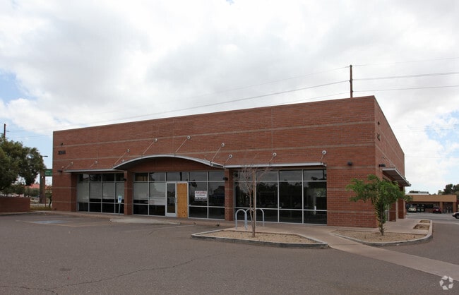
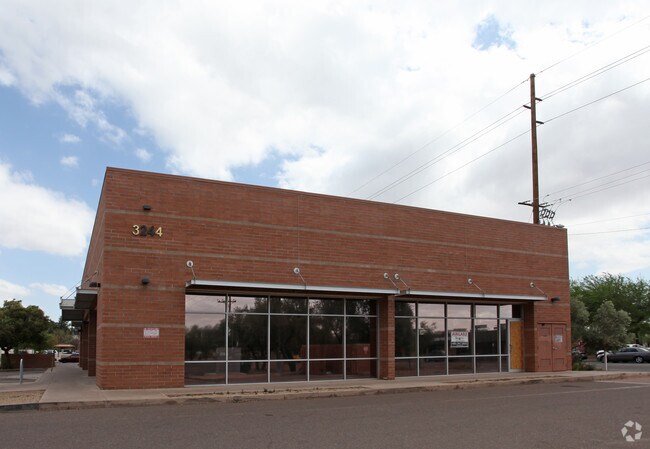
Property Record
3244 S Mill Ave, Tempe, AZ 85282


Property Detail
3244 S Mill Ave
133-29-001Z
PT OF SW4 SEC 27 BEG SW COR E 993.54F N 50F TO TPOB TH CONT N 150F E 150F S 150F W 150F TO POB P/D 5470-305 EX 20F X 20F TRI IN SE COR P/F 83-489865 & EX RD DAF COM SW COR SD SEC TH E 993.73F TH N 50F TO POB TH CONT N 5F TH E 134.93F TH S 44D 21M W 7
Storebuilding
Maricopa
C-G
Arizona
C and X Area of minimal flood hazard, usually depicted on FIRMs as above the 500-year flood level.
0.48 AC
2025
Tempe
2025
Phoenix
319600
Phoenix-Mesa-Chandler, AZ
5,132 SF
NEARBY LISTINGS FOR SALE OR LEASE
DEMOGRAPHICS near 3244 S Mill Ave
1 mile
3 mile
5 mile
2025 Total Population
16,549
163,825
322,464
2030 Population
17,089
169,772
334,205
Pop Growth 2025-2030
+ 3.26%
+ 3.63%
+ 3.64%
Average Age
35
34
36
2025 Total Households
6,829
66,959
134,582
HH Growth 2025-2030
+ 3.44%
+ 3.97%
+ 3.90%
Median Household Inc
$74,648
$71,253
$76,946
Avg Household Size
2.30
2.20
2.30
2025 Avg HH Vehicles
2.00
2.00
2.00
Median Home Value
$459,065
$432,419
$441,002
Median Year Built
1974
1982
1983
Nearby Places
Map Layers
Map Styles
 Street
 Aerial
Layers
 Traffic
 Biking
Places
Listings with unknown addresses are not visible on the map
- Restaurants
- Banks
- Shops
- Fitness
- Groceries
PUBLIC TRANSPORTATION
AIRPORT
Phoenix Sky Harbor International
Drive
Walk
Distance
Phoenix Sky Harbor International
14 min
8.0 mi
Phoenix-Mesa Gateway
Drive
Walk
Distance
Phoenix-Mesa Gateway
30 min
21.7 mi
Freight Ports
Port of San Diego
Drive
Walk
Distance
Port of San Diego
401 min
366.3 mi
Nearby Properties
Address
Land Use
TOTAL SIZE
Lot Size
Zoning
Address
Land Use
TOTAL SIZE
Lot Size
Zoning
4.59 AC
I-1
Address
Land Use
TOTAL SIZE
Lot Size
Zoning
12.93 AC
I-P
Address
Land Use
TOTAL SIZE
Lot Size
Zoning
2.63 AC
I-1
Address
Land Use
TOTAL SIZE
Lot Size
Zoning
Address
Land Use
TOTAL SIZE
Lot Size
Zoning
401,544 SF
64.59 AC
GID
Address
Land Use
TOTAL SIZE
Lot Size
Zoning
2,089,643 SF
33.80 AC
MU-ED
Address
Land Use
TOTAL SIZE
Lot Size
Zoning
1,227,029 SF
7.39 AC
R-6
Address
Land Use
TOTAL SIZE
Lot Size
Zoning
106,575 SF
2.50 AC
I-1
Address
Land Use
TOTAL SIZE
Lot Size
Zoning
1,056,321 SF
35.93 AC
R1-6
Address
Land Use
TOTAL SIZE
Lot Size
Zoning
5.13 AC
Address
Land Use
TOTAL SIZE
Lot Size
Zoning
1,102,629 SF
12.33 AC
R-3
Address
Land Use
TOTAL SIZE
Lot Size
Zoning
1,479,006 SF
84.96 AC
C-R
Address
Land Use
TOTAL SIZE
Lot Size
Zoning
2.54 AC
Address
Land Use
TOTAL SIZE
Lot Size
Zoning
571,804 SF
0.98 AC
CSS
Address
Land Use
TOTAL SIZE
Lot Size
Zoning
1,020,776 SF
11.33 AC
I-1
Address
Land Use
TOTAL SIZE
Lot Size
Zoning
331,050 SF
39 AC
I-1
Address
Land Use
TOTAL SIZE
Lot Size
Zoning
32,968 SF
2.10 AC
I-P
Address
Land Use
TOTAL SIZE
Lot Size
Zoning
548,227 SF
1.62 AC
C-G
Address
Land Use
TOTAL SIZE
Lot Size
Zoning
746,457 SF
20.95 AC
I-1
Address
Land Use
TOTAL SIZE
Lot Size
Zoning
352,244 SF
5.55 AC
R-6
Address
Land Use
TOTAL SIZE
Lot Size
Zoning
368,727 SF
12.77 AC
R1-6
Address
Land Use
TOTAL SIZE
Lot Size
Zoning
654,960 SF
19.48 AC
R-6
Address
Land Use
TOTAL SIZE
Lot Size
Zoning
544,646 SF
1.65 AC
MU4
Address
Land Use
TOTAL SIZE
Lot Size
Zoning
518,223 SF
3.54 AC
C-C
Address
Land Use
TOTAL SIZE
Lot Size
Zoning
377,014 SF
1.81 AC
PAD
Address
Land Use
TOTAL SIZE
Lot Size
Zoning
474,335 SF
9.54 AC
R-3
The World's #1 Commercial Real Estate Marketplace
Connect with us
© 2026 CoStar Group
The information above has been obtained from sources believed reliable. While we do not doubt its accuracy we have not verified it and make no guarantee, warranty or representation about it. It is your responsibility to independently confirm its accuracy and completeness. Any projections, opinions, assumptions, or estimates used are for example only and do not represent the current or future performance of the property. The value of this transaction to you depends on tax and other factors which should be evaluated by your tax, financial, and legal advisors. You and your advisors should conduct a careful, independent investigation of the property to determine to your satisfaction the suitability of the property for your needs.