Property Record
3244 Us Route 60, Huntington, WV 25705

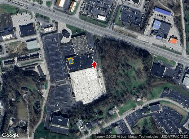
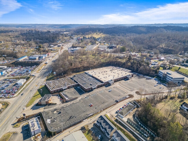
This Property Is For Sale
NEARBY LISTINGS FOR SALE OR LEASE
Property Detail
3244 Us Route 60
04-4P-01240017
E HLS PROF CTR CONDO 3244 US ROUTE 60 STE 21 C/F 4P/124 2009 TAX YEAR
Officebuilding
Cabell
X
West Virginia
54011C0137D
0.23 AC
2025
South Cabell County
2025
Huntington/Ashland
010202
Huntington-Ashland, WV-KY-OH
DEMOGRAPHICS near 3244 Us Route 60
1 Mile
3 Mile
5 Mile
2024 Total Population
3,750
27,114
58,925
2029 Population
3,639
26,318
57,778
Pop Growth 2024-2029
(2.96%)
(2.94%)
(1.95%)
Average Age
40
42
41
2024 Total Households
1,788
11,973
24,550
HH Growth 2024-2029
(3.24%)
(3.11%)
(2.11%)
Median Household Inc
$66,939
$60,958
$57,099
Avg Household Size
2.10
2.20
2.20
2024 Avg HH Vehicles
2.00
2.00
2.00
Median Home Value
$218,675
$175,708
$175,781
Median Year Built
1976
1972
1968
Nearby Places
- Restaurants
- Banks
- Shops
- Fitness
- Groceries
PUBLIC TRANSPORTATION
COMMUTER RAIL
Huntington Amtrak Station (Cardinal - Amtrak)
DRIVE
WALK
Distance
Huntington Amtrak Station (Cardinal - Amtrak)
13 min
7.3 mi
AIRPORT
Tri-State/Milton J Ferguson Field
DRIVE
WALK
Distance
Tri-State/Milton J Ferguson Field
25 min
18.0 mi
Freight Ports
Port of Toledo
DRIVE
WALK
Distance
Port of Toledo
357 min
278.2 mi
Nearby Properties
Address
Land Use
TOTAL SIZE
Lot Size
Zoning
Address
Land Use
TOTAL SIZE
Lot Size
Zoning
17.51 AC
Address
Land Use
TOTAL SIZE
Lot Size
Zoning
83.50 AC
Address
Land Use
TOTAL SIZE
Lot Size
Zoning
27.42 AC
Address
Land Use
TOTAL SIZE
Lot Size
Zoning
29.35 AC
Address
Land Use
TOTAL SIZE
Lot Size
Zoning
Address
Land Use
TOTAL SIZE
Lot Size
Zoning
49.03 AC
Address
Land Use
TOTAL SIZE
Lot Size
Zoning
14.23 AC
Address
Land Use
TOTAL SIZE
Lot Size
Zoning
2,550 SF
5.47 AC
Address
Land Use
TOTAL SIZE
Lot Size
Zoning
12.40 AC
Address
Land Use
TOTAL SIZE
Lot Size
Zoning
Address
Land Use
TOTAL SIZE
Lot Size
Zoning
Address
Land Use
TOTAL SIZE
Lot Size
Zoning
Address
Land Use
TOTAL SIZE
Lot Size
Zoning
144,332 SF
13.43 AC
Address
Land Use
TOTAL SIZE
Lot Size
Zoning
50.86 AC
Address
Land Use
TOTAL SIZE
Lot Size
Zoning
200.77 AC
Address
Land Use
TOTAL SIZE
Lot Size
Zoning
14.10 AC
Address
Land Use
TOTAL SIZE
Lot Size
Zoning
5.32 AC
Address
Land Use
TOTAL SIZE
Lot Size
Zoning
Address
Land Use
TOTAL SIZE
Lot Size
Zoning
1.21 AC
Address
Land Use
TOTAL SIZE
Lot Size
Zoning
4.86 AC
Address
Land Use
TOTAL SIZE
Lot Size
Zoning
Address
Land Use
TOTAL SIZE
Lot Size
Zoning
10.77 AC
Address
Land Use
TOTAL SIZE
Lot Size
Zoning
74,627 SF
8.44 AC
Address
Land Use
TOTAL SIZE
Lot Size
Zoning
17.38 AC
Address
Land Use
TOTAL SIZE
Lot Size
Zoning
Address
Land Use
TOTAL SIZE
Lot Size
Zoning
9.20 AC
Address
Land Use
TOTAL SIZE
Lot Size
Zoning
Address
Land Use
TOTAL SIZE
Lot Size
Zoning
Address
Land Use
TOTAL SIZE
Lot Size
Zoning
9.39 AC
Address
Land Use
TOTAL SIZE
Lot Size
Zoning
The World's #1 Commercial Real Estate Marketplace
Connect with us
© 2025 CoStar Group
The information above has been obtained from sources believed reliable. While we do not doubt its accuracy we have not verified it and make no guarantee, warranty or representation about it. It is your responsibility to independently confirm its accuracy and completeness. Any projections, opinions, assumptions, or estimates used are for example only and do not represent the current or future performance of the property. The value of this transaction to you depends on tax and other factors which should be evaluated by your tax, financial, and legal advisors. You and your advisors should conduct a careful, independent investigation of the property to determine to your satisfaction the suitability of the property for your needs.