Property Record
3245 Boulevard, Colonial Heights, VA 23834


Property Detail
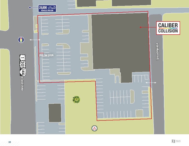
3245 Boulevard
6300010C019
SUB: MAPLE GROVE**SECTION: **BLOCK: C**LOT: 7-19
Vehiclerentalsvehiclesales
Colonial Heights City
B1
Virginia
B and X Area of moderate flood hazard, usually the area between the limits of the 100-year and 500-year floods.
7-19
2026
1.17 AC
2026
Colonial Heights
830200
Richmond VA
20,307 SF
Richmond, VA
NEARBY LISTINGS FOR SALE OR LEASE
DEMOGRAPHICS near 3245 Boulevard
1 mile
3 mile
5 mile
2025 Total Population
7,262
36,337
95,739
2030 Population
7,465
37,733
99,362
Pop Growth 2025-2030
+ 2.80%
+ 3.84%
+ 3.78%
Average Age
42
39
39
2025 Total Households
3,111
13,727
33,830
HH Growth 2025-2030
+ 2.76%
+ 3.97%
+ 4.10%
Median Household Inc
$66,797
$74,955
$68,536
Avg Household Size
2.20
2.40
2.40
2025 Avg HH Vehicles
2.00
2.00
2.00
Median Home Value
$250,958
$252,802
$266,020
Median Year Built
1970
1974
1976
Nearby Places
Map Layers
Map Styles
 Street
 Aerial
Layers
 Traffic
 Biking
Places
Listings with unknown addresses are not visible on the map
- Restaurants
- Banks
- Shops
- Fitness
- Groceries
PUBLIC TRANSPORTATION
COMMUTER RAIL
Drive
Walk
Distance
7 min
3.3 mi
AIRPORT
Richmond International
Drive
Walk
Distance
Richmond International
36 min
23.8 mi
SALE & LEASE HISTORY
LISTING DATE
SALE/LEASE

Oct 11, 2021
For Sale
May 14, 2024
For Sale
Jul 25, 2018
For Sale
Nearby Properties
Address
Land Use
TOTAL SIZE
Lot Size
Zoning
Address
Land Use
TOTAL SIZE
Lot Size
Zoning
500 SF
390.12 AC
R7 - SINGL
Address
Land Use
TOTAL SIZE
Lot Size
Zoning
165,942 SF
0.57 AC
R7 - SINGL
Address
Land Use
TOTAL SIZE
Lot Size
Zoning
505,068 SF
60.92 AC
I2 - GEN I
Address
Land Use
TOTAL SIZE
Lot Size
Zoning
806,770 SF
129.28 AC
I2 - GEN I
Address
Land Use
TOTAL SIZE
Lot Size
Zoning
101,300 SF
16.58 AC
C4 - REGIO
Address
Land Use
TOTAL SIZE
Lot Size
Zoning
265,641 SF
47.75 AC
I2 - GEN I
Address
Land Use
TOTAL SIZE
Lot Size
Zoning
154,764 SF
13.86 AC
RMF - RES,
Address
Land Use
TOTAL SIZE
Lot Size
Zoning
482,476 SF
19.75 AC
I2 - GEN I
Address
Land Use
TOTAL SIZE
Lot Size
Zoning
157,534 SF
38.15 AC
R7 - SINGL
Address
Land Use
TOTAL SIZE
Lot Size
Zoning
752 SF
28.91 AC
R7 - SINGL
Address
Land Use
TOTAL SIZE
Lot Size
Zoning
287,313 SF
17.26 AC
I1 - LT IN
Address
Land Use
TOTAL SIZE
Lot Size
Zoning
209,515 SF
21.20 AC
B3
Address
Land Use
TOTAL SIZE
Lot Size
Zoning
95,944 SF
15.75 AC
C2 - NBHD
Address
Land Use
TOTAL SIZE
Lot Size
Zoning
261,922 SF
19.85 AC
I1 - LT IN
Address
Land Use
TOTAL SIZE
Lot Size
Zoning
188,368 SF
18.96 AC
B1
Address
Land Use
TOTAL SIZE
Lot Size
Zoning
138,096 SF
16 AC
R7 - SINGL
Address
Land Use
TOTAL SIZE
Lot Size
Zoning
132,121 SF
61.15 AC
I2 - GEN I
Address
Land Use
TOTAL SIZE
Lot Size
Zoning
57,011 SF
4.45 AC
BB
Address
Land Use
TOTAL SIZE
Lot Size
Zoning
89,138 SF
6.45 AC
PUD
Address
Land Use
TOTAL SIZE
Lot Size
Zoning
37,809 SF
150 AC
R7 - SINGL
Address
Land Use
TOTAL SIZE
Lot Size
Zoning
130,698 SF
10.78 AC
PUD
Address
Land Use
TOTAL SIZE
Lot Size
Zoning
131,800 SF
21 AC
I2 - GEN I
Address
Land Use
TOTAL SIZE
Lot Size
Zoning
223,211 SF
19.99 AC
B3
Address
Land Use
TOTAL SIZE
Lot Size
Zoning
129,600 SF
12.21 AC
PUD
Address
Land Use
TOTAL SIZE
Lot Size
Zoning
173,829 SF
13.73 AC
B2
Address
Land Use
TOTAL SIZE
Lot Size
Zoning
218,821 SF
11.47 AC
I1 - LT IN
Address
Land Use
TOTAL SIZE
Lot Size
Zoning
140,000 SF
1 AC
999
Address
Land Use
TOTAL SIZE
Lot Size
Zoning
56 AC
I2 - GEN I
Address
Land Use
TOTAL SIZE
Lot Size
Zoning
56,701 SF
7.53 AC
R4
Address
Land Use
TOTAL SIZE
Lot Size
Zoning
220,009 SF
66.16 AC
I2 - GEN I
The World's #1 Commercial Real Estate Marketplace
Connect with us
© 2026 CoStar Group
The information above has been obtained from sources believed reliable. While we do not doubt its accuracy we have not verified it and make no guarantee, warranty or representation about it. It is your responsibility to independently confirm its accuracy and completeness. Any projections, opinions, assumptions, or estimates used are for example only and do not represent the current or future performance of the property. The value of this transaction to you depends on tax and other factors which should be evaluated by your tax, financial, and legal advisors. You and your advisors should conduct a careful, independent investigation of the property to determine to your satisfaction the suitability of the property for your needs.