Property Record
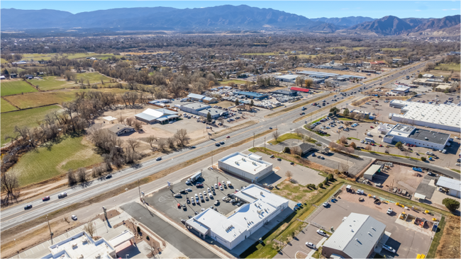
3245 E Us Highway 50, Penrose, CO 81240


NEARBY LISTINGS FOR SALE OR LEASE
Property Detail
3245 E Us Highway 50
000098104096
M & B Or Unknown
Medicalbuilding
SW4SE4 SEC 26-18-70 TR-976L BEG AT A PT ON THE N R/W LN OF US HWY 50 THAT IS N 229.26 FT AND E 660.16 FT FROM THE S4 COR OF
X
Fremont
08043C0633F
Colorado
2024
1.57 AC
2024
Colorado Southwest Area
978100
Other Market Areas
11,000 SF
Cañon City, CO
DEMOGRAPHICS near 3245 E Us Highway 50
1 Mile
3 Mile
5 Mile
2024 Total Population
2,166
23,143
30,548
2029 Population
2,211
23,495
31,072
Pop Growth 2024-2029
+ 2.08%
+ 1.52%
+ 1.72%
Average Age
46
44
44
2024 Total Households
876
8,146
11,281
HH Growth 2024-2029
+ 2.17%
+ 1.90%
+ 2.05%
Median Household Inc
$55,937
$54,648
$55,879
Avg Household Size
2.30
2.20
2.20
2024 Avg HH Vehicles
2.00
2.00
2.00
Median Home Value
$263,888
$226,872
$231,048
Median Year Built
1989
1975
1975
Nearby Places
Map Layers
Map Styles
 Street
 Aerial
- Restaurants
- Banks
- Shops
- Fitness
- Groceries
SALE & LEASE HISTORY
LISTING DATE
SALE/LEASE

Sep 18, 2017
For Lease
Nov 25, 2020
For Lease
Nov 22, 2021
For Sale
Mar 01, 2024
For Sale
Jun 25, 2025
For Sale
Feb 24, 2025
For Sale
Feb 02, 2018
For Sale
Nearby Properties
Address
Land Use
TOTAL SIZE
Lot Size
Zoning
Address
Land Use
TOTAL SIZE
Lot Size
Zoning
73,681 SF
10 AC
Address
Land Use
TOTAL SIZE
Lot Size
Zoning
181,210 SF
16 AC
Address
Land Use
TOTAL SIZE
Lot Size
Zoning
32,390 SF
Address
Land Use
TOTAL SIZE
Lot Size
Zoning
9,078 SF
18 AC
Address
Land Use
TOTAL SIZE
Lot Size
Zoning
Address
Land Use
TOTAL SIZE
Lot Size
Zoning
71,626 SF
10.34 AC
Address
Land Use
TOTAL SIZE
Lot Size
Zoning
24,563 SF
3.05 AC
Address
Land Use
TOTAL SIZE
Lot Size
Zoning
13,820 SF
10.89 AC
Address
Land Use
TOTAL SIZE
Lot Size
Zoning
41,602 SF
3.53 AC
Address
Land Use
TOTAL SIZE
Lot Size
Zoning
33,534 SF
4.92 AC
Address
Land Use
TOTAL SIZE
Lot Size
Zoning
36,860 SF
2.50 AC
Address
Land Use
TOTAL SIZE
Lot Size
Zoning
22,360 SF
2.60 AC
Address
Land Use
TOTAL SIZE
Lot Size
Zoning
36,919 SF
1.72 AC
Address
Land Use
TOTAL SIZE
Lot Size
Zoning
18,840 SF
3.75 AC
Address
Land Use
TOTAL SIZE
Lot Size
Zoning
15,096 SF
9.57 AC
Address
Land Use
TOTAL SIZE
Lot Size
Zoning
11,790 SF
1.57 AC
Address
Land Use
TOTAL SIZE
Lot Size
Zoning
27,120 SF
3.19 AC
Address
Land Use
TOTAL SIZE
Lot Size
Zoning
25,080 SF
12.57 AC
Address
Land Use
TOTAL SIZE
Lot Size
Zoning
12,699 SF
4.32 AC
Address
Land Use
TOTAL SIZE
Lot Size
Zoning
44,847 SF
1.96 AC
Address
Land Use
TOTAL SIZE
Lot Size
Zoning
23,232 SF
5.62 AC
Address
Land Use
TOTAL SIZE
Lot Size
Zoning
3,628 SF
4.81 AC
Address
Land Use
TOTAL SIZE
Lot Size
Zoning
6,120 SF
3.39 AC
Address
Land Use
TOTAL SIZE
Lot Size
Zoning
38,547 SF
1.94 AC
Address
Land Use
TOTAL SIZE
Lot Size
Zoning
14,735 SF
1.52 AC
Address
Land Use
TOTAL SIZE
Lot Size
Zoning
14,000 SF
3.83 AC
Address
Land Use
TOTAL SIZE
Lot Size
Zoning
27,776 SF
0.97 AC
Address
Land Use
TOTAL SIZE
Lot Size
Zoning
10,496 SF
1.31 AC
Address
Land Use
TOTAL SIZE
Lot Size
Zoning
10,452 SF
1.27 AC
Address
Land Use
TOTAL SIZE
Lot Size
Zoning
15,938 SF
4.85 AC
The World's #1 Commercial Real Estate Marketplace
Connect with us
© 2025 CoStar Group
The information above has been obtained from sources believed reliable. While we do not doubt its accuracy we have not verified it and make no guarantee, warranty or representation about it. It is your responsibility to independently confirm its accuracy and completeness. Any projections, opinions, assumptions, or estimates used are for example only and do not represent the current or future performance of the property. The value of this transaction to you depends on tax and other factors which should be evaluated by your tax, financial, and legal advisors. You and your advisors should conduct a careful, independent investigation of the property to determine to your satisfaction the suitability of the property for your needs.