Property Record
3245 Route 35 N, Lavallette, NJ 08735

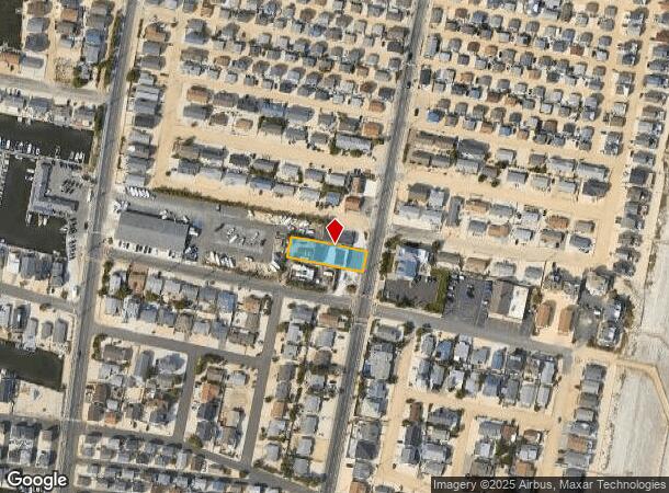
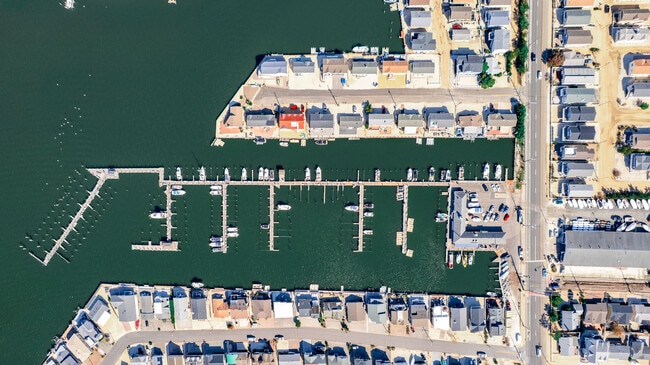
This Property Is For Sale
NEARBY LISTINGS FOR SALE OR LEASE
-
-
View all Lavallette listings for sale on LoopNet.com
Property Detail
3245 Route 35 N
New York-Jersey City-White Plains, NY-NJ
Ocean Beach Busn Sec 01-2 Un 0
08-00934-0000-00004
58X211
Commercialnec
Ocean
AE
New Jersey
34029C0327F
4
2024
0.28 AC
2025
Ocean County
722500
Northern New Jersey
5,400 SF
DEMOGRAPHICS near 3245 Route 35 N
1 Mile
3 Mile
5 Mile
2024 Total Population
5,402
20,610
80,489
2029 Population
6,521
24,094
89,355
Pop Growth 2024-2029
+ 20.71%
+ 16.90%
+ 11.02%
Average Age
58
53
45
2024 Total Households
2,888
10,058
33,987
HH Growth 2024-2029
+ 20.64%
+ 17.17%
+ 11.39%
Median Household Inc
$74,201
$91,496
$93,248
Avg Household Size
1.80
2.00
2.30
2024 Avg HH Vehicles
2.00
2.00
2.00
Median Home Value
$735,447
$664,467
$438,695
Median Year Built
1978
1979
1974
Nearby Places
- Restaurants
- Banks
- Shops
- Fitness
- Groceries
PUBLIC TRANSPORTATION
COMMUTER RAIL
Bay Head (North Jersey Coast Line - NJ Transit Commuter Rail (NJ Transit))
DRIVE
WALK
Distance
Bay Head (North Jersey Coast Line - NJ Transit Commuter Rail (NJ Transit))
13 min
6.3 mi
Point Pleasant Beach (North Jersey Coast Line - NJ Transit Commuter Rail (NJ Transit))
DRIVE
WALK
Distance
Point Pleasant Beach (North Jersey Coast Line - NJ Transit Commuter Rail (NJ Transit))
15 min
7.6 mi
Freight Ports
New York Container Terminal
DRIVE
WALK
Distance
New York Container Terminal
78 min
57.0 mi
Nearby Properties
Address
Land Use
TOTAL SIZE
Lot Size
Zoning
Address
Land Use
TOTAL SIZE
Lot Size
Zoning
2.67 AC
SMF
Address
Land Use
TOTAL SIZE
Lot Size
Zoning
12,520 SF
1.81 AC
RB
Address
Land Use
TOTAL SIZE
Lot Size
Zoning
6.16 AC
MF16
Address
Land Use
TOTAL SIZE
Lot Size
Zoning
1.30 AC
RR
Address
Land Use
TOTAL SIZE
Lot Size
Zoning
0.75 AC
RR
Address
Land Use
TOTAL SIZE
Lot Size
Zoning
20,271 SF
0.96 AC
PUB
Address
Land Use
TOTAL SIZE
Lot Size
Zoning
3,209 SF
7.40 AC
GB
Address
Land Use
TOTAL SIZE
Lot Size
Zoning
1.36 AC
PUB
Address
Land Use
TOTAL SIZE
Lot Size
Zoning
Address
Land Use
TOTAL SIZE
Lot Size
Zoning
29,422 SF
1.30 AC
Address
Land Use
TOTAL SIZE
Lot Size
Zoning
1.29 AC
Address
Land Use
TOTAL SIZE
Lot Size
Zoning
9.30 AC
PUB
Address
Land Use
TOTAL SIZE
Lot Size
Zoning
1.23 AC
SMF
Address
Land Use
TOTAL SIZE
Lot Size
Zoning
7,830 SF
5.52 AC
R40W
Address
Land Use
TOTAL SIZE
Lot Size
Zoning
1,679 SF
2.17 AC
SMF
Address
Land Use
TOTAL SIZE
Lot Size
Zoning
2.24 AC
R40E
Address
Land Use
TOTAL SIZE
Lot Size
Zoning
0.57 AC
LDR
Address
Land Use
TOTAL SIZE
Lot Size
Zoning
9,020 SF
0.37 AC
R
Address
Land Use
TOTAL SIZE
Lot Size
Zoning
0.66 AC
RB
Address
Land Use
TOTAL SIZE
Lot Size
Zoning
1.22 AC
SMF
Address
Land Use
TOTAL SIZE
Lot Size
Zoning
Address
Land Use
TOTAL SIZE
Lot Size
Zoning
2,268 SF
6.91 AC
R75
Address
Land Use
TOTAL SIZE
Lot Size
Zoning
Address
Land Use
TOTAL SIZE
Lot Size
Zoning
2.76 AC
Address
Land Use
TOTAL SIZE
Lot Size
Zoning
13,168 SF
0.66 AC
Address
Land Use
TOTAL SIZE
Lot Size
Zoning
5,289 SF
2.89 AC
Address
Land Use
TOTAL SIZE
Lot Size
Zoning
11,790 SF
0.14 AC
RR
Address
Land Use
TOTAL SIZE
Lot Size
Zoning
5,624 SF
1.28 AC
GB
Address
Land Use
TOTAL SIZE
Lot Size
Zoning
192 SF
0.71 AC
GB
Address
Land Use
TOTAL SIZE
Lot Size
Zoning
0.23 AC
RR
The World's #1 Commercial Real Estate Marketplace
Connect with us
© 2025 CoStar Group
The information above has been obtained from sources believed reliable. While we do not doubt its accuracy we have not verified it and make no guarantee, warranty or representation about it. It is your responsibility to independently confirm its accuracy and completeness. Any projections, opinions, assumptions, or estimates used are for example only and do not represent the current or future performance of the property. The value of this transaction to you depends on tax and other factors which should be evaluated by your tax, financial, and legal advisors. You and your advisors should conduct a careful, independent investigation of the property to determine to your satisfaction the suitability of the property for your needs.