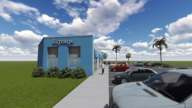
Property Record
3245 S Alameda St, Corpus Christi, TX 78404


NEARBY LISTINGS FOR SALE OR LEASE
Property Detail
3245 S Alameda St
Corpus Christi, TX
Lindale Park #4
260662
LINDALE PARK #4 BLK B2 LOT 1
Commercialnec
Nueces
X
Texas
48355C0320G
1
2024
0.54 AC
2025
Mid-City
002101
Corpus Christi
1,800 SF
DEMOGRAPHICS near 3245 S Alameda St
1 Mile
3 Mile
5 Mile
2024 Total Population
13,308
89,787
171,782
2029 Population
13,135
88,675
169,962
Pop Growth 2024-2029
(1.30%)
(1.24%)
(1.06%)
Average Age
40
39
39
2024 Total Households
5,384
33,541
64,570
HH Growth 2024-2029
(1.43%)
(1.27%)
(1.09%)
Median Household Inc
$56,899
$45,335
$47,613
Avg Household Size
2.40
2.50
2.50
2024 Avg HH Vehicles
2.00
2.00
2.00
Median Home Value
$161,012
$124,617
$134,038
Median Year Built
1954
1958
1968
Nearby Places
Map Layers
Map Styles
 Street
 Aerial
- Restaurants
- Banks
- Shops
- Fitness
- Groceries
PUBLIC TRANSPORTATION
AIRPORT
Corpus Christi International
DRIVE
WALK
Distance
Corpus Christi International
19 min
9.3 mi
Freight Ports
Port of Corpus Christi
DRIVE
WALK
Distance
Port of Corpus Christi
9 min
4.1 mi
SALE & LEASE HISTORY
LISTING DATE
SALE/LEASE

Nov 07, 2022
For Lease
Nearby Properties
Address
Land Use
TOTAL SIZE
Lot Size
Zoning
Address
Land Use
TOTAL SIZE
Lot Size
Zoning
567,638 SF
18.37 AC
B4
Address
Land Use
TOTAL SIZE
Lot Size
Zoning
674,927 SF
10.54 AC
B4
Address
Land Use
TOTAL SIZE
Lot Size
Zoning
1 SF
62.73 AC
III
Address
Land Use
TOTAL SIZE
Lot Size
Zoning
1 SF
13.71 AC
B5
Address
Land Use
TOTAL SIZE
Lot Size
Zoning
302,344 SF
5 AC
Address
Land Use
TOTAL SIZE
Lot Size
Zoning
176,076 SF
19.84 AC
R1B
Address
Land Use
TOTAL SIZE
Lot Size
Zoning
251,402 SF
7.17 AC
Address
Land Use
TOTAL SIZE
Lot Size
Zoning
117,000 SF
19.20 AC
R1B
Address
Land Use
TOTAL SIZE
Lot Size
Zoning
1 SF
10.53 AC
I2
Address
Land Use
TOTAL SIZE
Lot Size
Zoning
10,000 SF
35.96 AC
R1B
Address
Land Use
TOTAL SIZE
Lot Size
Zoning
72,106 SF
1.96 AC
B-5
Address
Land Use
TOTAL SIZE
Lot Size
Zoning
278,919 SF
39.27 AC
R1B
Address
Land Use
TOTAL SIZE
Lot Size
Zoning
78,000 SF
6.92 AC
R1B
Address
Land Use
TOTAL SIZE
Lot Size
Zoning
1 SF
40.02 AC
R1B
Address
Land Use
TOTAL SIZE
Lot Size
Zoning
75,120 SF
1.93 AC
B2
Address
Land Use
TOTAL SIZE
Lot Size
Zoning
80,354 SF
7.11 AC
R1B
Address
Land Use
TOTAL SIZE
Lot Size
Zoning
65,301 SF
7.37 AC
B-4
Address
Land Use
TOTAL SIZE
Lot Size
Zoning
177,545 SF
7.75 AC
B2
Address
Land Use
TOTAL SIZE
Lot Size
Zoning
74,261 SF
4.44 AC
R1B
Address
Land Use
TOTAL SIZE
Lot Size
Zoning
13,773 SF
28.82 AC
R1B
Address
Land Use
TOTAL SIZE
Lot Size
Zoning
213,050 SF
34.44 AC
R1B
Address
Land Use
TOTAL SIZE
Lot Size
Zoning
114,121 SF
2.64 AC
B-4
Address
Land Use
TOTAL SIZE
Lot Size
Zoning
145,296 SF
1.21 AC
B6
Address
Land Use
TOTAL SIZE
Lot Size
Zoning
186,106 SF
6.54 AC
B1
Address
Land Use
TOTAL SIZE
Lot Size
Zoning
94,600 SF
9.29 AC
R2
Address
Land Use
TOTAL SIZE
Lot Size
Zoning
315,038 SF
1.38 AC
B-6
Address
Land Use
TOTAL SIZE
Lot Size
Zoning
108,064 SF
6.09 AC
R1A
Address
Land Use
TOTAL SIZE
Lot Size
Zoning
73,595 SF
2.63 AC
B5
Address
Land Use
TOTAL SIZE
Lot Size
Zoning
123,098 SF
2.39 AC
A2
Address
Land Use
TOTAL SIZE
Lot Size
Zoning
123,206 SF
2.07 AC
The World's #1 Commercial Real Estate Marketplace
Connect with us
© 2026 CoStar Group
The information above has been obtained from sources believed reliable. While we do not doubt its accuracy we have not verified it and make no guarantee, warranty or representation about it. It is your responsibility to independently confirm its accuracy and completeness. Any projections, opinions, assumptions, or estimates used are for example only and do not represent the current or future performance of the property. The value of this transaction to you depends on tax and other factors which should be evaluated by your tax, financial, and legal advisors. You and your advisors should conduct a careful, independent investigation of the property to determine to your satisfaction the suitability of the property for your needs.