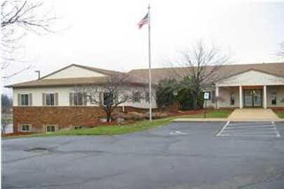
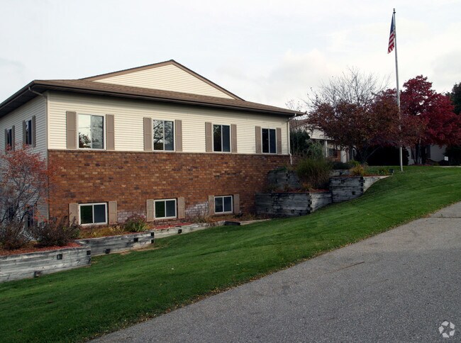
Property Record
325 84Th St Sw, Byron Center, MI 49315
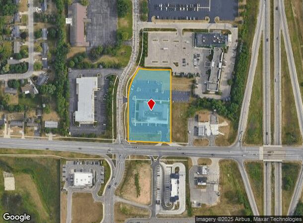
NEARBY LISTINGS FOR SALE OR LEASE
Property Detail
325 84Th St Sw
41-21-13-400-065
PART OF W 1/2 SE 1/4 COM AT S 1/4 COR TH N 0D 35M 00S W ALONG N&S 1/4 LINE 79.28 FT TO N LINE OF 84TH ST /100 FT WIDE/ TH S
Commercialnec
Kent
X
Michigan
26005C0125G
2.33 AC
2024
Byron/Gaines
2025
West Michigan
014605
Grand Rapids-Wyoming, MI
24,480 SF
DEMOGRAPHICS near 325 84Th St Sw
1 Mile
3 Mile
5 Mile
2024 Total Population
1,963
35,935
90,860
2029 Population
2,009
36,304
91,882
Pop Growth 2024-2029
+ 2.34%
+ 1.03%
+ 1.12%
Average Age
38
39
38
2024 Total Households
721
12,999
32,890
HH Growth 2024-2029
+ 2.36%
+ 1.04%
+ 1.13%
Median Household Inc
$92,613
$79,134
$73,796
Avg Household Size
2.70
2.70
2.70
2024 Avg HH Vehicles
2.00
2.00
2.00
Median Home Value
$321,466
$274,472
$249,752
Median Year Built
1999
1993
1988
Nearby Places
Map Layers
Map Styles
 Street
 Aerial
- Restaurants
- Banks
- Shops
- Fitness
- Groceries
PUBLIC TRANSPORTATION
AIRPORT
Gerald R Ford International
DRIVE
WALK
Distance
Gerald R Ford International
21 min
12.0 mi
SALE & LEASE HISTORY
LISTING DATE
SALE/LEASE

Sep 24, 2016
For Lease
Nearby Properties
Address
Land Use
TOTAL SIZE
Lot Size
Zoning
Address
Land Use
TOTAL SIZE
Lot Size
Zoning
490,769 SF
42.25 AC
B3
Address
Land Use
TOTAL SIZE
Lot Size
Zoning
63,788 SF
124.62 AC
D1
Address
Land Use
TOTAL SIZE
Lot Size
Zoning
487,739 SF
73.87 AC
RR
Address
Land Use
TOTAL SIZE
Lot Size
Zoning
38.98 AC
PUD-PL UNI
Address
Land Use
TOTAL SIZE
Lot Size
Zoning
58.30 AC
RA
Address
Land Use
TOTAL SIZE
Lot Size
Zoning
720 SF
74.47 AC
R4-MOBILE
Address
Land Use
TOTAL SIZE
Lot Size
Zoning
108,911 SF
10.80 AC
D1
Address
Land Use
TOTAL SIZE
Lot Size
Zoning
1,296 SF
12 AC
PUD-PL UNI
Address
Land Use
TOTAL SIZE
Lot Size
Zoning
140,742 SF
18.57 AC
D1
Address
Land Use
TOTAL SIZE
Lot Size
Zoning
49.29 AC
R4-MOBILE
Address
Land Use
TOTAL SIZE
Lot Size
Zoning
48.57 AC
RD
Address
Land Use
TOTAL SIZE
Lot Size
Zoning
45.66 AC
RD
Address
Land Use
TOTAL SIZE
Lot Size
Zoning
Address
Land Use
TOTAL SIZE
Lot Size
Zoning
22.37 AC
Address
Land Use
TOTAL SIZE
Lot Size
Zoning
201,500 SF
11.98 AC
D1
Address
Land Use
TOTAL SIZE
Lot Size
Zoning
Address
Land Use
TOTAL SIZE
Lot Size
Zoning
Address
Land Use
TOTAL SIZE
Lot Size
Zoning
31.20 AC
R4-MOBILE
Address
Land Use
TOTAL SIZE
Lot Size
Zoning
205,000 SF
9.88 AC
D1
Address
Land Use
TOTAL SIZE
Lot Size
Zoning
4.74 AC
D1PUD
Address
Land Use
TOTAL SIZE
Lot Size
Zoning
96,550 SF
19.95 AC
D1
Address
Land Use
TOTAL SIZE
Lot Size
Zoning
Address
Land Use
TOTAL SIZE
Lot Size
Zoning
36.87 AC
RD
Address
Land Use
TOTAL SIZE
Lot Size
Zoning
24.27 AC
RD
Address
Land Use
TOTAL SIZE
Lot Size
Zoning
55,110 SF
18.45 AC
Address
Land Use
TOTAL SIZE
Lot Size
Zoning
45,423 SF
6.25 AC
D1
Address
Land Use
TOTAL SIZE
Lot Size
Zoning
Address
Land Use
TOTAL SIZE
Lot Size
Zoning
189,537 SF
43.04 AC
D1
Address
Land Use
TOTAL SIZE
Lot Size
Zoning
210,000 SF
15.71 AC
D1
Address
Land Use
TOTAL SIZE
Lot Size
Zoning
The World's #1 Commercial Real Estate Marketplace
Connect with us
© 2025 CoStar Group
The information above has been obtained from sources believed reliable. While we do not doubt its accuracy we have not verified it and make no guarantee, warranty or representation about it. It is your responsibility to independently confirm its accuracy and completeness. Any projections, opinions, assumptions, or estimates used are for example only and do not represent the current or future performance of the property. The value of this transaction to you depends on tax and other factors which should be evaluated by your tax, financial, and legal advisors. You and your advisors should conduct a careful, independent investigation of the property to determine to your satisfaction the suitability of the property for your needs.