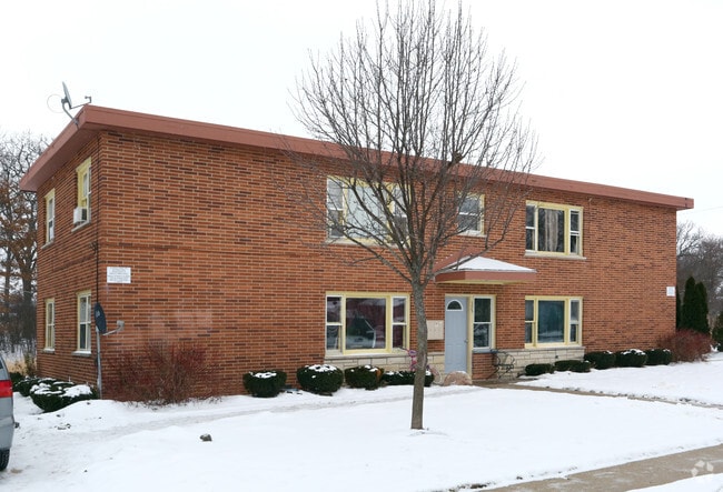
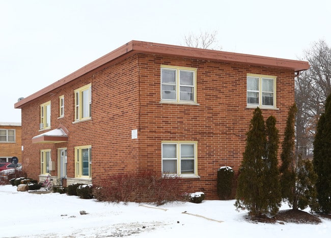
Property Record
325 Avilon Ct, Round Lake, IL 60073

Property Detail
325 Avilon Ct
Chicago-Naperville-Elgin, IL-IN
SUNCAP SUB UNIT ONE LOT 1
06-29-101-023
Lake
Commercialbuilding
Illinois
B and X Area of moderate flood hazard, usually the area between the limits of the 100-year and 500-year floods.
1
2024
0.23 AC
2025
Outlying Lake County
861402
Chicago
2,976 SF
NEARBY LISTINGS FOR SALE OR LEASE
-
-
View all Round Lake listings for sale on LoopNet.com
DEMOGRAPHICS near 325 Avilon Ct
1 mile
3 mile
5 mile
2025 Total Population
10,318
69,912
125,330
2030 Population
10,382
70,110
126,264
Pop Growth 2025-2030
+ 0.62%
+ 0.28%
+ 0.75%
Average Age
36
38
39
2025 Total Households
3,269
23,239
43,973
HH Growth 2025-2030
+ 0.52%
+ 0.25%
+ 0.78%
Median Household Inc
$79,374
$95,611
$101,806
Avg Household Size
3.10
2.90
2.80
2025 Avg HH Vehicles
2.00
2.00
2.00
Median Home Value
$174,659
$236,700
$260,144
Median Year Built
1978
1990
1992
Nearby Places
Map Layers
Map Styles
 Street
 Aerial
Layers
 Traffic
 Biking
Places
Listings with unknown addresses are not visible on the map
- Restaurants
- Banks
- Shops
- Fitness
- Groceries
PUBLIC TRANSPORTATION
COMMUTER RAIL
Round Lake Station (Milwaukee District North Line - Northeast Illinois Regional Commuter Railroad (Metra))
Drive
Walk
Distance
Round Lake Station (Milwaukee District North Line - Northeast Illinois Regional Commuter Railroad (Metra))
2 min
5 min
0.3 mi
Washington St (Grayslake) Station (NCS) (North Central Service - Northeast Illinois Regional Commuter Railroad (Metra))
Drive
Walk
Distance
Washington St (Grayslake) Station (NCS) (North Central Service - Northeast Illinois Regional Commuter Railroad (Metra))
9 min
13 min
0.7 mi
AIRPORT
Chicago O'Hare International
Drive
Walk
Distance
Chicago O'Hare International
53 min
37.9 mi
Freight Ports
Port of Baltimore
Drive
Walk
Distance
Port of Baltimore
1 min
637.6 mi
Nearby Properties
Address
Land Use
TOTAL SIZE
Lot Size
Zoning
Address
Land Use
TOTAL SIZE
Lot Size
Zoning
4,022,130 SF
22.22 AC
Address
Land Use
TOTAL SIZE
Lot Size
Zoning
30.60 AC
Address
Land Use
TOTAL SIZE
Lot Size
Zoning
194,075 SF
14.84 AC
Address
Land Use
TOTAL SIZE
Lot Size
Zoning
1,656,984 SF
11.84 AC
Address
Land Use
TOTAL SIZE
Lot Size
Zoning
1,407,234 SF
12.09 AC
Address
Land Use
TOTAL SIZE
Lot Size
Zoning
83.45 AC
Address
Land Use
TOTAL SIZE
Lot Size
Zoning
26.09 AC
Address
Land Use
TOTAL SIZE
Lot Size
Zoning
25.89 AC
Address
Land Use
TOTAL SIZE
Lot Size
Zoning
41,308 SF
4.48 AC
Address
Land Use
TOTAL SIZE
Lot Size
Zoning
70,256 SF
33.85 AC
Address
Land Use
TOTAL SIZE
Lot Size
Zoning
58,922 SF
71.36 AC
Address
Land Use
TOTAL SIZE
Lot Size
Zoning
86,920 SF
6.89 AC
Address
Land Use
TOTAL SIZE
Lot Size
Zoning
17,484 SF
3.52 AC
Address
Land Use
TOTAL SIZE
Lot Size
Zoning
104,143 SF
11.96 AC
Address
Land Use
TOTAL SIZE
Lot Size
Zoning
41,925 SF
5.15 AC
Address
Land Use
TOTAL SIZE
Lot Size
Zoning
62,821 SF
6.79 AC
Address
Land Use
TOTAL SIZE
Lot Size
Zoning
45,772 SF
89.95 AC
Address
Land Use
TOTAL SIZE
Lot Size
Zoning
102,750 SF
4.84 AC
Address
Land Use
TOTAL SIZE
Lot Size
Zoning
21.62 AC
Address
Land Use
TOTAL SIZE
Lot Size
Zoning
87,233 SF
7.72 AC
Address
Land Use
TOTAL SIZE
Lot Size
Zoning
14.80 AC
Address
Land Use
TOTAL SIZE
Lot Size
Zoning
188,183 SF
17.16 AC
Address
Land Use
TOTAL SIZE
Lot Size
Zoning
16,252 SF
2.23 AC
Address
Land Use
TOTAL SIZE
Lot Size
Zoning
74,850 SF
4.27 AC
Address
Land Use
TOTAL SIZE
Lot Size
Zoning
29,707 SF
7.12 AC
Address
Land Use
TOTAL SIZE
Lot Size
Zoning
33,158 SF
16.45 AC
Address
Land Use
TOTAL SIZE
Lot Size
Zoning
33,127 SF
3.37 AC
Address
Land Use
TOTAL SIZE
Lot Size
Zoning
Address
Land Use
TOTAL SIZE
Lot Size
Zoning
31,657 SF
30.97 AC
Address
Land Use
TOTAL SIZE
Lot Size
Zoning
11.90 AC
The World's #1 Commercial Real Estate Marketplace
Connect with us
© 2026 CoStar Group
The information above has been obtained from sources believed reliable. While we do not doubt its accuracy we have not verified it and make no guarantee, warranty or representation about it. It is your responsibility to independently confirm its accuracy and completeness. Any projections, opinions, assumptions, or estimates used are for example only and do not represent the current or future performance of the property. The value of this transaction to you depends on tax and other factors which should be evaluated by your tax, financial, and legal advisors. You and your advisors should conduct a careful, independent investigation of the property to determine to your satisfaction the suitability of the property for your needs.