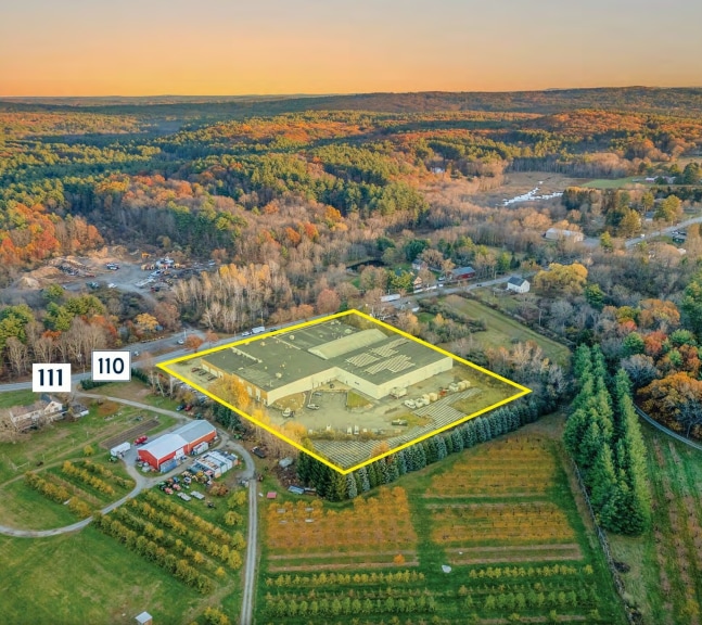
Property Record
8 Shaker Rd, Harvard, MA 01451
Current Lease Availabilities
NEARBY LISTINGS FOR SALE OR LEASE
Property Detail
8 Shaker Rd
Sfr
Worcester
X
Massachusetts
25027C0318F
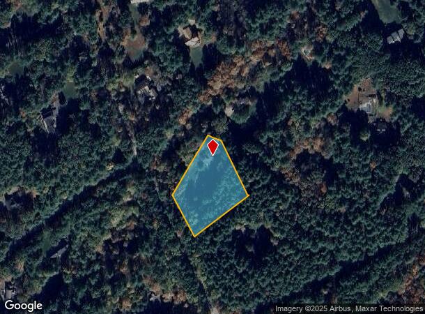
1.50 AC
2025
Ayer
2025
Boston
761402
Worcester, MA
1,864 SF
HARV-000010-000000-000004
DEMOGRAPHICS near 8 Shaker Rd
1 mile
3 mile
5 mile
2024 Total Population
2,404
14,679
35,946
2029 Population
2,389
14,700
35,763
Pop Growth 2024-2029
(0.62%)
+ 0.14%
(0.51%)
Average Age
41
43
43
2024 Total Households
1,083
5,507
13,155
HH Growth 2024-2029
(0.83%)
+ 0.13%
(0.52%)
Median Household Inc
$88,050
$120,659
$128,908
Avg Household Size
2.20
2.40
2.50
2024 Avg HH Vehicles
2.00
2.00
2.00
Median Home Value
$384,945
$446,671
$512,372
Median Year Built
1974
1978
1977
Nearby Places
Map Layers
Map Styles
 Street
 Aerial
Transit
 Traffic
 Biking
Places
Listings with unknown addresses are not visible on the map
- Restaurants
- Banks
- Shops
- Fitness
- Groceries
PUBLIC TRANSPORTATION
COMMUTER RAIL
Ayer (Fitchburg/South Acton Line - Massachusetts Bay Transportation Authority Commuter Rail (Purple Line))
Drive
Walk
Distance
Ayer (Fitchburg/South Acton Line - Massachusetts Bay Transportation Authority Commuter Rail (Purple Line))
11 min
3.7 mi
Littleton/Route 495 (Fitchburg/South Acton Line - Massachusetts Bay Transportation Authority Commuter Rail (Purple Line))
Drive
Walk
Distance
Littleton/Route 495 (Fitchburg/South Acton Line - Massachusetts Bay Transportation Authority Commuter Rail (Purple Line))
11 min
4.7 mi
AIRPORT
Worcester Regional
Drive
Walk
Distance
Worcester Regional
50 min
33.6 mi
General Edward Lawrence Logan International
Drive
Walk
Distance
General Edward Lawrence Logan International
58 min
35.4 mi
Manchester Boston Regional
Drive
Walk
Distance
Manchester Boston Regional
61 min
38.5 mi
Freight Ports
Port of Boston
Drive
Walk
Distance
Port of Boston
58 min
35.4 mi
Nearby Properties
Address
Land Use
TOTAL SIZE
Lot Size
Zoning
Address
Land Use
TOTAL SIZE
Lot Size
Zoning
312,503 SF
54.44 AC
AR
Address
Land Use
TOTAL SIZE
Lot Size
Zoning
337,563 SF
21.31 AC
17
Address
Land Use
TOTAL SIZE
Lot Size
Zoning
832,622 SF
43.78 AC
I
Address
Land Use
TOTAL SIZE
Lot Size
Zoning
448,759 SF
51.82 AC
IA
Address
Land Use
TOTAL SIZE
Lot Size
Zoning
481,300 SF
69.04 AC
IA
Address
Land Use
TOTAL SIZE
Lot Size
Zoning
2,295.68 AC
Address
Land Use
TOTAL SIZE
Lot Size
Zoning
260,475 SF
70.94 AC
OP
Address
Land Use
TOTAL SIZE
Lot Size
Zoning
143,640 SF
29.44 AC
IA
Address
Land Use
TOTAL SIZE
Lot Size
Zoning
374,270 SF
62.74 AC
IA
Address
Land Use
TOTAL SIZE
Lot Size
Zoning
125,160 SF
29.36 AC
R
Address
Land Use
TOTAL SIZE
Lot Size
Zoning
210,620 SF
12.97 AC
Address
Land Use
TOTAL SIZE
Lot Size
Zoning
342,309 SF
21.60 AC
I
Address
Land Use
TOTAL SIZE
Lot Size
Zoning
213,950 SF
22.71 AC
I
Address
Land Use
TOTAL SIZE
Lot Size
Zoning
293,250 SF
60.10 AC
LI
Address
Land Use
TOTAL SIZE
Lot Size
Zoning
343,400 SF
20 AC
LI
Address
Land Use
TOTAL SIZE
Lot Size
Zoning
216,289 SF
17.54 AC
I
Address
Land Use
TOTAL SIZE
Lot Size
Zoning
16.44 AC
IA
Address
Land Use
TOTAL SIZE
Lot Size
Zoning
162,000 SF
19.40 AC
I
Address
Land Use
TOTAL SIZE
Lot Size
Zoning
186,000 SF
16.02 AC
C
Address
Land Use
TOTAL SIZE
Lot Size
Zoning
134,920 SF
26.90 AC
I
Address
Land Use
TOTAL SIZE
Lot Size
Zoning
8.21 AC
R
Address
Land Use
TOTAL SIZE
Lot Size
Zoning
234,465 SF
16.13 AC
I
Address
Land Use
TOTAL SIZE
Lot Size
Zoning
122,184 SF
8.14 AC
Address
Land Use
TOTAL SIZE
Lot Size
Zoning
137,599 SF
21 AC
Address
Land Use
TOTAL SIZE
Lot Size
Zoning
154,436 SF
18.86 AC
IA
Address
Land Use
TOTAL SIZE
Lot Size
Zoning
97,210 SF
8.28 AC
Address
Land Use
TOTAL SIZE
Lot Size
Zoning
672 SF
183.18 AC
IA
Address
Land Use
TOTAL SIZE
Lot Size
Zoning
94,159 SF
13.31 AC
I
Address
Land Use
TOTAL SIZE
Lot Size
Zoning
98,125 SF
8.97 AC
IA
Address
Land Use
TOTAL SIZE
Lot Size
Zoning
120,612 SF
16.42 AC
The World's #1 Commercial Real Estate Marketplace
Connect with us
© 2026 CoStar Group
The information above has been obtained from sources believed reliable. While we do not doubt its accuracy we have not verified it and make no guarantee, warranty or representation about it. It is your responsibility to independently confirm its accuracy and completeness. Any projections, opinions, assumptions, or estimates used are for example only and do not represent the current or future performance of the property. The value of this transaction to you depends on tax and other factors which should be evaluated by your tax, financial, and legal advisors. You and your advisors should conduct a careful, independent investigation of the property to determine to your satisfaction the suitability of the property for your needs.