Property Record
325 Clemson Marina Dr, Seneca, SC 29678

NEARBY LISTINGS FOR SALE OR LEASE
-
-
View all Seneca listings for sale on LoopNet.com
Property Detail
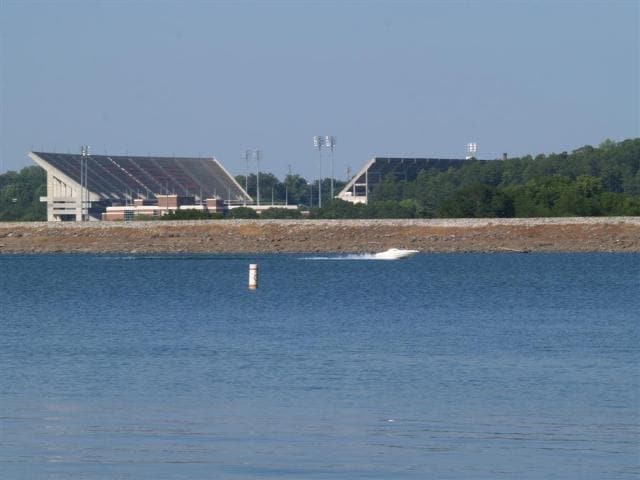
325 Clemson Marina Dr
257-00-01-016
SENECA MARINA LEASED
Marinafacility
Oconee
AE
South Carolina
45007C0090E
36.07 AC
0
South Carolina Rural Areas
2025
Other Market Areas
030702
Seneca, SC
DEMOGRAPHICS near 325 Clemson Marina Dr
1 Mile
3 Mile
5 Mile
2024 Total Population
790
15,843
41,334
2029 Population
830
16,272
42,993
Pop Growth 2024-2029
+ 5.06%
+ 2.71%
+ 4.01%
Average Age
38
30
36
2024 Total Households
359
4,889
15,880
HH Growth 2024-2029
+ 5.01%
+ 3.21%
+ 4.45%
Median Household Inc
$39,582
$33,669
$40,909
Avg Household Size
2.10
2.30
2.30
2024 Avg HH Vehicles
2.00
2.00
2.00
Median Home Value
$225,000
$255,882
$217,842
Median Year Built
1988
1989
1989
Nearby Places
Map Layers
Map Styles
 Street
 Aerial
- Restaurants
- Banks
- Shops
- Fitness
- Groceries
PUBLIC TRANSPORTATION
COMMUTER RAIL
Clemson Amtrak Station (Crescent - Amtrak)
DRIVE
WALK
Distance
Clemson Amtrak Station (Crescent - Amtrak)
10 min
4.9 mi
Freight Ports
Georgia Ports - Savannah
DRIVE
WALK
Distance
Georgia Ports - Savannah
322 min
229.0 mi
Nearby Properties
Address
Land Use
TOTAL SIZE
Lot Size
Zoning
Address
Land Use
TOTAL SIZE
Lot Size
Zoning
3,224.70 AC
NOT ZONED
Address
Land Use
TOTAL SIZE
Lot Size
Zoning
21,573 SF
4.91 AC
CP 2 COMMU
Address
Land Use
TOTAL SIZE
Lot Size
Zoning
3,985 SF
56.58 AC
Address
Land Use
TOTAL SIZE
Lot Size
Zoning
119,175 SF
2.11 AC
RM 3 MULTI
Address
Land Use
TOTAL SIZE
Lot Size
Zoning
259,277 SF
3.39 AC
PD17
Address
Land Use
TOTAL SIZE
Lot Size
Zoning
24,882 SF
12.94 AC
PD
Address
Land Use
TOTAL SIZE
Lot Size
Zoning
54,420 SF
9.52 AC
PD16
Address
Land Use
TOTAL SIZE
Lot Size
Zoning
15,783 SF
1.43 AC
RM 4 MULTI
Address
Land Use
TOTAL SIZE
Lot Size
Zoning
26,864 SF
0.98 AC
GC
Address
Land Use
TOTAL SIZE
Lot Size
Zoning
185,383 SF
2.52 AC
GENERAL CO
Address
Land Use
TOTAL SIZE
Lot Size
Zoning
4.97 AC
PD
Address
Land Use
TOTAL SIZE
Lot Size
Zoning
267,298 SF
1.68 AC
GC
Address
Land Use
TOTAL SIZE
Lot Size
Zoning
6,574 SF
0.50 AC
RLC
Address
Land Use
TOTAL SIZE
Lot Size
Zoning
84,530 SF
5.10 AC
CP 2 COMMU
Address
Land Use
TOTAL SIZE
Lot Size
Zoning
43,916 SF
0.25 AC
C
Address
Land Use
TOTAL SIZE
Lot Size
Zoning
0.78 AC
GENERAL CO
Address
Land Use
TOTAL SIZE
Lot Size
Zoning
0.40 AC
GC
Address
Land Use
TOTAL SIZE
Lot Size
Zoning
0.54 AC
RLC
Address
Land Use
TOTAL SIZE
Lot Size
Zoning
Address
Land Use
TOTAL SIZE
Lot Size
Zoning
6,000 SF
0.99 AC
Address
Land Use
TOTAL SIZE
Lot Size
Zoning
21,378 SF
0.95 AC
RLC RES LI
Address
Land Use
TOTAL SIZE
Lot Size
Zoning
0.52 AC
C
Address
Land Use
TOTAL SIZE
Lot Size
Zoning
0.48 AC
GC
Address
Land Use
TOTAL SIZE
Lot Size
Zoning
82,844 SF
5.92 AC
CP 2 COMMU
Address
Land Use
TOTAL SIZE
Lot Size
Zoning
53,460 SF
17.15 AC
Address
Land Use
TOTAL SIZE
Lot Size
Zoning
30,104 SF
0.27 AC
CP 1 NEIGH
Address
Land Use
TOTAL SIZE
Lot Size
Zoning
0.34 AC
GC
Address
Land Use
TOTAL SIZE
Lot Size
Zoning
1,990 SF
2.86 AC
RM 4 MULTI
The World's #1 Commercial Real Estate Marketplace
Connect with us
© 2025 CoStar Group
The information above has been obtained from sources believed reliable. While we do not doubt its accuracy we have not verified it and make no guarantee, warranty or representation about it. It is your responsibility to independently confirm its accuracy and completeness. Any projections, opinions, assumptions, or estimates used are for example only and do not represent the current or future performance of the property. The value of this transaction to you depends on tax and other factors which should be evaluated by your tax, financial, and legal advisors. You and your advisors should conduct a careful, independent investigation of the property to determine to your satisfaction the suitability of the property for your needs.