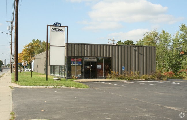
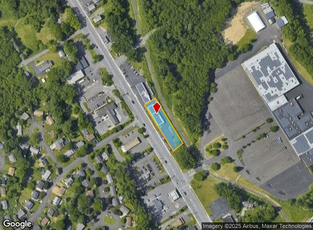
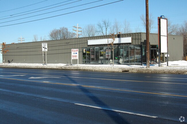
Property Record
325 Columbia Tpke, Rensselaer, NY 12144
NEARBY LISTINGS FOR SALE OR LEASE
Property Detail
325 Columbia Tpke
2400-155-12-3
NYS ACQ 240/2476
Storesoffices
Rensselaer
ARE
New York
36083C0351D
3.000
2025
0.42 AC
2024
Outer Rensselaer County
052406
Albany/Schenectady/Troy
4,712 SF
Albany-Schenectady-Troy, NY
DEMOGRAPHICS near 325 Columbia Tpke
1 Mile
3 Mile
5 Mile
2024 Total Population
5,827
32,062
116,968
2029 Population
5,751
31,751
115,668
Pop Growth 2024-2029
(1.30%)
(0.97%)
(1.11%)
Average Age
42
40
39
2024 Total Households
2,486
14,116
50,756
HH Growth 2024-2029
(1.45%)
(0.96%)
(1.13%)
Median Household Inc
$91,729
$72,681
$64,246
Avg Household Size
2.30
2.20
2.10
2024 Avg HH Vehicles
2.00
1.00
1.00
Median Home Value
$204,126
$222,725
$233,244
Median Year Built
1963
1965
1957
Nearby Places
- Restaurants
- Banks
- Shops
- Fitness
- Groceries
PUBLIC TRANSPORTATION
COMMUTER RAIL
DRIVE
WALK
Distance
7 min
2.6 mi
AIRPORT
Albany International
DRIVE
WALK
Distance
Albany International
27 min
13.5 mi
Freight Ports
Albany, NY Port
DRIVE
WALK
Distance
Albany, NY Port
12 min
4.9 mi
SALE & LEASE HISTORY
LISTING DATE
SALE/LEASE

Apr 18, 2017
For Lease
Nearby Properties
Address
Land Use
TOTAL SIZE
Lot Size
Zoning
Address
Land Use
TOTAL SIZE
Lot Size
Zoning
33.88 AC
I2
Address
Land Use
TOTAL SIZE
Lot Size
Zoning
83.50 AC
Address
Land Use
TOTAL SIZE
Lot Size
Zoning
541,564 SF
7.40 AC
C3
Address
Land Use
TOTAL SIZE
Lot Size
Zoning
802,560 SF
5.70 AC
R4
Address
Land Use
TOTAL SIZE
Lot Size
Zoning
177,030 SF
0.06 AC
C3
Address
Land Use
TOTAL SIZE
Lot Size
Zoning
296,914 SF
68.73 AC
PDD
Address
Land Use
TOTAL SIZE
Lot Size
Zoning
428,555 SF
1.20 AC
C3
Address
Land Use
TOTAL SIZE
Lot Size
Zoning
179,713 SF
126.43 AC
OC
Address
Land Use
TOTAL SIZE
Lot Size
Zoning
104,077 SF
6.64 AC
B-2
Address
Land Use
TOTAL SIZE
Lot Size
Zoning
316,634 SF
27.82 AC
OI
Address
Land Use
TOTAL SIZE
Lot Size
Zoning
161,972 SF
26.62 AC
OI
Address
Land Use
TOTAL SIZE
Lot Size
Zoning
171,096 SF
18.04 AC
B-2
Address
Land Use
TOTAL SIZE
Lot Size
Zoning
194,018 SF
73.71 AC
R-B
Address
Land Use
TOTAL SIZE
Lot Size
Zoning
2.25 AC
Address
Land Use
TOTAL SIZE
Lot Size
Zoning
88,040 SF
1.80 AC
C3
Address
Land Use
TOTAL SIZE
Lot Size
Zoning
5,776 SF
90.90 AC
M1
Address
Land Use
TOTAL SIZE
Lot Size
Zoning
17,440 SF
4.10 AC
R2A
Address
Land Use
TOTAL SIZE
Lot Size
Zoning
44,712 SF
25.58 AC
R-3
Address
Land Use
TOTAL SIZE
Lot Size
Zoning
62,714 SF
8.74 AC
OI
Address
Land Use
TOTAL SIZE
Lot Size
Zoning
27,612 SF
11.60 AC
M1
Address
Land Use
TOTAL SIZE
Lot Size
Zoning
99,223 SF
15.47 AC
R-B
Address
Land Use
TOTAL SIZE
Lot Size
Zoning
204,692 SF
30.97 AC
OC
Address
Land Use
TOTAL SIZE
Lot Size
Zoning
100,176 SF
3.23 AC
C1
Address
Land Use
TOTAL SIZE
Lot Size
Zoning
20.10 AC
M1
Address
Land Use
TOTAL SIZE
Lot Size
Zoning
64,600 SF
13.16 AC
Address
Land Use
TOTAL SIZE
Lot Size
Zoning
302,782 SF
1.43 AC
C3
Address
Land Use
TOTAL SIZE
Lot Size
Zoning
188,262 SF
0.57 AC
C3
Address
Land Use
TOTAL SIZE
Lot Size
Zoning
88,040 SF
1.80 AC
C3
Address
Land Use
TOTAL SIZE
Lot Size
Zoning
0.01 AC
I
Address
Land Use
TOTAL SIZE
Lot Size
Zoning
62,039 SF
5.02 AC
O
The World's #1 Commercial Real Estate Marketplace
Connect with us
© 2025 CoStar Group
The information above has been obtained from sources believed reliable. While we do not doubt its accuracy we have not verified it and make no guarantee, warranty or representation about it. It is your responsibility to independently confirm its accuracy and completeness. Any projections, opinions, assumptions, or estimates used are for example only and do not represent the current or future performance of the property. The value of this transaction to you depends on tax and other factors which should be evaluated by your tax, financial, and legal advisors. You and your advisors should conduct a careful, independent investigation of the property to determine to your satisfaction the suitability of the property for your needs.