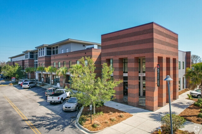
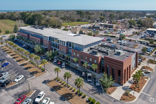
Property Record
325 Folly Rd, Charleston, SC 29412

NEARBY LISTINGS FOR SALE OR LEASE
Property Detail
325 Folly Rd
Charleston-North Charleston, SC
Cross Creek
424-00-00-034
DESCRIPTION - LOT A-2 SITE NAME -CROSS CREEK VILLAGE
Commercialnec
Charleston
AE
South Carolina
45019C0513K
a-2
2025
2.46 AC
2024
James Island/Folly Beach
001902
Charleston/N Charleston
65,397 SF
DEMOGRAPHICS near 325 Folly Rd
1 Mile
3 Mile
5 Mile
2024 Total Population
7,391
57,466
124,080
2029 Population
8,013
61,676
133,277
Pop Growth 2024-2029
+ 8.42%
+ 7.33%
+ 7.41%
Average Age
40
39
39
2024 Total Households
3,721
26,193
55,920
HH Growth 2024-2029
+ 8.25%
+ 7.32%
+ 7.39%
Median Household Inc
$74,581
$78,705
$74,398
Avg Household Size
2.00
2.10
2.10
2024 Avg HH Vehicles
2.00
2.00
2.00
Median Home Value
$388,588
$449,484
$420,521
Median Year Built
1989
1970
1975
Nearby Places
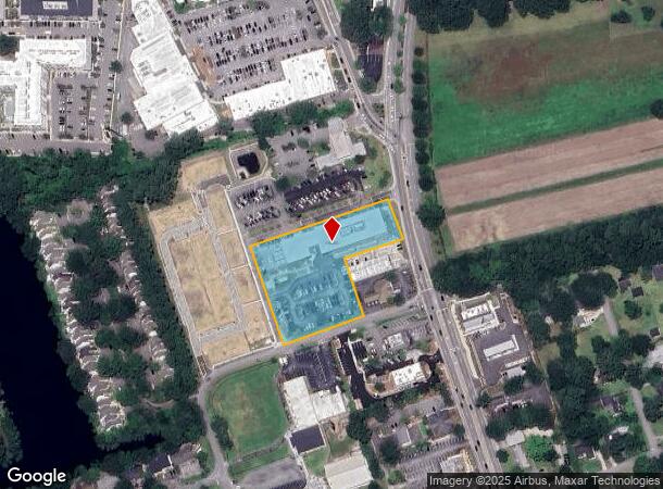
Map Layers
Map Styles
 Street
 Aerial
- Restaurants
- Banks
- Shops
- Fitness
- Groceries
PUBLIC TRANSPORTATION
COMMUTER RAIL
DRIVE
WALK
Distance
16 min
9.4 mi
AIRPORT
Charleston AFB/International
DRIVE
WALK
Distance
Charleston AFB/International
25 min
14.9 mi
Freight Ports
Columbus Street Terminal
DRIVE
WALK
Distance
Columbus Street Terminal
9 min
4.1 mi
SALE & LEASE HISTORY
LISTING DATE
SALE/LEASE

Oct 17, 2018
For Lease
Feb 23, 2021
For Lease
Feb 03, 2020
For Lease
Nearby Properties
Address
Land Use
TOTAL SIZE
Lot Size
Zoning
Address
Land Use
TOTAL SIZE
Lot Size
Zoning
0.62 AC
Address
Land Use
TOTAL SIZE
Lot Size
Zoning
80,044 SF
2.48 AC
Address
Land Use
TOTAL SIZE
Lot Size
Zoning
66,136 SF
1.88 AC
Address
Land Use
TOTAL SIZE
Lot Size
Zoning
17,459 SF
4.16 AC
Address
Land Use
TOTAL SIZE
Lot Size
Zoning
8,714 SF
1.60 AC
Address
Land Use
TOTAL SIZE
Lot Size
Zoning
Address
Land Use
TOTAL SIZE
Lot Size
Zoning
Address
Land Use
TOTAL SIZE
Lot Size
Zoning
5,733 SF
0.10 AC
Address
Land Use
TOTAL SIZE
Lot Size
Zoning
Address
Land Use
TOTAL SIZE
Lot Size
Zoning
22,825 SF
4.36 AC
Address
Land Use
TOTAL SIZE
Lot Size
Zoning
257,500 SF
4.72 AC
Address
Land Use
TOTAL SIZE
Lot Size
Zoning
12,766 SF
1.72 AC
Address
Land Use
TOTAL SIZE
Lot Size
Zoning
Address
Land Use
TOTAL SIZE
Lot Size
Zoning
Address
Land Use
TOTAL SIZE
Lot Size
Zoning
7.09 AC
Address
Land Use
TOTAL SIZE
Lot Size
Zoning
0.72 AC
Address
Land Use
TOTAL SIZE
Lot Size
Zoning
1,056 SF
1.65 AC
Address
Land Use
TOTAL SIZE
Lot Size
Zoning
22,360 SF
1.06 AC
Address
Land Use
TOTAL SIZE
Lot Size
Zoning
14,576 SF
0.17 AC
Address
Land Use
TOTAL SIZE
Lot Size
Zoning
4,178 SF
0.22 AC
Address
Land Use
TOTAL SIZE
Lot Size
Zoning
0.84 AC
Address
Land Use
TOTAL SIZE
Lot Size
Zoning
Address
Land Use
TOTAL SIZE
Lot Size
Zoning
0.72 AC
Address
Land Use
TOTAL SIZE
Lot Size
Zoning
0.60 AC
Address
Land Use
TOTAL SIZE
Lot Size
Zoning
0.61 AC
Address
Land Use
TOTAL SIZE
Lot Size
Zoning
0.60 AC
Address
Land Use
TOTAL SIZE
Lot Size
Zoning
32,971 SF
1.47 AC
Address
Land Use
TOTAL SIZE
Lot Size
Zoning
1,793 SF
Address
Land Use
TOTAL SIZE
Lot Size
Zoning
1.08 AC
Address
Land Use
TOTAL SIZE
Lot Size
Zoning
25,860 SF
0.78 AC
The World's #1 Commercial Real Estate Marketplace
Connect with us
© 2025 CoStar Group
The information above has been obtained from sources believed reliable. While we do not doubt its accuracy we have not verified it and make no guarantee, warranty or representation about it. It is your responsibility to independently confirm its accuracy and completeness. Any projections, opinions, assumptions, or estimates used are for example only and do not represent the current or future performance of the property. The value of this transaction to you depends on tax and other factors which should be evaluated by your tax, financial, and legal advisors. You and your advisors should conduct a careful, independent investigation of the property to determine to your satisfaction the suitability of the property for your needs.