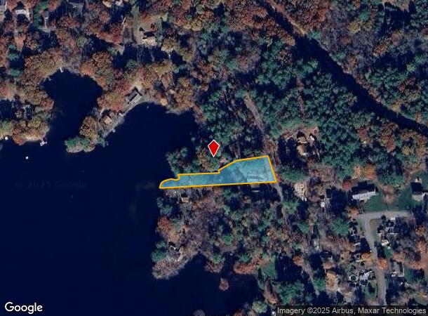
Property Record
325 Lakeshore Dr, Bellingham, MA 02019


NEARBY LISTINGS FOR SALE OR LEASE
Property Detail
325 Lakeshore Dr
Vacantlandnec
Norfolk
A
Massachusetts
25021C0311F
0.73 AC
2025
I-95 Corridor South
2025
Boston
443104
Boston-Cambridge-Newton, MA-NH
1,646 SF
BELL-000070-000053
DEMOGRAPHICS near 325 Lakeshore Dr
1 Mile
3 Mile
5 Mile
2024 Total Population
2,400
22,370
91,188
2029 Population
2,383
22,192
90,418
Pop Growth 2024-2029
(0.71%)
(0.80%)
(0.84%)
Average Age
41
41
41
2024 Total Households
870
8,489
36,484
HH Growth 2024-2029
(0.69%)
(0.84%)
(0.92%)
Median Household Inc
$127,623
$107,431
$76,775
Avg Household Size
2.70
2.60
2.40
2024 Avg HH Vehicles
2.00
2.00
2.00
Median Home Value
$423,924
$393,756
$370,755
Median Year Built
1975
1975
1965
Nearby Places
Map Layers
Map Styles
 Street
 Aerial
- Restaurants
- Banks
- Shops
- Fitness
- Groceries
PUBLIC TRANSPORTATION
COMMUTER RAIL
Forge Park/Route 495 (Franklin Line - Massachusetts Bay Transportation Authority Commuter Rail (Purple Line))
DRIVE
WALK
Distance
Forge Park/Route 495 (Franklin Line - Massachusetts Bay Transportation Authority Commuter Rail (Purple Line))
11 min
5.0 mi
Franklin (Franklin Line - Massachusetts Bay Transportation Authority Commuter Rail (Purple Line))
DRIVE
WALK
Distance
Franklin (Franklin Line - Massachusetts Bay Transportation Authority Commuter Rail (Purple Line))
14 min
6.8 mi
AIRPORT
Rhode Island Tf Green International
DRIVE
WALK
Distance
Rhode Island Tf Green International
41 min
26.7 mi
Worcester Regional
DRIVE
WALK
Distance
Worcester Regional
53 min
36.5 mi
Freight Ports
Port of Davisville, RI
DRIVE
WALK
Distance
Port of Davisville, RI
54 min
38.5 mi
SALE & LEASE HISTORY
LISTING DATE
SALE/LEASE

Apr 18, 2018
For Sale
Nearby Properties
Address
Land Use
TOTAL SIZE
Lot Size
Zoning
Address
Land Use
TOTAL SIZE
Lot Size
Zoning
20.97 AC
CRPC
Address
Land Use
TOTAL SIZE
Lot Size
Zoning
14.82 AC
AGR
Address
Land Use
TOTAL SIZE
Lot Size
Zoning
345,000 SF
60.44 AC
BUS1
Address
Land Use
TOTAL SIZE
Lot Size
Zoning
231,817 SF
35.01 AC
IND
Address
Land Use
TOTAL SIZE
Lot Size
Zoning
238,602 SF
109.37 AC
Address
Land Use
TOTAL SIZE
Lot Size
Zoning
238,975 SF
33.82 AC
IND
Address
Land Use
TOTAL SIZE
Lot Size
Zoning
75,140 SF
39.40 AC
Address
Land Use
TOTAL SIZE
Lot Size
Zoning
208,826 SF
18.96 AC
IND
Address
Land Use
TOTAL SIZE
Lot Size
Zoning
203,792 SF
27.93 AC
IND
Address
Land Use
TOTAL SIZE
Lot Size
Zoning
150,385 SF
27.10 AC
Address
Land Use
TOTAL SIZE
Lot Size
Zoning
124,320 SF
10 AC
BUS1
Address
Land Use
TOTAL SIZE
Lot Size
Zoning
112,894 SF
9.96 AC
Address
Land Use
TOTAL SIZE
Lot Size
Zoning
128,693 SF
28.30 AC
Address
Land Use
TOTAL SIZE
Lot Size
Zoning
65,093 SF
4.65 AC
R4
Address
Land Use
TOTAL SIZE
Lot Size
Zoning
23.19 AC
C2
Address
Land Use
TOTAL SIZE
Lot Size
Zoning
49,920 SF
8.77 AC
IND
Address
Land Use
TOTAL SIZE
Lot Size
Zoning
110,931 SF
46.97 AC
Address
Land Use
TOTAL SIZE
Lot Size
Zoning
8.25 AC
C2
Address
Land Use
TOTAL SIZE
Lot Size
Zoning
65,698 SF
19.07 AC
B
Address
Land Use
TOTAL SIZE
Lot Size
Zoning
34,933 SF
6.37 AC
IND
Address
Land Use
TOTAL SIZE
Lot Size
Zoning
13,688 SF
320.62 AC
Address
Land Use
TOTAL SIZE
Lot Size
Zoning
23.21 AC
C2
Address
Land Use
TOTAL SIZE
Lot Size
Zoning
36,026 SF
4.03 AC
RES
Address
Land Use
TOTAL SIZE
Lot Size
Zoning
2,270 SF
71.25 AC
IND
Address
Land Use
TOTAL SIZE
Lot Size
Zoning
81,000 SF
6.47 AC
Address
Land Use
TOTAL SIZE
Lot Size
Zoning
60,981 SF
8.80 AC
Address
Land Use
TOTAL SIZE
Lot Size
Zoning
59,079 SF
5.43 AC
Address
Land Use
TOTAL SIZE
Lot Size
Zoning
7,680 SF
2.44 AC
IND
Address
Land Use
TOTAL SIZE
Lot Size
Zoning
14,730 SF
1.89 AC
Address
Land Use
TOTAL SIZE
Lot Size
Zoning
13,487 SF
1.73 AC
BUS1
The World's #1 Commercial Real Estate Marketplace
Connect with us
© 2025 CoStar Group
The information above has been obtained from sources believed reliable. While we do not doubt its accuracy we have not verified it and make no guarantee, warranty or representation about it. It is your responsibility to independently confirm its accuracy and completeness. Any projections, opinions, assumptions, or estimates used are for example only and do not represent the current or future performance of the property. The value of this transaction to you depends on tax and other factors which should be evaluated by your tax, financial, and legal advisors. You and your advisors should conduct a careful, independent investigation of the property to determine to your satisfaction the suitability of the property for your needs.