Property Record
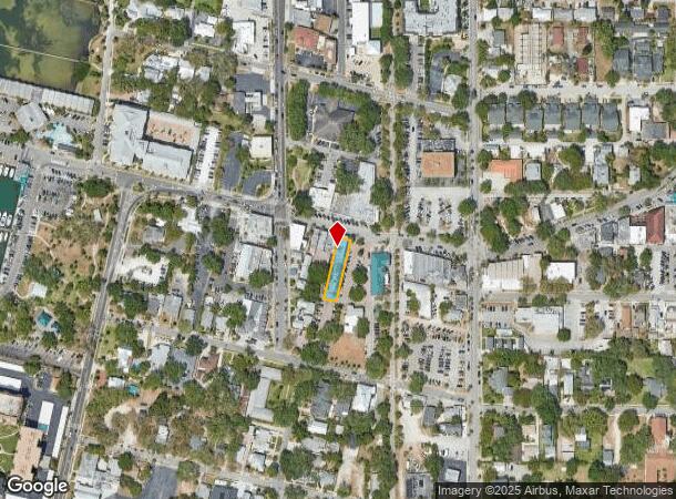
325 Main St, Dunedin, FL 34698

NEARBY LISTINGS FOR SALE OR LEASE
Property Detail
325 Main St
Tampa-St. Petersburg-Clearwater, FL
Jones & Wifes Sub
27-28-15-44298-023-0030
JONES & WIFES SUB BLK 23, LOT 3 & E 15FT OF LOT 4 (LYING IN NNW34-28-15)
Bartavern
Pinellas
X
Florida
12103C0068H
3,4
2024
0.18 AC
2025
North Pinellas
027108
Tampa/St Petersburg
5,536 SF
DEMOGRAPHICS near 325 Main St
1 Mile
3 Mile
5 Mile
2024 Total Population
10,495
73,241
179,351
2029 Population
10,715
73,950
180,316
Pop Growth 2024-2029
+ 2.10%
+ 0.97%
+ 0.54%
Average Age
52
49
47
2024 Total Households
5,517
34,404
81,910
HH Growth 2024-2029
+ 2.10%
+ 0.89%
+ 0.52%
Median Household Inc
$50,747
$57,718
$58,359
Avg Household Size
1.80
2.00
2.10
2024 Avg HH Vehicles
1.00
2.00
2.00
Median Home Value
$278,044
$291,310
$292,184
Median Year Built
1969
1975
1977
Nearby Places
Map Layers
Map Styles
 Street
 Aerial
- Restaurants
- Banks
- Shops
- Fitness
- Groceries
PUBLIC TRANSPORTATION
AIRPORT
St Pete-Clearwater International
DRIVE
WALK
Distance
St Pete-Clearwater International
23 min
13.3 mi
Tampa International
DRIVE
WALK
Distance
Tampa International
36 min
21.3 mi
Freight Ports
Port of Tampa Bay
DRIVE
WALK
Distance
Port of Tampa Bay
50 min
29.8 mi
Nearby Properties
Address
Land Use
TOTAL SIZE
Lot Size
Zoning
Address
Land Use
TOTAL SIZE
Lot Size
Zoning
675,202 SF
43.24 AC
Address
Land Use
TOTAL SIZE
Lot Size
Zoning
167,201 SF
63.11 AC
AE
Address
Land Use
TOTAL SIZE
Lot Size
Zoning
412,099 SF
49.21 AC
Address
Land Use
TOTAL SIZE
Lot Size
Zoning
278,505 SF
38.67 AC
Address
Land Use
TOTAL SIZE
Lot Size
Zoning
362,238 SF
13.80 AC
Address
Land Use
TOTAL SIZE
Lot Size
Zoning
4,250 SF
235.09 AC
Address
Land Use
TOTAL SIZE
Lot Size
Zoning
367,503 SF
20.34 AC
M2
Address
Land Use
TOTAL SIZE
Lot Size
Zoning
117,024 SF
56.52 AC
Address
Land Use
TOTAL SIZE
Lot Size
Zoning
241,170 SF
17.23 AC
Address
Land Use
TOTAL SIZE
Lot Size
Zoning
151,730 SF
49.66 AC
Address
Land Use
TOTAL SIZE
Lot Size
Zoning
191,375 SF
13.58 AC
AE
Address
Land Use
TOTAL SIZE
Lot Size
Zoning
250,113 SF
39.50 AC
Address
Land Use
TOTAL SIZE
Lot Size
Zoning
196,808 SF
12.70 AC
Address
Land Use
TOTAL SIZE
Lot Size
Zoning
7,504 SF
1.71 AC
Address
Land Use
TOTAL SIZE
Lot Size
Zoning
1.51 AC
Address
Land Use
TOTAL SIZE
Lot Size
Zoning
220,640 SF
9.02 AC
Address
Land Use
TOTAL SIZE
Lot Size
Zoning
201,208 SF
2.16 AC
Address
Land Use
TOTAL SIZE
Lot Size
Zoning
228,493 SF
21.21 AC
Address
Land Use
TOTAL SIZE
Lot Size
Zoning
173,160 SF
5.39 AC
Address
Land Use
TOTAL SIZE
Lot Size
Zoning
107,766 SF
25.15 AC
Address
Land Use
TOTAL SIZE
Lot Size
Zoning
158,400 SF
9.80 AC
Address
Land Use
TOTAL SIZE
Lot Size
Zoning
396,841 SF
9.73 AC
Address
Land Use
TOTAL SIZE
Lot Size
Zoning
13,774 SF
3.44 AC
Address
Land Use
TOTAL SIZE
Lot Size
Zoning
11,755 SF
4.25 AC
Address
Land Use
TOTAL SIZE
Lot Size
Zoning
415,593 SF
29.66 AC
Address
Land Use
TOTAL SIZE
Lot Size
Zoning
6,296 SF
1.03 AC
Address
Land Use
TOTAL SIZE
Lot Size
Zoning
116,557 SF
12.57 AC
R4
Address
Land Use
TOTAL SIZE
Lot Size
Zoning
14,344 SF
7.89 AC
Address
Land Use
TOTAL SIZE
Lot Size
Zoning
76,848 SF
12.60 AC
AE
Address
Land Use
TOTAL SIZE
Lot Size
Zoning
110,984 SF
0.93 AC
The World's #1 Commercial Real Estate Marketplace
Connect with us
© 2025 CoStar Group
The information above has been obtained from sources believed reliable. While we do not doubt its accuracy we have not verified it and make no guarantee, warranty or representation about it. It is your responsibility to independently confirm its accuracy and completeness. Any projections, opinions, assumptions, or estimates used are for example only and do not represent the current or future performance of the property. The value of this transaction to you depends on tax and other factors which should be evaluated by your tax, financial, and legal advisors. You and your advisors should conduct a careful, independent investigation of the property to determine to your satisfaction the suitability of the property for your needs.