Property Record
243 Main St Sw, Los Lunas, NM 87031
NEARBY LISTINGS FOR SALE OR LEASE
-
-
View all Los Lunas listings for sale on LoopNet.com
Property Detail
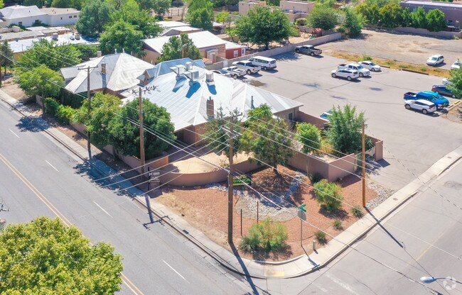
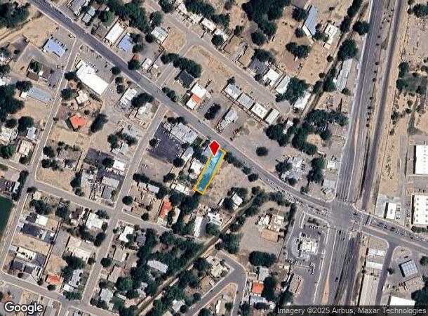
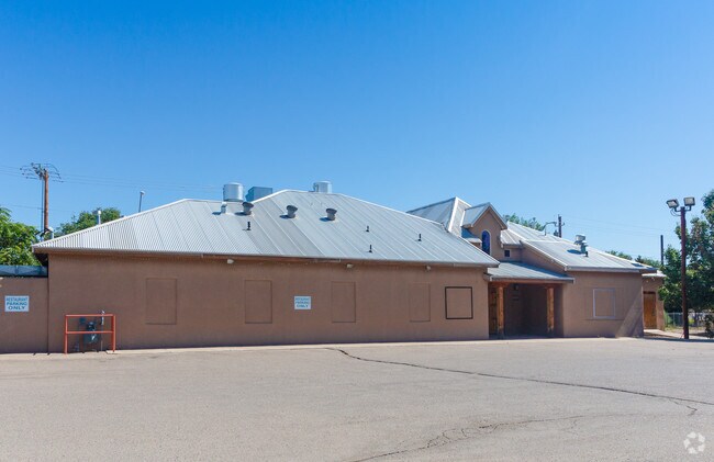
243 Main St Sw
Albuquerque, NM
Valencia
1-009-038-233-392-000000
New Mexico
Singlefamilyresidentialassumed
0.05 AC
X
Los Lunas Corridor
35001C0750H
Albuquerque
843 SF
DEMOGRAPHICS near 243 Main St Sw
1 Mile
3 Mile
5 Mile
2024 Total Population
5,813
23,420
39,858
2029 Population
6,145
24,890
42,288
Pop Growth 2024-2029
+ 5.71%
+ 6.28%
+ 6.10%
Average Age
41
41
41
2024 Total Households
2,242
8,756
14,644
HH Growth 2024-2029
+ 5.89%
+ 6.51%
+ 6.33%
Median Household Inc
$49,956
$59,401
$57,217
Avg Household Size
2.50
2.60
2.60
2024 Avg HH Vehicles
2.00
2.00
2.00
Median Home Value
$198,481
$214,313
$225,174
Median Year Built
1989
1992
1990
Nearby Places
Map Layers
Map Styles
 Street
 Aerial
- Restaurants
- Banks
- Shops
- Fitness
- Groceries
PUBLIC TRANSPORTATION
COMMUTER RAIL
Los Lunas (NMRX - Rio Metro Regional Transit District, Rail Runner Express - Rio Metro Regional Transit District)
DRIVE
WALK
Distance
Los Lunas (NMRX - Rio Metro Regional Transit District, Rail Runner Express - Rio Metro Regional Transit District)
1 min
13 min
0.7 mi
AIRPORT
Albuquerque International Sunport
DRIVE
WALK
Distance
Albuquerque International Sunport
39 min
22.5 mi
Freight Ports
Port of San Diego
DRIVE
WALK
Distance
Port of San Diego
870 min
811.4 mi
SALE & LEASE HISTORY
LISTING DATE
SALE/LEASE

Sep 24, 2016
For Sale
Aug 28, 2019
For Sale
Apr 26, 2018
For Sale
Apr 25, 2018
For Lease
Nearby Properties
Address
Land Use
TOTAL SIZE
Lot Size
Zoning
Address
Land Use
TOTAL SIZE
Lot Size
Zoning
1,152 SF
168.84 AC
Address
Land Use
TOTAL SIZE
Lot Size
Zoning
Address
Land Use
TOTAL SIZE
Lot Size
Zoning
109.69 AC
Address
Land Use
TOTAL SIZE
Lot Size
Zoning
Address
Land Use
TOTAL SIZE
Lot Size
Zoning
Address
Land Use
TOTAL SIZE
Lot Size
Zoning
14.79 AC
Address
Land Use
TOTAL SIZE
Lot Size
Zoning
66.69 AC
Address
Land Use
TOTAL SIZE
Lot Size
Zoning
Address
Land Use
TOTAL SIZE
Lot Size
Zoning
4.90 AC
Address
Land Use
TOTAL SIZE
Lot Size
Zoning
14.68 AC
Address
Land Use
TOTAL SIZE
Lot Size
Zoning
Address
Land Use
TOTAL SIZE
Lot Size
Zoning
Address
Land Use
TOTAL SIZE
Lot Size
Zoning
106,160 SF
13.72 AC
Address
Land Use
TOTAL SIZE
Lot Size
Zoning
187,077 SF
18.96 AC
Address
Land Use
TOTAL SIZE
Lot Size
Zoning
381,767 SF
19.99 AC
Address
Land Use
TOTAL SIZE
Lot Size
Zoning
Address
Land Use
TOTAL SIZE
Lot Size
Zoning
25.46 AC
Address
Land Use
TOTAL SIZE
Lot Size
Zoning
94,883 SF
12.09 AC
Address
Land Use
TOTAL SIZE
Lot Size
Zoning
108.49 AC
Address
Land Use
TOTAL SIZE
Lot Size
Zoning
121,362 SF
12.42 AC
Address
Land Use
TOTAL SIZE
Lot Size
Zoning
1.31 AC
Address
Land Use
TOTAL SIZE
Lot Size
Zoning
Address
Land Use
TOTAL SIZE
Lot Size
Zoning
100,000 SF
6 AC
Address
Land Use
TOTAL SIZE
Lot Size
Zoning
12.72 AC
Address
Land Use
TOTAL SIZE
Lot Size
Zoning
54,889 SF
6.87 AC
Address
Land Use
TOTAL SIZE
Lot Size
Zoning
Address
Land Use
TOTAL SIZE
Lot Size
Zoning
Address
Land Use
TOTAL SIZE
Lot Size
Zoning
48,456 SF
5.68 AC
Address
Land Use
TOTAL SIZE
Lot Size
Zoning
76,324 SF
3.85 AC
Address
Land Use
TOTAL SIZE
Lot Size
Zoning
The World's #1 Commercial Real Estate Marketplace
Connect with us
© 2025 CoStar Group
The information above has been obtained from sources believed reliable. While we do not doubt its accuracy we have not verified it and make no guarantee, warranty or representation about it. It is your responsibility to independently confirm its accuracy and completeness. Any projections, opinions, assumptions, or estimates used are for example only and do not represent the current or future performance of the property. The value of this transaction to you depends on tax and other factors which should be evaluated by your tax, financial, and legal advisors. You and your advisors should conduct a careful, independent investigation of the property to determine to your satisfaction the suitability of the property for your needs.