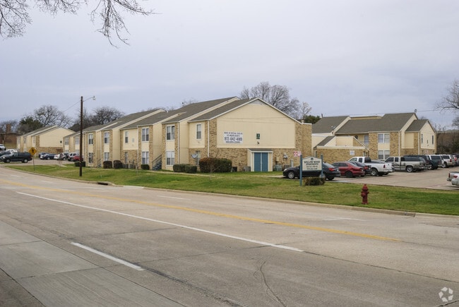
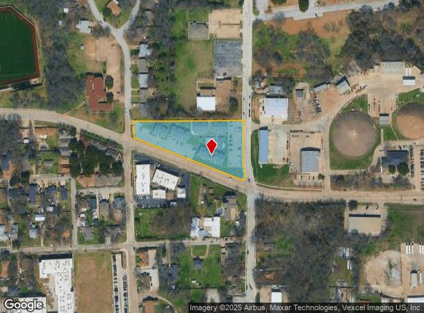
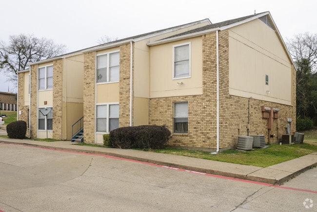
Property Record
325 Ne 5Th St, Grand Prairie, TX 75050
NEARBY LISTINGS FOR SALE OR LEASE
-
-
View all Grand Prairie listings for sale on LoopNet.com
Property Detail
325 Ne 5Th St
65100307060560000
Mckinney & Wms
Apartment
MCKINNEY & WMS ABST 1003 PG 070 TRS 56-58 & 60 2.1869 ACS VOL2002236/5827 DD11112002 CO-DC 1003070605600 26510030706
X
Dallas
48113C0455M
Texas
2024
2.19 AC
2025
Grand Prairie
015500
Dallas/Ft Worth
31,533 SF
Dallas-Fort Worth-Arlington, TX
DEMOGRAPHICS near 325 Ne 5Th St
1 Mile
3 Mile
5 Mile
2024 Total Population
11,116
68,966
199,428
2029 Population
10,868
68,543
200,762
Pop Growth 2024-2029
(2.23%)
(0.61%)
+ 0.67%
Average Age
35
35
35
2024 Total Households
3,562
22,083
66,389
HH Growth 2024-2029
(2.47%)
(0.77%)
+ 0.79%
Median Household Inc
$47,177
$51,406
$55,060
Avg Household Size
3.00
3.00
2.90
2024 Avg HH Vehicles
2.00
2.00
2.00
Median Home Value
$152,164
$175,593
$198,048
Median Year Built
1958
1974
1979
Nearby Places
Map Layers
Map Styles
 Street
 Aerial
- Restaurants
- Banks
- Shops
- Fitness
- Groceries
PUBLIC TRANSPORTATION
COMMUTER RAIL
West Irving (TRINITY RAILWAY - Dallas Area Rapid Transit (DART), Trinity Railway Express - Dallas Area Rapid Transit (DART))
DRIVE
WALK
Distance
West Irving (TRINITY RAILWAY - Dallas Area Rapid Transit (DART), Trinity Railway Express - Dallas Area Rapid Transit (DART))
11 min
5.8 mi
East Tex Yard Limit (TRINITY RAILWAY - Dallas Area Rapid Transit (DART))
DRIVE
WALK
Distance
East Tex Yard Limit (TRINITY RAILWAY - Dallas Area Rapid Transit (DART))
11 min
7.0 mi
AIRPORT
Dallas-Fort Worth International
DRIVE
WALK
Distance
Dallas-Fort Worth International
21 min
14.4 mi
Dallas Love Field
DRIVE
WALK
Distance
Dallas Love Field
25 min
14.9 mi
Freight Ports
Port of Shreveport
DRIVE
WALK
Distance
Port of Shreveport
225 min
209.0 mi
Nearby Properties
Address
Land Use
TOTAL SIZE
Lot Size
Zoning
Address
Land Use
TOTAL SIZE
Lot Size
Zoning
2,395,314 SF
152.04 AC
Address
Land Use
TOTAL SIZE
Lot Size
Zoning
1,577,320 SF
122.55 AC
Z123
Address
Land Use
TOTAL SIZE
Lot Size
Zoning
1,080,000 SF
51.04 AC
Z123
Address
Land Use
TOTAL SIZE
Lot Size
Zoning
703,500 SF
47.38 AC
Z236
Address
Land Use
TOTAL SIZE
Lot Size
Zoning
496,283 SF
246.29 AC
Z236
Address
Land Use
TOTAL SIZE
Lot Size
Zoning
450,535 SF
27.23 AC
Address
Land Use
TOTAL SIZE
Lot Size
Zoning
680,900 SF
32.25 AC
Z236
Address
Land Use
TOTAL SIZE
Lot Size
Zoning
334,057 SF
20.05 AC
Z312
Address
Land Use
TOTAL SIZE
Lot Size
Zoning
358,350 SF
13.15 AC
Address
Land Use
TOTAL SIZE
Lot Size
Zoning
1,054,767 SF
37.45 AC
Z123
Address
Land Use
TOTAL SIZE
Lot Size
Zoning
531,072 SF
26.50 AC
Z236
Address
Land Use
TOTAL SIZE
Lot Size
Zoning
264,010 SF
34.50 AC
Z190
Address
Land Use
TOTAL SIZE
Lot Size
Zoning
641,780 SF
34.38 AC
Z236
Address
Land Use
TOTAL SIZE
Lot Size
Zoning
197,000 SF
25.51 AC
Z236
Address
Land Use
TOTAL SIZE
Lot Size
Zoning
283,087 SF
15.22 AC
Z236
Address
Land Use
TOTAL SIZE
Lot Size
Zoning
436,343 SF
5.36 AC
Z236
Address
Land Use
TOTAL SIZE
Lot Size
Zoning
602,000 SF
72.59 AC
Z123
Address
Land Use
TOTAL SIZE
Lot Size
Zoning
266,448 SF
17 AC
Z97
Address
Land Use
TOTAL SIZE
Lot Size
Zoning
224,486 SF
18.11 AC
Z236
Address
Land Use
TOTAL SIZE
Lot Size
Zoning
251,392 SF
14.54 AC
Z190
Address
Land Use
TOTAL SIZE
Lot Size
Zoning
436,014 SF
47.53 AC
Z236
Address
Land Use
TOTAL SIZE
Lot Size
Zoning
226,438 SF
12.98 AC
Z190
Address
Land Use
TOTAL SIZE
Lot Size
Zoning
746,852 SF
34.91 AC
Address
Land Use
TOTAL SIZE
Lot Size
Zoning
492,500 SF
27.79 AC
Address
Land Use
TOTAL SIZE
Lot Size
Zoning
158,430 SF
4.42 AC
Z97
Address
Land Use
TOTAL SIZE
Lot Size
Zoning
346,500 SF
18.75 AC
Z236
Address
Land Use
TOTAL SIZE
Lot Size
Zoning
392,220 SF
24.55 AC
Z102
Address
Land Use
TOTAL SIZE
Lot Size
Zoning
315,000 SF
16.30 AC
Z236
Address
Land Use
TOTAL SIZE
Lot Size
Zoning
310,047 SF
16.40 AC
Z236
Address
Land Use
TOTAL SIZE
Lot Size
Zoning
344,400 SF
17.35 AC
Z236
The World's #1 Commercial Real Estate Marketplace
Connect with us
© 2025 CoStar Group
The information above has been obtained from sources believed reliable. While we do not doubt its accuracy we have not verified it and make no guarantee, warranty or representation about it. It is your responsibility to independently confirm its accuracy and completeness. Any projections, opinions, assumptions, or estimates used are for example only and do not represent the current or future performance of the property. The value of this transaction to you depends on tax and other factors which should be evaluated by your tax, financial, and legal advisors. You and your advisors should conduct a careful, independent investigation of the property to determine to your satisfaction the suitability of the property for your needs.