Property Record
325 Route 22 E, Plainfield, NJ 07060


Property Detail
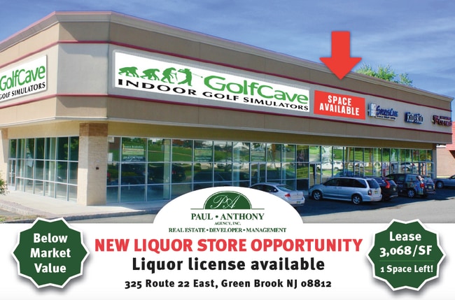
325 Route 22 E
Lakewood-New Brunswick, NJ
ADDITIONAL LOTS: 17256
09-00004-0000-00011
SOMERSET
Vacantlandnec
New Jersey
RHC
11
B and X Area of moderate flood hazard, usually the area between the limits of the 100-year and 500-year floods.
2.77 AC
2024
Route 78 East
2025
Northern New Jersey
039302
NEARBY LISTINGS FOR SALE OR LEASE
DEMOGRAPHICS near 325 Route 22 E
1 mile
3 mile
5 mile
2025 Total Population
8,980
83,831
204,374
2030 Population
9,252
86,774
212,098
Pop Growth 2025-2030
+ 3.03%
+ 3.51%
+ 3.78%
Average Age
42
41
40
2025 Total Households
3,200
29,283
68,602
HH Growth 2025-2030
+ 3.09%
+ 3.66%
+ 4.03%
Median Household Inc
$130,027
$117,033
$114,648
Avg Household Size
2.80
2.80
2.90
2025 Avg HH Vehicles
2.00
2.00
2.00
Median Home Value
$464,473
$466,522
$473,715
Median Year Built
1968
1965
1966
Nearby Places
Map Layers
Map Styles
 Street
 Aerial
Transit
 Traffic
 Biking
Places
Listings with unknown addresses are not visible on the map
- Restaurants
- Banks
- Shops
- Fitness
- Groceries
PUBLIC TRANSPORTATION
COMMUTER RAIL
Dunellen (Raritan Valley Line - NJ Transit Commuter Rail (NJ Transit))
Drive
Walk
Distance
Dunellen (Raritan Valley Line - NJ Transit Commuter Rail (NJ Transit))
6 min
3.0 mi
Bound Brook (Raritan Valley Line - NJ Transit Commuter Rail (NJ Transit))
Drive
Walk
Distance
Bound Brook (Raritan Valley Line - NJ Transit Commuter Rail (NJ Transit))
7 min
3.9 mi
AIRPORT
Newark Liberty International
Drive
Walk
Distance
Newark Liberty International
34 min
24.7 mi
Trenton Mercer
Drive
Walk
Distance
Trenton Mercer
60 min
38.7 mi
Freight Ports
New York Container Terminal
Drive
Walk
Distance
New York Container Terminal
40 min
27.5 mi
SALE & LEASE HISTORY
LISTING DATE
SALE/LEASE

Sep 25, 2016
For Lease
Sep 13, 2018
For Lease
Sep 12, 2018
For Lease
Mar 27, 2017
For Lease
Jan 23, 2018
For Lease
Feb 22, 2018
For Lease
Feb 21, 2018
For Lease
Feb 09, 2023
For Lease
Nearby Properties
Address
Land Use
TOTAL SIZE
Lot Size
Zoning
Address
Land Use
TOTAL SIZE
Lot Size
Zoning
31.49 AC
LI5
Address
Land Use
TOTAL SIZE
Lot Size
Zoning
24.62 AC
R20
Address
Land Use
TOTAL SIZE
Lot Size
Zoning
41.40 AC
LI5
Address
Land Use
TOTAL SIZE
Lot Size
Zoning
64.99 AC
LI5
Address
Land Use
TOTAL SIZE
Lot Size
Zoning
27.51 AC
RM
Address
Land Use
TOTAL SIZE
Lot Size
Zoning
22.75 AC
LC
Address
Land Use
TOTAL SIZE
Lot Size
Zoning
21.60 AC
LI5
Address
Land Use
TOTAL SIZE
Lot Size
Zoning
Address
Land Use
TOTAL SIZE
Lot Size
Zoning
10.09 AC
Address
Land Use
TOTAL SIZE
Lot Size
Zoning
24.34 AC
IND
Address
Land Use
TOTAL SIZE
Lot Size
Zoning
27.70 AC
Address
Land Use
TOTAL SIZE
Lot Size
Zoning
230,022 SF
15.48 AC
LI5
Address
Land Use
TOTAL SIZE
Lot Size
Zoning
4.05 AC
Address
Land Use
TOTAL SIZE
Lot Size
Zoning
13.38 AC
B2
Address
Land Use
TOTAL SIZE
Lot Size
Zoning
277,731 SF
17.91 AC
LI5
Address
Land Use
TOTAL SIZE
Lot Size
Zoning
19.90 AC
IND
Address
Land Use
TOTAL SIZE
Lot Size
Zoning
254,656 SF
16.53 AC
LI5
Address
Land Use
TOTAL SIZE
Lot Size
Zoning
18.31 AC
LI5
Address
Land Use
TOTAL SIZE
Lot Size
Zoning
26.40 AC
LI5
Address
Land Use
TOTAL SIZE
Lot Size
Zoning
Address
Land Use
TOTAL SIZE
Lot Size
Zoning
11.83 AC
RM
Address
Land Use
TOTAL SIZE
Lot Size
Zoning
158,966 SF
13.92 AC
LI5
Address
Land Use
TOTAL SIZE
Lot Size
Zoning
96,102 SF
23.60 AC
ER
Address
Land Use
TOTAL SIZE
Lot Size
Zoning
Address
Land Use
TOTAL SIZE
Lot Size
Zoning
10.50 AC
RM
Address
Land Use
TOTAL SIZE
Lot Size
Zoning
9.05 AC
RM
Address
Land Use
TOTAL SIZE
Lot Size
Zoning
12.57 AC
Address
Land Use
TOTAL SIZE
Lot Size
Zoning
167,861 SF
9.75 AC
LI5
Address
Land Use
TOTAL SIZE
Lot Size
Zoning
137,228 SF
15 AC
R75
Address
Land Use
TOTAL SIZE
Lot Size
Zoning
14.24 AC
RM
The World's #1 Commercial Real Estate Marketplace
Connect with us
© 2026 CoStar Group
The information above has been obtained from sources believed reliable. While we do not doubt its accuracy we have not verified it and make no guarantee, warranty or representation about it. It is your responsibility to independently confirm its accuracy and completeness. Any projections, opinions, assumptions, or estimates used are for example only and do not represent the current or future performance of the property. The value of this transaction to you depends on tax and other factors which should be evaluated by your tax, financial, and legal advisors. You and your advisors should conduct a careful, independent investigation of the property to determine to your satisfaction the suitability of the property for your needs.